
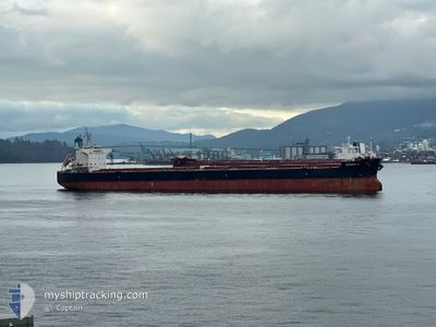
EFRAIM A
Bulk Carrier
Current Trip
| Trip Time | 41 days |
|---|---|
| Trip Distance | 10002.14 nm |
| AVG Speed | 11.4 Knop |
| MAX Speed | 14.4 Knop |
| Djupgående | 7.2 m |
| AVG Wind | 14.1 knots |
| MAX Wind | 37 knots |
| MIN Temp | 12.8°C / 55.04°F |
| MAX Temp | 33.4°C / 92.12°F |
| Position mottagen | 4 d sen |
Current Position
| Longitud | -56.25431° |
|---|---|
| Latitude | -35.16942° |
| Status | Under way using engine |
| Fart | 12.5 Knop |
| Kurs | 262.4° |
| Område | Rio de La Plata |
| Station | T-AIS |
| Position mottagen | 4 d sen |
Info
Information
The current position of EFRAIM A is in Rio de La Plata with coordinates -35.16942° / -56.25431° as reported on 2025-02-05 00:19 by AIS to our vessel tracker app. The vessel's current speed is 12.5 Knop and is currently inside the port of SAN LORENZO.
The vessel EFRAIM A (IMO: 9520778, MMSI: 210043000) is a Bulk Carrier that was built in 2010 ( 15 År gammal ). It's sailing under the flag of [CY] Cyprus.
In this page you can find informations about the vessels current position, last detected port calls, and current voyage information. If the vessels is not in coverage by AIS you will find the latest position.
The current position of EFRAIM A is detected by our AIS receivers and we are not responsible for the reliability of the data. The last position was recorded while the vessel was in Coverage by the Ais receivers of our vessel tracking app.
The current draught of EFRAIM A as reported by AIS is 7.2 meters
Weather
| Temperature | 26.1°C / 78.98°F |
|---|---|
| Wind Speed | 4 knots |
| Direction | 36° NE |
| Pressure | 1011.7 hPa |
| Humidity | 40.8 % |
| Cloud Coverage | 40 % |
Featured Company
Last Port Calls
| Port | Arrival | Departure | Time In Port |
|---|---|---|---|
| 2025-02-06 16:01 | |||
| 2024-12-24 11:33 | 2024-12-27 14:53 | 3 d |
Last Trips
| Origin | Departure | Destination | Arrival | Distance | |
|---|---|---|---|---|---|
| 2024-12-27 22:53 | 2025-02-06 13:01 | 10002.14 nm | |||
| 2024-11-29 21:24 | 2024-12-24 19:33 | 5936.25 nm |
Events
| Tid | Event | Detaljer | Position / Dest | Information |
|---|---|---|---|---|
| 2025-02-07 04:35 | STOPPAR förflyttning |
-32.60387 / -60.76058
[AR] SAN LORENZO
|
Fart: 0.3 kn Kurs: 320° |
|
| 2025-02-07 04:06 | STARTAR förflyttning |
-32.62214 / -60.74997
[AR] SAN LORENZO
|
Fart: 4.4 kn Kurs: 336° |
|
| 2025-02-06 16:05 | STOPPAR förflyttning |
-32.63495 / -60.74367
[AR] SAN LORENZO
|
Fart: 0.3 kn Kurs: 1° |
|
| 2025-02-06 16:01 | ANLÄNDER HAMN |
|
-32.63550 / -60.74377
[AR] SAN LORENZO
|
Fart: 2.8 kn Kurs: 344° |
| 2025-02-05 16:52 | STARTAR förflyttning | 7.4 nm, North East of LA PLATA |
-34.74786 / -57.80156
BR SSZ
|
Fart: 6.1 kn Kurs: 301° |
| 2025-02-05 07:13 | STOPPAR förflyttning | 7.31 nm, North East of LA PLATA |
-34.75106 / -57.79928
BR SSZ
|
Fart: 0.1 kn Kurs: 26° |
| 2025-02-05 00:26 | Status ändrad | Default Under way using engine |
-35.17064 / -56.28733
BR SSZ
|
Fart: 12.5 kn Kurs: 262.4° |
| 2025-02-05 00:19 | Status ändrad | Under way using engine Default |
-35.16942 / -56.25431
BR SSZ
|
Fart: 12.5 kn Kurs: 248° |
| 2025-02-05 00:19 | UTANFÖR täckningsområde |
-35.16942 / -56.25431
Rio de La Plata
|
Fart: 12.5 kn Kurs: 262.4° |
|
| 2025-02-05 00:14 | Status ändrad | Default Under way using engine |
-35.16424 / -56.23634
BR SSZ
|
Fart: 12.4 kn Kurs: 247.5° |