
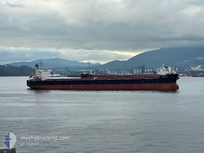
EFRAIM A
Bulk Carrier
Current Trip
BR SSZ
| Time Travelled | 3 days |
|---|---|
| Remaining Time | --- |
| Distance Travelled | 527.50 nm |
| Remaining Distance | --- |
| AVG Speed | 11 Knopen |
| MAX Speed | 14.5 Knopen |
| AVG Wind | 11.8 knots |
| MAX Wind | 25.8 knots |
| MIN Temp | 20.9°C / 69.62°F |
| MAX Temp | 40.2°C / 104.36°F |
| Diepgang | 7.2 M |
| Positie ontvangen | 17 h, 57 m geleden |
Current Position
| Lengtegraad | -55.94886° |
|---|---|
| Breedtegraat | -35.06569° |
| Status | Under way using engine |
| Snelheid | 9.8 Knopen |
| Koers | 90.7° |
| Gebied | Rio de La Plata |
| Station | T-AIS |
| Positie ontvangen | 17 h, 57 m geleden |
Info
Information
The current position of EFRAIM A is in Rio de La Plata with coordinates -35.06569° / -55.94886° as reported on 2025-02-12 16:41 by AIS to our vessel tracker app. The vessel's current speed is 9.8 Knopen
The vessel EFRAIM A (IMO: 9520778, MMSI: 210043000) is a Bulk Carrier that was built in 2010 ( 15 Jaar oud ). It's sailing under the flag of [CY] Cyprus.
In this page you can find informations about the vessels current position, last detected port calls, and current voyage information. If the vessels is not in coverage by AIS you will find the latest position.
The current position of EFRAIM A is detected by our AIS receivers and we are not responsible for the reliability of the data. The last position was recorded while the vessel was in Coverage by the Ais receivers of our vessel tracking app.
The current draught of EFRAIM A as reported by AIS is 7.2 meters
Weather
| Temperature | 22.8°C / 73.04°F |
|---|---|
| Wind Speed | 12 knots |
| Direction | 139° SE |
| Pressure | 1015.8 hPa |
| Humidity | 68.9 % |
| Cloud Coverage | 87 % |
Featured Company
Last Port Calls
| Port | Arrival | Departure | Time In Port |
|---|---|---|---|
| 2025-02-06 13:01 | 2025-02-09 21:18 | 3 d | |
| 2024-12-24 19:33 | 2024-12-27 22:53 | 3 d |
Last Trips
| Origin | Departure | Destination | Arrival | Distance | |
|---|---|---|---|---|---|
| 2024-12-27 22:53 | 2025-02-06 13:01 | 10002.14 nm | |||
| 2024-11-29 21:24 | 2024-12-24 19:33 | 5936.25 nm |
Events
| Tijd | Evenement | Details | Positie / Bestemming | Info |
|---|---|---|---|---|
| 2025-02-12 16:45 | Status Changed | Default Under way using engine |
-35.06606 / -55.93290
BR SSZ
|
Snelheid: 9.8 kn Koers: 90.7° |
| 2025-02-12 16:41 | Buitenbereik |
-35.06569 / -55.94886
Rio de La Plata
|
Snelheid: 9.8 kn Koers: 90.7° |
|
| 2025-02-12 15:53 | Status Changed | Under way using engine Default |
-35.10153 / -56.05602
BR SSZ
|
Snelheid: 6.5 kn Koers: 68° |
| 2025-02-12 15:50 | Status Changed | Default Under way using engine |
-35.10353 / -56.06198
BR SSZ
|
Snelheid: 5.3 kn Koers: 67.2° |
| 2025-02-12 15:27 | Status Changed | Under way using engine Default |
-35.12071 / -56.10993
BR SSZ
|
Snelheid: 9.9 kn Koers: 67° |
| 2025-02-12 15:26 | Status Changed | Default Under way using engine |
-35.12175 / -56.11302
BR SSZ
|
Snelheid: 10.7 kn Koers: 67.9° |
| 2025-02-12 15:21 | Status Changed | Under way using engine Default |
-35.12818 / -56.13176
BR SSZ
|
Snelheid: 11 kn Koers: 67° |
| 2025-02-12 14:58 | Status Changed | Default Under way using engine |
-35.15554 / -56.21068
BR SSZ
|
Snelheid: 11.4 kn Koers: 68.7° |
| 2025-02-12 14:50 | Status Changed | Under way using engine Default |
-35.16628 / -56.24244
BR SSZ
|
Snelheid: 11.6 kn Koers: 82° |
| 2025-02-12 14:34 | Binnenbereik |
-35.16628 / -56.24244
Rio de La Plata
|
Snelheid: 11.4 kn Koers: 68.7° |