

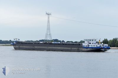
EILTANK 70
Tanker

Current Trip
| Time Travelled | 10 h, 34 mins |
|---|---|
| Remaining Time | 14 h, 0 mins |
| Distance Travelled | 53.49 nm |
| Remaining Distance | 76.37 nm |
| AVG Speed | 5.5 Knop |
| MAX Speed | 6.9 Knop |
| AVG Wind | 5 knots |
| MAX Wind | 9.3 knots |
| MIN Temp | 12.4°C / 54.32°F |
| MAX Temp | 19.9°C / 67.82°F |
| Djupgående | 1.5 m |
| Position mottagen | 1 m sen |
Current Position
| Longitud | 6.71357° |
|---|---|
| Latitude | 51.28644° |
| Status | Under way using engine |
| Fart | 5 Knop |
| Kurs | 214.9° |
| Område | North Sea |
| Station | T-AIS |
| Position mottagen | 1 m sen |
Information
The current position of EILTANK 70 is in North Sea with coordinates 51.28644° / 6.71357° as reported on 2025-04-15 23:04 by AIS to our vessel tracker app. The vessel's current speed is 5 Knop and is heading at the port of ANDERNACH. The estimated time of arrival as calculated by MyShipTracking vessel tracking app is 2025-04-16 15:06 LT
The vessel EILTANK 70 (MMSI: 211516810) is a Tanker It's sailing under the flag of [DE] Germany.
In this page you can find informations about the vessels current position, last detected port calls, and current voyage information. If the vessels is not in coverage by AIS you will find the latest position.
The current position of EILTANK 70 is detected by our AIS receivers and we are not responsible for the reliability of the data. The last position was recorded while the vessel was in Coverage by the Ais receivers of our vessel tracking app.
The current draught of EILTANK 70 as reported by AIS is 1.5 meters
Weather
| Temperature | 12.6°C / 54.68°F |
|---|---|
| Wind Speed | 5 knots |
| Direction | 179° S |
| Pressure | 1003.1 hPa |
| Humidity | 89.4 % |
| Cloud Coverage | 42 % |


Featured Company
Last Port Calls
| Port | Arrival | Departure | Time In Port |
|---|---|---|---|
| 2025-04-15 13:33 | 2025-04-15 14:32 | 59 m | |
| 2025-04-13 20:54 | 2025-04-14 22:30 | 1 d | |
| 2025-04-10 14:29 | 2025-04-11 13:40 | 23 h | |
| 2025-04-09 12:13 | 2025-04-09 12:17 | 3 m | |
| 2025-04-08 11:02 | 2025-04-08 18:56 | 7 h | |
| 2025-04-07 14:30 | 2025-04-07 15:14 | 44 m | |
| 2025-04-05 05:38 | 2025-04-06 16:02 | 1 d | |
| 2025-04-03 06:35 | 2025-04-03 13:45 | 7 h | |
| 2025-04-02 17:31 | 2025-04-02 18:13 | 41 m | |
| 2025-04-01 09:10 | 2025-04-02 13:53 | 1 d |
Most Visited Ports (Last year)
| Port | Arrivals | |
|---|---|---|
| 120 | ||
| 117 | ||
| 29 | ||
| 20 | ||
| 19 | ||
| 16 |
Last Trips
| Origin | Departure | Destination | Arrival | Distance | |
|---|---|---|---|---|---|
| 2025-04-14 22:30 | 2025-04-15 13:33 | 94.18 nm | |||
| 2025-04-11 13:40 | 2025-04-13 20:54 | 345.77 nm | |||
| 2025-04-09 12:17 | 2025-04-10 14:29 | 99.89 nm | |||
| 2025-04-08 18:56 | 2025-04-09 12:13 | 3.67 nm | |||
| 2025-04-07 15:14 | 2025-04-08 11:02 | 0.71 nm | |||
| 2025-04-06 16:02 | 2025-04-07 14:30 | 103.84 nm | |||
| 2025-04-03 13:45 | 2025-04-05 05:38 | 207.25 nm | |||
| 2025-04-02 18:13 | 2025-04-03 06:35 | 71.60 nm | |||
| 2025-04-02 13:53 | 2025-04-02 17:31 | 30.73 nm | |||
| 2025-04-01 09:02 | 2025-04-01 09:10 | 1.17 nm |
Events
| Tid | Event | Detaljer | Position / Dest | Information |
|---|---|---|---|---|
| 2025-04-15 19:00 | Status ändrad | Under way using engine Default |
51.53102 / 6.68255
ANDERNACH
|
Fart: 5.8 kn Kurs: 170° |
| 2025-04-15 18:54 | Status ändrad | Default Under way using engine |
51.53852 / 6.67492
ANDERNACH
|
Fart: 5.7 kn Kurs: 178.1° |
| 2025-04-15 18:39 | Status ändrad | Under way using engine Default |
51.56126 / 6.68696
ANDERNACH
|
Fart: 5.9 kn Kurs: 169° |
| 2025-04-15 18:36 | Status ändrad | Default Under way using engine |
51.56656 / 6.68695
ANDERNACH
|
Fart: 5.6 kn Kurs: 152.5° |
| 2025-04-15 18:33 | I täckningsområde |
51.57008 / 6.68543
North Sea
ANDERNACH
|
Fart: 5.6 kn Kurs: 152.5° |
|
| 2025-04-15 13:20 | UTANFÖR täckningsområde |
51.83325 / 6.18462
North Sea
ANDERNACH
|
Fart: 5.2 kn Kurs: 122° |
|
| 2025-04-15 12:32 | AVGÅTT HAMN |
|
51.86462 / 6.06591
ANDERNACH
|
Fart: 6.9 kn Kurs: 120.8° |
| 2025-04-15 12:25 | STARTAR förflyttning |
51.86996 / 6.04695
[NL] MILLINGEN AAN DE RIJN
|
Fart: 6.3 kn Kurs: 97.1° |
|
| 2025-04-15 11:33 | ANLÄNDER HAMN |
|
51.87037 / 6.04224
[NL] MILLINGEN AAN DE RIJN
|
Fart: 0.9 kn Kurs: 511° |
| 2025-04-15 11:08 | STOPPAR förflyttning | 0.58 nm, North West of MILLINGEN AAN DE RIJN |
51.87167 / 6.03877
ANDERNACH
|
Fart: 0.1 kn Kurs: 511° |