

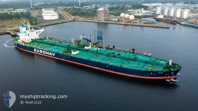
FRONT VOSSO
Tanker

Current Trip
| Time Travelled | 11 days |
|---|---|
| Remaining Time | --- |
| Distance Travelled | 2566.63 nm |
| Remaining Distance | 11.52 nm |
| AVG Speed | 9.5 Knop |
| MAX Speed | 13.9 Knop |
| AVG Wind | 12.8 knots |
| MAX Wind | 25.3 knots |
| MIN Temp | 17.4°C / 63.32°F |
| MAX Temp | 29.7°C / 85.46°F |
| Djupgående | 11 m |
| Position mottagen | 2 m sen |
Current Position
| Longitud | 103.91942° |
|---|---|
| Latitude | 1.26591° |
| Status | At anchor |
| Fart | 0.1 Knop |
| Kurs | 178° |
| Område | Singapore Strait |
| Station | T-AIS |
| Position mottagen | 2 m sen |
Information
The current position of FRONT VOSSO is in Singapore Strait with coordinates 1.26591° / 103.91942° as reported on 2025-06-12 02:41 by AIS to our vessel tracker app. The vessel's current speed is 0.1 Knop and is heading at the port of JURONG ISLAND. The estimated time of arrival as calculated by MyShipTracking vessel tracking app is 2025-06-12 08:15 LT
The vessel FRONT VOSSO (IMO: 9730086, MMSI: 636017082) is a Tanker It's sailing under the flag of [LR] Liberia.
In this page you can find informations about the vessels current position, last detected port calls, and current voyage information. If the vessels is not in coverage by AIS you will find the latest position.
The current position of FRONT VOSSO is detected by our AIS receivers and we are not responsible for the reliability of the data. The last position was recorded while the vessel was in Coverage by the Ais receivers of our vessel tracking app.
The current draught of FRONT VOSSO as reported by AIS is 11 meters
Weather
| Temperature | 29.3°C / 84.74°F |
|---|---|
| Wind Speed | 8 knots |
| Direction | 170° S |
| Pressure | 1009.3 hPa |
| Humidity | 70.3 % |
| Cloud Coverage | 95 % |


Featured Company
Last Port Calls
| Port | Arrival | Departure | Time In Port |
|---|---|---|---|
| 2025-05-29 07:10 | 2025-06-01 07:50 | 3 d | |
| 2025-05-17 14:09 | 2025-05-19 01:03 | 1 d | |
| 2025-04-06 17:01 | 2025-04-09 17:09 | 3 d |
Most Visited Ports (Last year)
| Port | Arrivals | |
|---|---|---|
| 3 | ||
| 1 | ||
| 1 | ||
| 1 |
Last Trips
| Origin | Departure | Destination | Arrival | Distance | |
|---|---|---|---|---|---|
| 2025-05-19 01:03 | 2025-05-29 07:10 | 2690.43 nm | |||
| 2025-04-09 17:09 | 2025-05-17 14:09 | 7737.94 nm | |||
| 2025-03-04 09:11 | 2025-04-06 17:01 | 7662.44 nm |
Events
| Tid | Event | Detaljer | Position / Dest | Information |
|---|---|---|---|---|
| 2025-06-12 02:32 | Status ändrad | At anchor Default |
1.26599 / 103.91913
PEBGC
|
Fart: 0.1 kn Kurs: 169° |
| 2025-06-12 02:26 | Status ändrad | Default At anchor |
1.26600 / 103.91898
PEBGC
|
Fart: 0.1 kn Kurs: 167° |
| 2025-06-12 01:41 | STOPPAR förflyttning | 3.83 nm, East of SINGAPORE |
1.26573 / 103.91776
PEBGC
|
Fart: 0.2 kn Kurs: 146° |
| 2025-06-12 01:26 | Status ändrad | At anchor Under way using engine |
1.26551 / 103.91981
PEBGC
|
Fart: 0.6 kn Kurs: 190° |
| 2025-06-11 23:46 | Upptäckt i hav | Singaporean part of the Singapore Strait |
1.26766 / 104.02658
Singapore Strait
PEBGC
|
Fart: 5.1 kn Kurs: 264.6° |
| 2025-06-11 23:25 | Byter havsområde | Indonesian part of the Singapore Strait Singaporean part of the Singapore Strait |
1.27013 / 104.04198
Singapore Strait
PEBGC
|
Fart: 4.5 kn Kurs: 260.2° |
| 2025-06-11 23:13 | Byter havsområde | Singaporean part of the Singapore Strait Malaysian part of the Singapore Strait |
1.27298 / 104.05867
Singapore Strait
PEBGC
|
Fart: 5.3 kn Kurs: 257.1° |
| 2025-06-11 22:25 | Djupgående ändrat | 11 18.3 |
1.27841 / 104.15827
PEBGC
|
Fart: 8.7 kn Kurs: 260.3° |
| 2025-06-11 22:25 | Destination ändrad | PEBGC CNDJK |
1.27841 / 104.15827
PEBGC
|
Fart: 8.7 kn Kurs: 260.3° |
| 2025-06-11 22:25 | ETA ändrat | 2025/06/12 00:15 2025/05/28 01:00 |
1.27841 / 104.15827
PEBGC
|
Fart: 8.7 kn Kurs: 260.3° |