
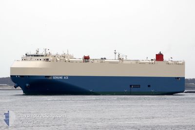
GENUINE ACE
Vehicles Carrier
Current Trip
| Time Travelled | 1 day |
|---|---|
| Remaining Time | --- |
| Distance Travelled | 465.41 nm |
| Remaining Distance | --- |
| AVG Speed | 17.2 Knop |
| MAX Speed | 18.9 Knop |
| AVG Wind | 9.2 knots |
| MAX Wind | 13.7 knots |
| MIN Temp | 22.6°C / 72.68°F |
| MAX Temp | 26.4°C / 79.52°F |
| Djupgående | 9 m |
| Position mottagen | 11 d sen |
Current Position
| Longitud | -73.85371° |
|---|---|
| Latitude | -51.79416° |
| Status | Under way using engine |
| Fart | 16.7 Knop |
| Kurs | 329.2° |
| Område | South Pacific Ocean |
| Station | T-AIS |
| Position mottagen | 11 d sen |
Info
Information
The current position of GENUINE ACE is in South Pacific Ocean with coordinates -51.79416° / -73.85371° as reported on 2025-12-26 11:36 by AIS to our vessel tracker app. The vessel's current speed is 16.7 Knop and is heading at the port of SAN ANTONIO. The estimated time of arrival as calculated by MyShipTracking vessel tracking app is 2025-12-29 16:00 LT
The vessel GENUINE ACE (IMO: 9610418, MMSI: 636015557) is a Vehicles Carrier that was built in 2012 ( 14 År gammal ). It's sailing under the flag of [LR] Liberia.
In this page you can find informations about the vessels current position, last detected port calls, and current voyage information. If the vessels is not in coverage by AIS you will find the latest position.
The current position of GENUINE ACE is detected by our AIS receivers and we are not responsible for the reliability of the data. The last position was recorded while the vessel was in Coverage by the Ais receivers of our vessel tracking app.
The current draught of GENUINE ACE as reported by AIS is 9 meters
Weather
| Temperature | 25.6°C / 78.08°F |
|---|---|
| Wind Speed | 6 knots |
| Direction | 194° SSW |
| Pressure | 1010.9 hPa |
| Humidity | 82.9 % |
| Cloud Coverage | 16 % |
Featured Company
Last Port Calls
| Port | Arrival | Departure | Time In Port |
|---|---|---|---|
| 2026-01-04 22:35 | 2026-01-05 03:09 | 4 h | |
| 2026-01-02 14:21 | 2026-01-02 22:53 | 8 h | |
| 2025-12-30 05:51 | 2025-12-30 14:52 | 9 h | |
| 2025-12-20 06:17 | 2025-12-21 15:35 | 1 d | |
| 2025-12-16 15:07 | 2025-12-17 06:23 | 15 h | |
| 2025-12-02 01:21 | 2025-12-03 19:13 | 1 d | |
| 2025-11-30 03:40 | 2025-12-01 16:19 | 1 d | |
| 2025-11-28 04:11 | 2025-11-28 22:50 | 18 h | |
| 2025-11-23 20:06 | 2025-11-24 17:21 | 21 h |
Last Trips
| Origin | Departure | Destination | Arrival | Distance | |
|---|---|---|---|---|---|
| 2026-01-02 22:53 | 2026-01-04 22:35 | 774.53 nm | |||
| 2025-12-30 14:52 | 2026-01-02 14:21 | 1143.48 nm | |||
| 2025-12-21 15:35 | 2025-12-30 05:51 | 3190.00 nm | |||
| 2025-12-17 06:23 | 2025-12-20 06:17 | 1056.49 nm | |||
| 2025-12-03 19:13 | 2025-12-16 15:07 | 5086.54 nm | |||
| 2025-12-01 16:19 | 2025-12-02 01:21 | 91.52 nm | |||
| 2025-11-28 22:50 | 2025-11-30 03:40 | 232.62 nm | |||
| 2025-11-24 17:21 | 2025-11-28 04:11 | 881.86 nm | |||
| 2025-10-24 11:42 | 2025-11-23 20:06 | 10594.78 nm |
Events
| Tid | Event | Detaljer | Position / Dest | Information |
|---|---|---|---|---|
| 2026-01-05 08:15 | STARTAR förflyttning | 0.8 nm, North East of MANTA |
-.92678 / -80.71666
CL SAI
|
Fart: 3.8 kn Kurs: 348° |
| 2026-01-05 08:09 | AVGÅTT HAMN |
|
-.93093 / -80.71654
CL SAI
|
Fart: 0.1 kn Kurs: 265° |
| 2026-01-05 03:38 | STOPPAR förflyttning |
-.93321 / -80.72069
[EC] MANTA
|
Fart: 0.2 kn Kurs: 261° |
|
| 2026-01-05 03:35 | ANLÄNDER HAMN |
|
-.93322 / -80.72057
[EC] MANTA
|
Fart: 1.2 kn Kurs: 235° |
| 2026-01-03 03:53 | AVGÅTT HAMN |
|
-12.04679 / -77.16157
CL SAI
|
Fart: 4.8 kn Kurs: 279° |
| 2026-01-03 03:46 | STARTAR förflyttning |
-12.04922 / -77.15112
[PE] CALLAO
|
Fart: 4.4 kn Kurs: 305° |
|
| 2026-01-02 19:54 | STOPPAR förflyttning |
-12.05168 / -77.14642
[PE] CALLAO
|
Fart: 0.2 kn Kurs: 275° |
|
| 2026-01-02 19:21 | ANLÄNDER HAMN |
|
-12.04794 / -77.15403
[PE] CALLAO
|
Fart: 3.8 kn Kurs: 102° |
| 2026-01-02 18:54 | STARTAR förflyttning | 2.45 nm, North West of CALLAO |
-12.03609 / -77.19186
CL SAI
|
Fart: 4.2 kn Kurs: 149° |
| 2026-01-02 18:26 | STOPPAR förflyttning | 2.69 nm, North West of CALLAO |
-12.03341 / -77.19501
CL SAI
|
Fart: 0.2 kn Kurs: 81° |