

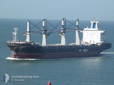
GOLDEN KAROO
General Cargo
Current Trip
MZ MPM
| Time Travelled | 10 h, 32 mins |
|---|---|
| Remaining Time | --- |
| Distance Travelled | 115.47 nm |
| Remaining Distance | --- |
| AVG Speed | 11.4 Knop |
| MAX Speed | 13.3 Knop |
| AVG Wind | 12 knots |
| MAX Wind | 15 knots |
| MIN Temp | 26.7°C / 80.06°F |
| MAX Temp | 31.8°C / 89.24°F |
| Djupgående | 10 m |
| Position mottagen | 3 d sen |
Current Position
| Longitud | 31.75030° |
|---|---|
| Latitude | -29.62429° |
| Status | Under way using engine |
| Fart | 10.9 Knop |
| Kurs | 38.6° |
| Område | Indian Ocean |
| Station | T-AIS |
| Position mottagen | 3 d sen |
Information
The current position of GOLDEN KAROO is in Indian Ocean with coordinates -29.62429° / 31.75030° as reported on 2025-03-05 10:45 by AIS to our vessel tracker app. The vessel's current speed is 10.9 Knop
The vessel GOLDEN KAROO (IMO: 9465423, MMSI: 538090452) is a General Cargo that was built in 2013 ( 12 År gammal ). It's sailing under the flag of [MH] Marshall Is.
In this page you can find informations about the vessels current position, last detected port calls, and current voyage information. If the vessels is not in coverage by AIS you will find the latest position.
The current position of GOLDEN KAROO is detected by our AIS receivers and we are not responsible for the reliability of the data. The last position was recorded while the vessel was in Coverage by the Ais receivers of our vessel tracking app.
The current draught of GOLDEN KAROO as reported by AIS is 10 meters
Weather
| Temperature | 27.2°C / 80.96°F |
|---|---|
| Wind Speed | 11 knots |
| Direction | 92° E |
| Pressure | 1015.9 hPa |
| Humidity | 76.5 % |
| Cloud Coverage | --- |
Featured Company
Last Port Calls
| Port | Arrival | Departure | Time In Port |
|---|---|---|---|
| 2025-03-06 12:00 | 2025-03-08 09:40 | 1 d | |
| 2025-02-28 18:12 | 2025-03-02 10:40 | 1 d | |
| 2025-02-21 06:08 | 2025-02-23 19:24 | 2 d | |
| 2025-02-06 14:01 | 2025-02-07 05:49 | 15 h | |
| 2025-01-29 19:21 | 2025-02-01 22:05 | 3 d | |
| 2025-01-25 22:20 | 2025-01-28 09:19 | 2 d | |
| 2025-01-23 06:33 | 2025-01-24 21:54 | 1 d | |
| 2025-01-22 19:02 | 2025-01-22 21:24 | 2 h | |
| 2025-01-19 04:41 | 2025-01-19 18:22 | 13 h | |
| 2025-01-04 22:56 |
Last Trips
| Origin | Departure | Destination | Arrival | Distance | |
|---|---|---|---|---|---|
| 2025-03-02 12:40 | 2025-03-06 14:00 | 1135.31 nm | |||
| 2025-02-23 21:24 | 2025-02-28 20:12 | 728.02 nm | |||
| 2025-02-07 05:49 | 2025-02-21 08:08 | 4701.84 nm | |||
| 2025-02-01 23:05 | 2025-02-06 14:01 | 1062.31 nm | |||
| 2025-01-28 10:19 | 2025-01-29 20:21 | 380.37 nm | |||
| 2025-01-24 22:54 | 2025-01-25 23:20 | 312.51 nm | |||
| 2025-01-22 22:24 | 2025-01-23 07:33 | 102.21 nm | |||
| 2025-01-19 19:22 | 2025-01-22 20:02 | 865.69 nm | |||
| 2025-01-05 00:56 | 2025-01-19 05:41 | 4765.47 nm |
Events
| Tid | Event | Detaljer | Position / Dest | Information |
|---|---|---|---|---|
| 2025-03-08 09:49 | STARTAR förflyttning | 0.98 nm, North West of MAPUTO |
-25.96811 / 32.55109
MZ MPM
|
Fart: 3.9 kn Kurs: 126° |
| 2025-03-08 09:40 | AVGÅTT HAMN |
|
-25.96557 / 32.54649
MZ MPM
|
Fart: 1 kn Kurs: 145° |
| 2025-03-06 12:05 | STOPPAR förflyttning |
-25.96232 / 32.54657
[MZ] MAPUTO
|
Fart: 0.1 kn Kurs: 307° |
|
| 2025-03-06 12:00 | ANLÄNDER HAMN |
|
-25.96248 / 32.54646
[MZ] MAPUTO
|
Fart: 4.4 kn Kurs: 315° |
| 2025-03-05 10:52 | Status ändrad | Default Under way using engine |
-29.60840 / 31.76537
MZ MPM
|
Fart: 10.9 kn Kurs: 38.6° |
| 2025-03-05 10:45 | Status ändrad | Under way using engine Default |
-29.62429 / 31.75030
MZ MPM
|
Fart: 10.8 kn Kurs: 39° |
| 2025-03-05 10:45 | UTANFÖR täckningsområde |
-29.62429 / 31.75030
Indian Ocean
MZ MPM
|
Fart: 10.9 kn Kurs: 38.6° |
|
| 2025-03-05 10:44 | Status ändrad | Default Under way using engine |
-29.62742 / 31.74736
MZ MPM
|
Fart: 10.4 kn Kurs: 39.6° |
| 2025-03-05 10:25 | ETA ändrat | 2025/03/06 10:00 2025/03/06 07:00 |
-29.67002 / 31.70783
MZ MPM
|
Fart: 10.5 kn Kurs: 38.6° |
| 2025-03-05 06:02 | ETA ändrat | 2025/03/06 07:00 2025/03/06 16:00 |
-30.34028 / 31.05579
MZ MPM
|
Fart: 13.1 kn Kurs: 38.3° |