

GRAMBA
Cargo

Current Trip
| Time Travelled | 23 days |
|---|---|
| Remaining Time | --- |
| Distance Travelled | 2701.76 nm |
| Remaining Distance | --- |
| AVG Speed | 11 Knop |
| MAX Speed | 14.5 Knop |
| AVG Wind | 11.6 knots |
| MAX Wind | 23 knots |
| MIN Temp | 15.4°C / 59.72°F |
| MAX Temp | 27.1°C / 80.78°F |
| Djupgående | 12.9 m |
| Position mottagen | 1 d sen |
Current Position
| Longitud | -13.08188° |
|---|---|
| Latitude | 41.18069° |
| Status | Under way using engine |
| Fart | 11 Knop |
| Kurs | 8° |
| Område | North Atlantic Ocean |
| Station | T-AIS |
| Position mottagen | 1 d sen |
Information
The current position of GRAMBA is in North Atlantic Ocean with coordinates 41.18069° / -13.08188° as reported on 2025-05-27 00:01 by AIS to our vessel tracker app. The vessel's current speed is 11 Knop and is heading at the port of AUGHINISH. The estimated time of arrival as calculated by MyShipTracking vessel tracking app is 2025-05-29 01:05 LT
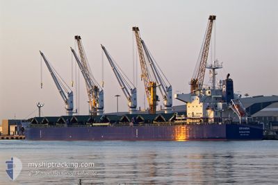
The vessel GRAMBA (IMO: 9917048, MMSI: 563134200) is a Cargo It's sailing under the flag of [SG] Singapore.
In this page you can find informations about the vessels current position, last detected port calls, and current voyage information. If the vessels is not in coverage by AIS you will find the latest position.
The current position of GRAMBA is detected by our AIS receivers and we are not responsible for the reliability of the data. The last position was recorded while the vessel was in Coverage by the Ais receivers of our vessel tracking app.
The current draught of GRAMBA as reported by AIS is 12.9 meters
Weather
| Temperature | 15.8°C / 60.44°F |
|---|---|
| Wind Speed | 12 knots |
| Direction | 258° WSW |
| Pressure | 1023.2 hPa |
| Humidity | 96.1 % |
| Cloud Coverage | 60 % |


Featured Company
Last Port Calls
| Port | Arrival | Departure | Time In Port |
|---|---|---|---|
| 2025-04-29 13:55 | 2025-05-04 17:53 | 5 d | |
| 2025-04-17 09:56 | 2025-04-26 18:20 | 9 d | |
| 2025-03-06 18:21 | 2025-03-12 16:18 | 5 d |
Last Trips
| Origin | Departure | Destination | Arrival | Distance | |
|---|---|---|---|---|---|
| 2025-04-26 18:20 | 2025-04-29 13:55 | 269.81 nm | |||
| 2025-03-12 16:18 | 2025-04-17 09:56 | 9154.62 nm | |||
| 2025-02-08 21:20 | 2025-03-06 18:21 | 2587.13 nm |
Events
| Tid | Event | Detaljer | Position / Dest | Information |
|---|---|---|---|---|
| 2025-05-27 00:09 | Status ändrad | Default Under way using engine |
41.20375 / -13.07855
IE AUG
|
Fart: 11 kn Kurs: 8° |
| 2025-05-27 00:01 | UTANFÖR täckningsområde |
41.18069 / -13.08188
North Atlantic Ocean
IE AUG
|
Fart: 11 kn Kurs: 8° |
|
| 2025-05-26 23:41 | Status ändrad | Under way using engine Default |
41.12171 / -13.09132
IE AUG
|
Fart: 10.7 kn Kurs: 9° |
| 2025-05-26 23:37 | Status ändrad | Default Under way using engine |
41.10730 / -13.09406
IE AUG
|
Fart: 10.7 kn Kurs: 9.4° |
| 2025-05-26 23:36 | Status ändrad | Under way using engine Default |
41.10681 / -13.09415
IE AUG
|
Fart: 10.7 kn Kurs: 8° |
| 2025-05-26 23:28 | Status ändrad | Default Under way using engine |
41.08323 / -13.09830
IE AUG
|
Fart: 10.7 kn Kurs: 7.3° |
| 2025-05-26 22:55 | Status ändrad | Under way using engine Default |
40.98311 / -13.11818
IE AUG
|
Fart: 11 kn Kurs: 11° |
| 2025-05-26 22:52 | Status ändrad | Default Under way using engine |
40.97614 / -13.11976
IE AUG
|
Fart: 11.1 kn Kurs: 9.6° |
| 2025-05-26 22:45 | Status ändrad | Under way using engine Default |
40.95468 / -13.12462
IE AUG
|
Fart: 11.2 kn Kurs: 10° |
| 2025-05-26 22:44 | Status ändrad | Default Under way using engine |
40.95114 / -13.12537
IE AUG
|
Fart: 11.1 kn Kurs: 9.8° |