

GRAMBA
Cargo

Current Trip
SN DKR
| Time Travelled | 18 days |
|---|---|
| Remaining Time | --- |
| Distance Travelled | 1486.18 nm |
| Remaining Distance | --- |
| AVG Speed | 11.2 Knots |
| MAX Speed | 14.5 Knots |
| AVG Wind | 10.4 knots |
| MAX Wind | 22.6 knots |
| MIN Temp | 18.4°C / 65.12°F |
| MAX Temp | 27.1°C / 80.78°F |
| Draught | 10.2 m |
| Position Received | 1 d ago |
Current Position
| Longitude | -18.10110° |
|---|---|
| Latitude | 20.41894° |
| Status | Under way using engine |
| Speed | 10.7 Knots |
| Course | 356.4° |
| Area | North Atlantic Ocean |
| Station | T-AIS |
| Position Received | 1 d ago |
Information
The current position of GRAMBA is in North Atlantic Ocean with coordinates 20.41894° / -18.10110° as reported on 2025-05-21 13:35 by AIS to our vessel tracker app. The vessel's current speed is 10.7 Knots
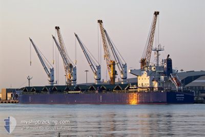
The vessel GRAMBA (IMO: 9917048, MMSI: 563134200) is a Cargo It's sailing under the flag of [SG] Singapore.
In this page you can find informations about the vessels current position, last detected port calls, and current voyage information. If the vessels is not in coverage by AIS you will find the latest position.
The current position of GRAMBA is detected by our AIS receivers and we are not responsible for the reliability of the data. The last position was recorded while the vessel was in Coverage by the Ais receivers of our vessel tracking app.
The current draught of GRAMBA as reported by AIS is 10.2 meters
Weather
| Temperature | 19.6°C / 67.28°F |
|---|---|
| Wind Speed | 22 knots |
| Direction | 41° NE |
| Pressure | 1017.4 hPa |
| Humidity | 84.9 % |
| Cloud Coverage | 2 % |


Featured Company
Last Port Calls
| Port | Arrival | Departure | Time In Port |
|---|---|---|---|
| 2025-04-29 13:55 | 2025-05-04 17:53 | 5 d | |
| 2025-04-17 09:56 | 2025-04-26 18:20 | 9 d | |
| 2025-03-06 18:21 | 2025-03-12 16:18 | 5 d |
Most Visited Ports (Last year)
| Port | Arrivals | |
|---|---|---|
| 2 | ||
| 2 | ||
| 1 | ||
| 1 | ||
| 1 | ||
| 1 |
Last Trips
| Origin | Departure | Destination | Arrival | Distance | |
|---|---|---|---|---|---|
| 2025-04-26 18:20 | 2025-04-29 13:55 | 269.81 nm | |||
| 2025-03-12 16:18 | 2025-04-17 09:56 | 9154.62 nm | |||
| 2025-02-08 21:20 | 2025-03-06 18:21 | 2587.13 nm |
Events
| Time | Event | Details | Position / Dest | Info |
|---|---|---|---|---|
| 2025-05-21 13:41 | Status Changed | Default Under way using engine |
20.43733 / -18.10196
SN DKR
|
Speed: 10.7 kn Course: 356.4° |
| 2025-05-21 13:35 | OUT of Coverage |
20.41894 / -18.10110
North Atlantic Ocean
|
Speed: 10.7 kn Course: 356.4° |
|
| 2025-05-21 13:29 | Detected in Sea | Western Saharan part of the North Atlantic Ocean |
20.39996 / -18.09998
North Atlantic Ocean
|
Speed: 10.8 kn Course: 357.2° |
| 2025-05-21 13:29 | Status Changed | Under way using engine Default |
20.39996 / -18.09998
SN DKR
|
Speed: 10.7 kn Course: 358° |
| 2025-05-21 13:11 | IN Coverage |
20.39996 / -18.09998
North Atlantic Ocean
|
Speed: 10.8 kn Course: 357.2° |
|
| 2025-05-18 18:29 | START Moving | 17.17 nm, South West of KAMSAR |
10.41298 / -14.81038
SN DKR
|
Speed: 3.2 kn Course: 267° |