
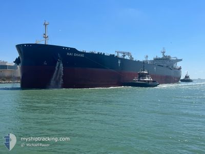
HAI SHANG
Tanker
Current Trip
| Time Travelled | 37 days |
|---|---|
| Remaining Time | --- |
| Distance Travelled | 4084.14 nm |
| Remaining Distance | 21.02 nm |
| AVG Speed | 10.7 Knop |
| MAX Speed | 16.9 Knop |
| AVG Wind | 14.3 knots |
| MAX Wind | 35 knots |
| MIN Temp | -23.7°C / -10.66°F |
| MAX Temp | 26.4°C / 79.52°F |
| Djupgående | 8.2 m |
| Position mottagen | 10 h, 3 m sen |
Current Position
| Longitud | -94.59542° |
|---|---|
| Latitude | 29.09128° |
| Status | At anchor |
| Fart | 0.1 Knop |
| Kurs | 153° |
| Område | Gulf of Mexico |
| Station | T-AIS |
| Position mottagen | 10 h, 3 m sen |
Info
Information
The current position of HAI SHANG is in Gulf of Mexico with coordinates 29.09128° / -94.59542° as reported on 2025-03-14 14:54 by AIS to our vessel tracker app. The vessel's current speed is 0.1 Knop and is heading at the port of GALVESTON. The estimated time of arrival as calculated by MyShipTracking vessel tracking app is 2025-03-11 09:00 LT
The vessel HAI SHANG (IMO: 9792852, MMSI: 636020804) is a Tanker It's sailing under the flag of [LR] Liberia.
In this page you can find informations about the vessels current position, last detected port calls, and current voyage information. If the vessels is not in coverage by AIS you will find the latest position.
The current position of HAI SHANG is detected by our AIS receivers and we are not responsible for the reliability of the data. The last position was recorded while the vessel was in Coverage by the Ais receivers of our vessel tracking app.
The current draught of HAI SHANG as reported by AIS is 8.2 meters
Weather
| Temperature | 20.1°C / 68.18°F |
|---|---|
| Wind Speed | 10 knots |
| Direction | 171° S |
| Pressure | 1002.4 hPa |
| Humidity | 97.8 % |
| Cloud Coverage | 100 % |
Featured Company
Most Visited Ports (Last year)
| Port | Arrivals | |
|---|---|---|
| 6 | ||
| 3 | ||
| 2 | ||
| 1 | ||
| 1 | ||
| 1 |
Events
| Tid | Event | Detaljer | Position / Dest | Information |
|---|---|---|---|---|
| 2025-03-14 14:57 | Status ändrad | Default At anchor |
29.09129 / -94.59540
USGLS
|
Fart: 0.1 kn Kurs: 153° |
| 2025-03-14 14:54 | UTANFÖR täckningsområde |
29.09128 / -94.59542
Gulf of Mexico
|
Fart: 0.1 kn Kurs: 83.4° |
|
| 2025-03-14 14:39 | Status ändrad | At anchor Default |
29.09114 / -94.59573
USGLS
|
Fart: 0.1 kn Kurs: 140° |
| 2025-03-14 14:33 | Status ändrad | Default At anchor |
29.09104 / -94.59586
USGLS
|
Fart: 0.1 kn Kurs: 138° |
| 2025-03-14 14:12 | Status ändrad | At anchor Default |
29.09085 / -94.59609
USGLS
|
Fart: 0.1 kn Kurs: 128° |
| 2025-03-14 13:36 | Status ändrad | Default At anchor |
29.09049 / -94.59648
USGLS
|
Fart: 0.1 kn Kurs: 115° |
| 2025-03-14 13:33 | Status ändrad | At anchor Default |
29.09045 / -94.59646
USGLS
|
Fart: 0.1 kn Kurs: 113° |
| 2025-03-14 13:21 | Status ändrad | Default At anchor |
29.09032 / -94.59657
USGLS
|
Fart: 0.1 kn Kurs: 111° |
| 2025-03-14 13:15 | Status ändrad | At anchor Default |
29.09032 / -94.59656
USGLS
|
Fart: 0.2 kn Kurs: 115° |
| 2025-03-14 13:06 | Status ändrad | Default At anchor |
29.09036 / -94.59647
USGLS
|
Fart: 0.1 kn Kurs: 118° |