
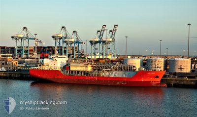
HAPPY CONDOR
Lpg Tanker
Current Trip
| Time Travelled | 7 days |
|---|---|
| Remaining Time | --- |
| Distance Travelled | 2120.50 nm |
| Remaining Distance | 74.06 nm |
| AVG Speed | 10.2 Knop |
| MAX Speed | 15.6 Knop |
| AVG Wind | 21.1 knots |
| MAX Wind | 30.3 knots |
| MIN Temp | 4.1°C / 39.38°F |
| MAX Temp | 15.6°C / 60.08°F |
| Djupgående | 5 m |
| Position mottagen | 1 m sen |
Current Position
| Longitud | 2.64105° |
|---|---|
| Latitude | 51.48923° |
| Status | Under way using engine |
| Fart | 1 Knop |
| Kurs | 146° |
| Område | North Sea |
| Station | T-AIS |
| Position mottagen | 1 m sen |
Info
Information
The current position of HAPPY CONDOR is in North Sea with coordinates 51.48923° / 2.64105° as reported on 2025-02-07 21:56 by AIS to our vessel tracker app. The vessel's current speed is 1 Knop and is heading at the port of ANTWERP. The estimated time of arrival as calculated by MyShipTracking vessel tracking app is 2025-02-07 00:01 LT
The vessel HAPPY CONDOR (IMO: 9368780, MMSI: 219028000) is a Lpg Tanker that was built in 2008 ( 17 År gammal ). It's sailing under the flag of [DK] Denmark.
In this page you can find informations about the vessels current position, last detected port calls, and current voyage information. If the vessels is not in coverage by AIS you will find the latest position.
The current position of HAPPY CONDOR is detected by our AIS receivers and we are not responsible for the reliability of the data. The last position was recorded while the vessel was in Coverage by the Ais receivers of our vessel tracking app.
The current draught of HAPPY CONDOR as reported by AIS is 5 meters
Weather
| Temperature | 4.8°C / 40.64°F |
|---|---|
| Wind Speed | 24 knots |
| Direction | 95° E |
| Pressure | 1019.7 hPa |
| Humidity | 77.2 % |
| Cloud Coverage | 100 % |
Featured Company
Last Port Calls
| Port | Arrival | Departure | Time In Port |
|---|---|---|---|
| 2025-01-25 15:59 | 2025-01-31 10:45 | 5 d | |
| 2025-01-20 03:45 | 2025-01-20 13:37 | 9 h | |
| 2025-01-15 07:19 | 2025-01-17 10:00 | 2 d | |
| 2025-01-13 04:32 | 2025-01-13 13:34 | 9 h | |
| 2024-12-28 18:10 | 2024-12-30 01:54 | 1 d | |
| 2024-12-22 22:35 | 2024-12-22 22:39 | 3 m | |
| 2024-12-05 19:35 |
Most Visited Ports (Last year)
| Port | Arrivals | |
|---|---|---|
| 4 | ||
| 4 | ||
| 4 | ||
| 2 | ||
| 2 | ||
| 2 |
Last Trips
| Origin | Departure | Destination | Arrival | Distance | |
|---|---|---|---|---|---|
| 2025-01-17 13:00 | 2025-01-25 16:59 | 2277.98 nm | |||
| 2025-01-17 13:00 | 2025-01-20 05:45 | 581.27 nm | |||
| 2024-12-30 02:54 | 2025-01-15 10:19 | 2473.32 nm | |||
| 2024-12-30 02:54 | 2025-01-13 06:32 | 1808.34 nm | |||
| 2024-12-22 23:39 | 2024-12-28 19:10 | 716.28 nm | |||
| 2024-12-05 20:35 | 2024-12-22 23:35 | 2061.09 nm |
Events
| Tid | Event | Detaljer | Position / Dest | Information |
|---|---|---|---|---|
| 2025-02-07 20:10 | STOPPAR förflyttning | 18.52 nm, North West of OOSTENDE |
51.49103 / 2.69235
FRFOS>WANDELAAR
|
Fart: 0.1 kn Kurs: 82° |
| 2025-02-07 10:44 | STARTAR förflyttning | 19.26 nm, North West of OOSTENDE |
51.47238 / 2.61540
FRFOS>WANDELAAR
|
Fart: 3.1 kn Kurs: 53° |
| 2025-02-07 08:44 | STOPPAR förflyttning | 18.59 nm, North West of OOSTENDE |
51.49365 / 2.69560
FRFOS>WANDELAAR
|
Fart: 0.1 kn Kurs: 88° |
| 2025-02-07 04:20 | STARTAR förflyttning | 19.51 nm, North West of OOSTENDE |
51.49728 / 2.65837
FRFOS>WANDELAAR
|
Fart: 3.1 kn Kurs: 38° |
| 2025-02-07 03:19 | STOPPAR förflyttning | 18.72 nm, North West of OOSTENDE |
51.46603 / 2.62570
FRFOS>WANDELAAR
|
Fart: 0.2 kn Kurs: 36° |
| 2025-02-06 23:57 | STARTAR förflyttning | 18.73 nm, North West of OOSTENDE |
51.46757 / 2.62812
FRFOS>WANDELAAR
|
Fart: 3.1 kn Kurs: 74° |
| 2025-02-06 23:03 | STOPPAR förflyttning | 19.08 nm, North West of OOSTENDE |
51.48927 / 2.65982
FRFOS>WANDELAAR
|
Fart: 0.3 kn Kurs: 64° |
| 2025-02-06 21:47 | Byter havsområde | Belgian part of the North Sea French part of the North Sea |
51.32400 / 2.37402
North Sea
FRFOS>WANDELAAR
|
Fart: 12.8 kn Kurs: 56.2° |
| 2025-02-06 19:11 | Byter havsområde | French part of the North Sea French part of the English Channel |
51.00700 / 1.60603
North Sea
FRFOS>WANDELAAR
|
Fart: 14.6 kn Kurs: 43.2° |
| 2025-02-06 17:36 | Status ändrad | Under way using engine Default |
50.67903 / 1.30963
FRFOS>WANDELAAR
|
Fart: 13.6 kn Kurs: 46° |