
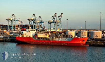
HAPPY CONDOR
Lpg Tanker
Current Trip
| Time Travelled | 13 h, 21 mins |
|---|---|
| Remaining Time | 5 days |
| Distance Travelled | 149.04 nm |
| Remaining Distance | 1964.98 nm |
| AVG Speed | 14.7 Knots |
| MAX Speed | 15.6 Knots |
| AVG Wind | 21.2 knots |
| MAX Wind | 30.3 knots |
| MIN Temp | 10.1°C / 50.18°F |
| MAX Temp | 11.6°C / 52.88°F |
| Draught | 5 m |
| Position Received | Now |
Current Position
| Longitude | 3.34317° |
|---|---|
| Latitude | 41.38407° |
| Status | Under way using engine |
| Speed | 15.2 Knots |
| Course | 220.7° |
| Area | Balearic Sea |
| Station | T-AIS |
| Position Received | Now |
Info
Information
The current position of HAPPY CONDOR is in Balearic Sea with coordinates 41.38407° / 3.34317° as reported on 2025-02-01 00:06 by AIS to our vessel tracker app. The vessel's current speed is 15.2 Knots and is heading at the port of ANTWERP. The estimated time of arrival as calculated by MyShipTracking vessel tracking app is 2025-02-06 07:48 LT
The vessel HAPPY CONDOR (IMO: 9368780, MMSI: 219028000) is a Lpg Tanker that was built in 2008 ( 17 years old ). It's sailing under the flag of [DK] Denmark.
In this page you can find informations about the vessels current position, last detected port calls, and current voyage information. If the vessels is not in coverage by AIS you will find the latest position.
The current position of HAPPY CONDOR is detected by our AIS receivers and we are not responsible for the reliability of the data. The last position was recorded while the vessel was in Coverage by the Ais receivers of our vessel tracking app.
The current draught of HAPPY CONDOR as reported by AIS is 5 meters
Weather
| Temperature | 11°C / 51.8°F |
|---|---|
| Wind Speed | 9 knots |
| Direction | 29° NNE |
| Pressure | 1025.2 hPa |
| Humidity | 64.7 % |
| Cloud Coverage | 85 % |
Featured Company
Last Port Calls
| Port | Arrival | Departure | Time In Port |
|---|---|---|---|
| 2025-01-25 15:59 | 2025-01-31 10:45 | 5 d | |
| 2025-01-31 10:45 | |||
| 2025-01-25 15:59 | |||
| 2025-01-20 03:45 | 2025-01-20 13:37 | 9 h | |
| 2025-01-20 13:37 | |||
| 2025-01-20 03:45 | |||
| 2025-01-15 07:19 | 2025-01-17 10:00 | 2 d | |
| 2025-01-17 10:00 | |||
| 2025-01-15 07:19 | |||
| 2025-01-13 04:32 | 2025-01-13 13:34 | 9 h |
Most Visited Ports (Last year)
| Port | Arrivals | |
|---|---|---|
| 4 | ||
| 4 | ||
| 4 | ||
| 2 | ||
| 2 | ||
| 2 |
Last Trips
| Origin | Departure | Destination | Arrival | Distance | |
|---|---|---|---|---|---|
| 2025-01-17 13:00 | 2025-01-25 16:59 | 2277.98 nm | |||
| 2025-01-17 13:00 | 2025-01-25 16:59 | 2277.98 nm | |||
| 2025-01-17 13:00 | 2025-01-20 05:45 | 581.27 nm | |||
| 2025-01-17 13:00 | 2025-01-20 05:45 | 581.27 nm | |||
| 2024-12-30 02:54 | 2025-01-15 10:19 | 2473.32 nm | |||
| 2024-12-30 02:54 | 2025-01-15 10:19 | 2473.32 nm | |||
| 2024-12-30 02:54 | 2025-01-13 06:32 | 1808.34 nm | |||
| 2024-12-30 02:54 | 2025-01-13 06:32 | 1808.34 nm | |||
| 2024-12-22 23:39 | 2024-12-28 19:10 | 716.28 nm | |||
| 2024-12-05 20:35 | 2024-12-22 23:35 | 2061.09 nm |
Events
| Time | Event | Details | Position / Dest | Info |
|---|---|---|---|---|
| 2025-01-31 23:37 | Change Sea Area | Spanish part of the Balearic Sea Spanish part of the Mediterranean Sea - Western Basin |
41.47565 / 3.44658
Balearic Sea
FRFOS>WANDELAAR
|
Speed: 15.3 kn Course: 223.2° |
| 2025-01-31 23:03 | Destination Changed | FRFOS>WANDELAAR FRFOS>>FOR ORDER |
41.58655 / 3.57188
FRFOS>WANDELAAR
|
Speed: 15.2 kn Course: 221.8° |
| 2025-01-31 23:03 | ETA Changed | 2025/02/06 21:00 2025/01/31 12:00 |
41.58655 / 3.57188
FRFOS>WANDELAAR
|
Speed: 15.2 kn Course: 221.8° |
| 2025-01-31 21:49 | Change Sea Area | Spanish part of the Mediterranean Sea - Western Basin French part of the Mediterranean Sea - Western Basin |
41.80763 / 3.83780
Mediterranean Sea - Western Basin
|
Speed: 14.2 kn Course: 220.7° |
| 2025-01-31 21:48 | IN Coverage |
41.80763 / 3.83780
Mediterranean Sea - Western Basin
|
Speed: 14.2 kn Course: 220.7° |
|
| 2025-01-31 11:37 | Status Changed | Default Under way using engine |
43.21107 / 5.01130
FRFOS>>FOR ORDER
|
Speed: 14.7 kn Course: 165.2° |
| 2025-01-31 11:31 | OUT of Coverage |
43.23542 / 5.00617
Mediterranean Sea - Western Basin
FRFOS>>FOR ORDER
|
Speed: 14.7 kn Course: 165.2° |
|
| 2025-01-31 10:55 | Status Changed | Under way using engine Moored |
43.37542 / 4.95305
FRFOS>>FOR ORDER
|
Speed: 12 kn Course: 134.8° |
| 2025-01-31 10:45 | PORT DEPARTURE |
|
43.39175 / 4.92585
FRFOS>>FOR ORDER
|
Speed: 10.2 kn Course: 125° |
| 2025-01-31 10:33 | Draught Changed | 5 7.2 |
43.40177 / 4.87230
[FR] FOS
|
Speed: 11.5 kn Course: 101° |