

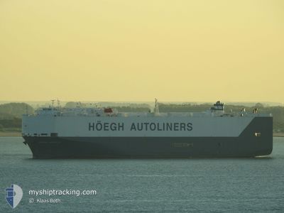
HOEGH MANILA
Ro-Ro/Passenger Ship

Current Trip
| Trip Time | 17 days |
|---|---|
| Trip Distance | 5401.04 nm |
| AVG Speed | 12.8 Knop |
| MAX Speed | 19 Knop |
| Djupgående | 7.1 m |
| AVG Wind | 15 knots |
| MAX Wind | 24.5 knots |
| MIN Temp | 10°C / 50°F |
| MAX Temp | 31.3°C / 88.34°F |
| Position mottagen | 1 m sen |
Current Position
| Longitud | 8.55304° |
|---|---|
| Latitude | 53.57551° |
| Status | Moored |
| Fart | |
| Kurs | 241° |
| Område | North Sea |
| Station | T-AIS |
| Position mottagen | 1 m sen |
Information
The current position of HOEGH MANILA is in North Sea with coordinates 53.57551° / 8.55304° as reported on 2025-06-09 13:08 by AIS to our vessel tracker app. The vessel's current speed is 0 Knop and is currently inside the port of BREMERHAVEN.
The vessel HOEGH MANILA (IMO: 9368912, MMSI: 259709000) is a Ro-Ro/Passenger Ship that was built in 2007 ( 18 År gammal ). It's sailing under the flag of [NO] Norway.
In this page you can find informations about the vessels current position, last detected port calls, and current voyage information. If the vessels is not in coverage by AIS you will find the latest position.
The current position of HOEGH MANILA is detected by our AIS receivers and we are not responsible for the reliability of the data. The last position was recorded while the vessel was in Coverage by the Ais receivers of our vessel tracking app.
The current draught of HOEGH MANILA as reported by AIS is 7.3 meters
Weather
| Temperature | 15.8°C / 60.44°F |
|---|---|
| Wind Speed | 10 knots |
| Direction | 269° W |
| Pressure | 1020.4 hPa |
| Humidity | 71 % |
| Cloud Coverage | 100 % |


Featured Company
Last Port Calls
| Port | Arrival | Departure | Time In Port |
|---|---|---|---|
| 2025-06-09 01:57 | |||
| 2025-05-22 12:44 | 2025-05-22 19:47 | 7 h | |
| 2025-05-20 04:48 | 2025-05-20 18:52 | 14 h | |
| 2025-05-15 20:56 | 2025-05-16 21:28 | 1 d | |
| 2025-05-11 12:16 | 2025-05-12 16:48 | 1 d | |
| 2025-05-06 11:04 | 2025-05-07 00:44 | 13 h | |
| 2025-05-03 04:57 | 2025-05-03 16:33 | 11 h | |
| 2025-05-02 05:14 | 2025-05-02 19:27 | 14 h | |
| 2025-04-23 05:13 | 2025-04-23 19:01 | 13 h | |
| 2025-04-20 10:33 | 2025-04-20 19:25 | 8 h |
Most Visited Ports (Last year)
| Port | Arrivals | |
|---|---|---|
| 13 | ||
| 7 | ||
| 7 | ||
| 7 | ||
| 7 | ||
| 6 |
Last Trips
| Origin | Departure | Destination | Arrival | Distance | |
|---|---|---|---|---|---|
| 2025-05-22 19:47 | 2025-06-09 01:57 | 5401.04 nm | |||
| 2025-05-20 18:52 | 2025-05-22 12:44 | 654.83 nm | |||
| 2025-05-16 21:28 | 2025-05-20 04:48 | 1284.44 nm | |||
| 2025-05-12 16:48 | 2025-05-15 20:56 | 259.01 nm | |||
| 2025-05-07 00:44 | 2025-05-11 12:16 | 1348.09 nm | |||
| 2025-05-03 16:33 | 2025-05-06 11:04 | 949.09 nm | |||
| 2025-05-02 19:27 | 2025-05-03 04:57 | 114.19 nm | |||
| 2025-04-23 19:01 | 2025-05-02 05:14 | 3162.99 nm | |||
| 2025-04-20 19:25 | 2025-04-23 05:13 | 730.35 nm | |||
| 2025-04-19 23:49 | 2025-04-20 10:33 | 112.56 nm |
Events
| Tid | Event | Detaljer | Position / Dest | Information |
|---|---|---|---|---|
| 2025-06-09 02:48 | Djupgående ändrat | 7.3 7.1 |
53.57550 / 8.55301
[DE] BREMERHAVEN
|
Fart: Kurs: 241° |
| 2025-06-09 02:48 | ETA ändrat | 2025/06/10 17:30 2025/06/08 22:30 |
53.57550 / 8.55301
[DE] BREMERHAVEN
|
Fart: Kurs: 241° |
| 2025-06-09 02:41 | Destination ändrad | DEBRV>BEANR USJAX>DEBRV |
53.57551 / 8.55301
[DE] BREMERHAVEN
|
Fart: Kurs: 241° |
| 2025-06-09 01:20 | Status ändrad | Moored Under way using engine |
53.57546 / 8.55298
[DE] BREMERHAVEN
|
Fart: 0.3 kn Kurs: 246° |
| 2025-06-09 00:40 | STOPPAR förflyttning |
53.56960 / 8.54989
[DE] BREMERHAVEN
|
Fart: 0.3 kn Kurs: 183° |
|
| 2025-06-08 23:57 | ANLÄNDER HAMN |
|
53.60375 / 8.50258
[DE] BREMERHAVEN
|
Fart: 10.4 kn Kurs: 141.2° |
| 2025-06-08 21:58 | Djupgående ändrat | 7.1 6.8 |
53.87485 / 7.80765
USJAX>DEBRV
|
Fart: 11 kn Kurs: 101° |
| 2025-06-08 21:58 | Destination ändrad | USJAX>DEBRV PAWVN |
53.87485 / 7.80765
USJAX>DEBRV
|
Fart: 11 kn Kurs: 101° |
| 2025-06-08 21:40 | Djupgående ändrat | 6.8 7.1 |
53.88535 / 7.71302
PAWVN
|
Fart: 9.1 kn Kurs: 99.9° |
| 2025-06-08 21:40 | Destination ändrad | PAWVN USJAX>DEBRV |
53.88535 / 7.71302
PAWVN
|
Fart: 9.1 kn Kurs: 99.9° |