
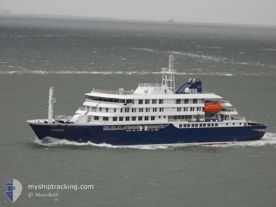
HONDIUS
Passenger
Current Trip
WILD POINT
| Time Travelled | 11 days |
|---|---|
| Remaining Time | --- |
| Distance Travelled | 2131.99 nm |
| Remaining Distance | --- |
| AVG Speed | 10.7 Knop |
| MAX Speed | 16 Knop |
| AVG Wind | 15.1 knots |
| MAX Wind | 32 knots |
| MIN Temp | -3.6°C / 25.52°F |
| MAX Temp | 12.2°C / 53.96°F |
| Djupgående | 5.4 m |
| Position mottagen | 1 m sen |
Current Position
| Longitud | -52.65810° |
|---|---|
| Latitude | -59.80421° |
| Status | Under way using engine |
| Fart | 8.8 Knop |
| Kurs | 243.6° |
| Område | South Atlantic Ocean |
| Station | T-AIS |
| Position mottagen | 1 m sen |
Info
Information
The current position of HONDIUS is in South Atlantic Ocean with coordinates -59.80421° / -52.65810° as reported on 2025-02-13 04:13 by AIS to our vessel tracker app. The vessel's current speed is 8.8 Knop
The vessel HONDIUS (IMO: 9818709, MMSI: 244327000) is a Passenger It's sailing under the flag of [NL] Netherlands.
In this page you can find informations about the vessels current position, last detected port calls, and current voyage information. If the vessels is not in coverage by AIS you will find the latest position.
The current position of HONDIUS is detected by our AIS receivers and we are not responsible for the reliability of the data. The last position was recorded while the vessel was in Coverage by the Ais receivers of our vessel tracking app.
The current draught of HONDIUS as reported by AIS is 5.4 meters
Weather
| Temperature | -1.5°C / 29.3°F |
|---|---|
| Wind Speed | 21 knots |
| Direction | 191° S |
| Pressure | 996.1 hPa |
| Humidity | 76.3 % |
| Cloud Coverage | 100 % |
Featured Company
Most Visited Ports (Last year)
| Port | Arrivals | |
|---|---|---|
| 11 | ||
| 2 | ||
| 1 | ||
| 1 | ||
| 1 | ||
| 1 |
Last Trips
| Origin | Departure | Destination | Arrival | Distance | |
|---|---|---|---|---|---|
| 2025-01-22 17:52 | 2025-02-01 01:26 | 1601.87 nm | |||
| 2025-01-04 18:07 | 2025-01-22 00:57 | 3734.67 nm | |||
| 2024-12-17 18:02 | 2025-01-04 00:56 | 3554.13 nm | |||
| 2024-12-05 18:26 | 2024-12-17 01:34 | 1785.04 nm | |||
| 2024-11-23 17:55 | 2024-12-05 01:22 | 1788.65 nm |
Events
| Tid | Event | Detaljer | Position / Dest | Information |
|---|---|---|---|---|
| 2025-02-13 02:38 | Status ändrad | Under way using engine Default |
-59.67886 / -52.18758
WILD POINT
|
Fart: 10.7 kn Kurs: 241° |
| 2025-02-13 02:34 | Status ändrad | Default Under way using engine |
-59.67320 / -52.16645
WILD POINT
|
Fart: 9.2 kn Kurs: 243.9° |
| 2025-02-13 02:26 | Status ändrad | Under way using engine Default |
-59.66326 / -52.12805
WILD POINT
|
Fart: 10 kn Kurs: 242° |
| 2025-02-13 02:21 | Status ändrad | Default Under way using engine |
-59.65722 / -52.10458
WILD POINT
|
Fart: 10.3 kn Kurs: 242.6° |
| 2025-02-13 02:14 | Status ändrad | Under way using engine Default |
-59.64780 / -52.06811
WILD POINT
|
Fart: 10.4 kn Kurs: 243° |
| 2025-02-13 02:09 | Status ändrad | Default Under way using engine |
-59.64088 / -52.04094
WILD POINT
|
Fart: 11 kn Kurs: 248.1° |
| 2025-02-13 01:50 | Status ändrad | Under way using engine Default |
-59.61736 / -51.95001
WILD POINT
|
Fart: 10 kn Kurs: 245° |
| 2025-02-13 01:24 | Status ändrad | Default Under way using engine |
-59.58551 / -51.82010
WILD POINT
|
Fart: 9.3 kn Kurs: 246.2° |
| 2025-02-13 01:21 | Status ändrad | Under way using engine Default |
-59.58196 / -51.80492
WILD POINT
|
Fart: 10.9 kn Kurs: 242° |
| 2025-02-13 00:14 | UTANFÖR täckningsområde |
-59.49714 / -51.45990
South Atlantic Ocean
WILD POINT
|
Fart: 9.7 kn Kurs: 239.2° |