

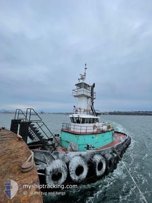
ISLAND BREEZE
Tug

Current Trip
| Trip Time | 7 h, 29 mins |
|---|---|
| Trip Distance | 68.09 nm |
| AVG Speed | 9.3 Knop |
| MAX Speed | 11.1 Knop |
| Djupgående | 4 m |
| AVG Wind | 6.4 knots |
| MAX Wind | 8.8 knots |
| MIN Temp | 10.5°C / 50.9°F |
| MAX Temp | 25.5°C / 77.9°F |
| Position mottagen | 1 d sen |
Current Position
| Longitud | -122.35626° |
|---|---|
| Latitude | 47.57275° |
| Status | Under way using engine |
| Fart | |
| Kurs | --- |
| Område | The Coastal Waters of Southeast Alaska and British Columbia |
| Station | T-AIS |
| Position mottagen | 1 d sen |
Information
The current position of ISLAND BREEZE is in The Coastal Waters of Southeast Alaska and British Columbia with coordinates 47.57275° / -122.35626° as reported on 2025-05-31 01:09 by AIS to our vessel tracker app. The vessel's current speed is 0 Knop and is currently inside the port of SEATTLE.
The vessel ISLAND BREEZE (IMO: 7308762, MMSI: 367439390) is a Tug that was built in 1970 ( 55 År gammal ). It's sailing under the flag of [US] USA.
In this page you can find informations about the vessels current position, last detected port calls, and current voyage information. If the vessels is not in coverage by AIS you will find the latest position.
The current position of ISLAND BREEZE is detected by our AIS receivers and we are not responsible for the reliability of the data. The last position was recorded while the vessel was in Coverage by the Ais receivers of our vessel tracking app.
The current draught of ISLAND BREEZE as reported by AIS is 4 meters
Weather
| Temperature | 24.4°C / 75.92°F |
|---|---|
| Wind Speed | 7 knots |
| Direction | 351° N |
| Pressure | 1018.7 hPa |
| Humidity | 29.5 % |
| Cloud Coverage | 98 % |


Featured Company
Last Port Calls
| Port | Arrival | Departure | Time In Port |
|---|---|---|---|
| 2025-05-30 18:00 | |||
| 2025-05-27 05:41 | 2025-05-30 10:31 | 3 d | |
| 2025-05-25 18:23 | 2025-05-26 21:43 | 1 d | |
| 2025-05-24 12:29 | 2025-05-25 17:15 | 1 d | |
| 2025-05-22 12:08 | 2025-05-24 12:17 | 2 d | |
| 2025-05-22 09:49 | 2025-05-22 11:13 | 1 h | |
| 2025-05-20 12:31 | 2025-05-20 16:35 | 4 h | |
| 2025-05-20 07:06 | 2025-05-20 11:50 | 4 h | |
| 2025-05-20 02:35 | 2025-05-20 04:48 | 2 h | |
| 2025-05-18 18:37 | 2025-05-19 13:24 | 18 h |
Last Trips
| Origin | Departure | Destination | Arrival | Distance | |
|---|---|---|---|---|---|
| 2025-05-30 10:31 | 2025-05-30 18:00 | 68.09 nm | |||
| 2025-05-26 21:43 | 2025-05-27 05:41 | 67.05 nm | |||
| 2025-05-25 17:15 | 2025-05-25 18:23 | 4.18 nm | |||
| 2025-05-24 12:17 | 2025-05-24 12:29 | 1.24 nm | |||
| 2025-05-22 11:13 | 2025-05-22 12:08 | 1.81 nm | |||
| 2025-05-20 16:35 | 2025-05-22 09:49 | 108.64 nm | |||
| 2025-05-20 11:50 | 2025-05-20 12:31 | 1.96 nm | |||
| 2025-05-20 04:48 | 2025-05-20 07:06 | 21.87 nm | |||
| 2025-05-19 13:24 | 2025-05-20 02:35 | 50.95 nm | |||
| 2025-05-18 15:49 | 2025-05-18 18:37 | 1.74 nm |
Events
| Tid | Event | Detaljer | Position / Dest | Information |
|---|---|---|---|---|
| 2025-05-31 01:09 | UTANFÖR täckningsområde |
47.57275 / -122.35626
The Coastal Waters of Southeast Alaska and British Columbia
[US] SEATTLE
|
Fart: Kurs: 312.3° |
|
| 2025-05-31 01:00 | STOPPAR förflyttning |
47.57277 / -122.35621
[US] SEATTLE
|
Fart: 0.3 kn Kurs: 313° |
|
| 2025-05-31 01:00 | ANLÄNDER HAMN |
|
47.57276 / -122.35620
[US] SEATTLE
|
Fart: 0.6 kn Kurs: 311° |
| 2025-05-30 23:12 | ETA ändrat | 2025/05/17 11:00 |
47.82947 / -122.47145
PORT_ANGELES
|
Fart: 10.2 kn Kurs: 167.7° |
| 2025-05-30 17:31 | AVGÅTT HAMN |
|
48.13168 / -123.39553
PORT_ANGELES
|
Fart: 9.4 kn Kurs: 74° |
| 2025-05-30 17:17 | STARTAR förflyttning |
48.12479 / -123.43809
[US] PORT ANGELES
|
Fart: 6 kn Kurs: 81° |
|
| 2025-05-30 16:05 | I täckningsområde |
48.12461 / -123.44092
The Coastal Waters of Southeast Alaska and British Columbia
[US] PORT ANGELES
|
Fart: Kurs: 319.8° |
|
| 2025-05-30 13:32 | UTANFÖR täckningsområde |
48.12455 / -123.44097
The Coastal Waters of Southeast Alaska and British Columbia
[US] PORT ANGELES
|
Fart: Kurs: 179.1° |
|
| 2025-05-29 16:27 | I täckningsområde |
48.12464 / -123.44094
The Coastal Waters of Southeast Alaska and British Columbia
[US] PORT ANGELES
|
Fart: Kurs: 216.2° |
|
| 2025-05-29 04:51 | UTANFÖR täckningsområde |
48.12441 / -123.44184
The Coastal Waters of Southeast Alaska and British Columbia
[US] PORT ANGELES
|
Fart: Kurs: 142.3° |