
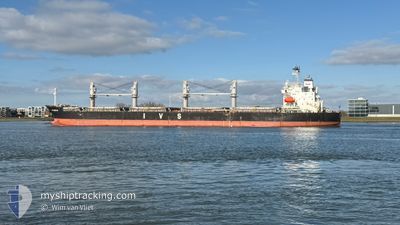
IVS MERLIN
Bulk Carrier
Current Trip
WAIT FOR ORDER
| Time Travelled | 9 days |
|---|---|
| Remaining Time | --- |
| Distance Travelled | 94.13 nm |
| Remaining Distance | --- |
| AVG Speed | 10.7 Knop |
| MAX Speed | 16.2 Knop |
| AVG Wind | 11.1 knots |
| MAX Wind | 21 knots |
| MIN Temp | 4.1°C / 39.38°F |
| MAX Temp | 11°C / 51.8°F |
| Djupgående | 6.1 m |
| Position mottagen | 3 m sen |
Current Position
| Longitud | 2.65639° |
|---|---|
| Latitude | 51.41465° |
| Status | At anchor |
| Fart | 0.1 Knop |
| Kurs | 321° |
| Område | North Sea |
| Station | T-AIS |
| Position mottagen | 3 m sen |
Info
Information
The current position of IVS MERLIN is in North Sea with coordinates 51.41465° / 2.65639° as reported on 2025-03-15 01:17 by AIS to our vessel tracker app. The vessel's current speed is 0.1 Knop
The vessel IVS MERLIN (IMO: 9604847, MMSI: 538009709) is a Bulk Carrier that was built in 2011 ( 14 År gammal ). It's sailing under the flag of [MH] Marshall Is.
In this page you can find informations about the vessels current position, last detected port calls, and current voyage information. If the vessels is not in coverage by AIS you will find the latest position.
The current position of IVS MERLIN is detected by our AIS receivers and we are not responsible for the reliability of the data. The last position was recorded while the vessel was in Coverage by the Ais receivers of our vessel tracking app.
The current draught of IVS MERLIN as reported by AIS is 6.1 meters
Weather
| Temperature | 4.8°C / 40.64°F |
|---|---|
| Wind Speed | 19 knots |
| Direction | 53° NE |
| Pressure | 1017.3 hPa |
| Humidity | 63.5 % |
| Cloud Coverage | 23 % |
Featured Company
Last Port Calls
| Port | Arrival | Departure | Time In Port |
|---|---|---|---|
| 2025-03-03 05:35 | 2025-03-05 07:53 | 2 d | |
| 2025-02-27 03:43 | 2025-03-01 15:12 | 2 d | |
| 2025-02-02 19:57 | 2025-02-06 17:56 | 3 d | |
| 2025-01-20 11:04 | 2025-01-28 05:08 | 7 d | |
| 2025-01-06 07:03 | 2025-01-09 21:34 | 3 d |
Most Visited Ports (Last year)
| Port | Arrivals | |
|---|---|---|
| 3 | ||
| 2 | ||
| 1 | ||
| 1 | ||
| 1 | ||
| 1 |
Last Trips
| Origin | Departure | Destination | Arrival | Distance | |
|---|---|---|---|---|---|
| 2025-03-01 15:12 | 2025-03-03 05:35 | 120.07 nm | |||
| 2025-02-06 17:56 | 2025-02-27 03:43 | 5657.13 nm | |||
| 2025-01-28 05:08 | 2025-02-02 19:57 | 1638.22 nm | |||
| 2025-01-09 21:34 | 2025-01-20 11:04 | 1542.10 nm | |||
| 2024-12-06 18:43 | 2025-01-06 07:03 | 6867.42 nm |
Events
| Tid | Event | Detaljer | Position / Dest | Information |
|---|---|---|---|---|
| 2025-03-13 13:38 | Status ändrad | At anchor Default |
51.41649 / 2.65823
WAIT FOR ORDER
|
Fart: Kurs: 264° |
| 2025-03-13 13:35 | Status ändrad | Default At anchor |
51.41647 / 2.65815
WAIT FOR ORDER
|
Fart: Kurs: 262° |
| 2025-03-12 23:47 | Status ändrad | At anchor Default |
51.41643 / 2.65905
WAIT FOR ORDER
|
Fart: 0.1 kn Kurs: 253° |
| 2025-03-12 23:44 | Status ändrad | Default At anchor |
51.41637 / 2.65913
WAIT FOR ORDER
|
Fart: 0.1 kn Kurs: 253° |
| 2025-03-12 07:56 | Status ändrad | At anchor Under way using engine |
51.41495 / 2.65605
WAIT FOR ORDER
|
Fart: 0.2 kn Kurs: 21° |
| 2025-03-12 07:56 | STOPPAR förflyttning | 15.66 nm, North West of OOSTENDE |
51.41494 / 2.65599
WAIT FOR ORDER
|
Fart: 0.3 kn Kurs: 23° |
| 2025-03-12 07:08 | STARTAR förflyttning | 17.45 nm, North West of OOSTENDE |
51.45434 / 2.65636
WAIT FOR ORDER
|
Fart: 3.1 kn Kurs: 132° |
| 2025-03-12 06:59 | Status ändrad | Under way using engine At anchor |
51.45421 / 2.65374
WAIT FOR ORDER
|
Fart: 0.5 kn Kurs: 24° |
| 2025-03-11 17:04 | Status ändrad | At anchor Default |
51.45240 / 2.65311
WAIT FOR ORDER
|
Fart: 0.1 kn Kurs: 25° |
| 2025-03-11 17:02 | Status ändrad | Default At anchor |
51.45249 / 2.65299
WAIT FOR ORDER
|
Fart: 0.1 kn Kurs: 25° |