
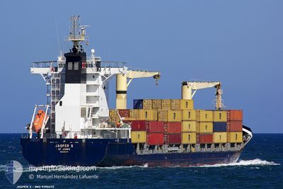
JSP BORA
General Cargo
Current Trip
| Trip Time | 10 h, 1 mins |
|---|---|
| Trip Distance | 114.23 nm |
| AVG Speed | 12.8 Knop |
| MAX Speed | 16.7 Knop |
| Djupgående | 7.1 m |
| AVG Wind | 19.7 knots |
| MAX Wind | 21 knots |
| MIN Temp | 24.8°C / 76.64°F |
| MAX Temp | 26.3°C / 79.34°F |
| Position mottagen | 1 h, 48 m sen |
Current Position
| Longitud | -59.64252° |
|---|---|
| Latitude | 13.10908° |
| Status | Under way using engine |
| Fart | 5.4 Knop |
| Kurs | 108° |
| Område | Caribbean Sea |
| Station | T-AIS |
| Position mottagen | 1 h, 48 m sen |
Info
Information
The current position of JSP BORA is in Caribbean Sea with coordinates 13.10908° / -59.64252° as reported on 2025-02-12 10:15 by AIS to our vessel tracker app. The vessel's current speed is 5.4 Knop and is currently inside the port of BRIDGETOWN.
The vessel JSP BORA (IMO: 9390472, MMSI: 305079000) is a General Cargo that was built in 2007 ( 18 År gammal ). It's sailing under the flag of [AG] Antigua Barbuda.
In this page you can find informations about the vessels current position, last detected port calls, and current voyage information. If the vessels is not in coverage by AIS you will find the latest position.
The current position of JSP BORA is detected by our AIS receivers and we are not responsible for the reliability of the data. The last position was recorded while the vessel was in Coverage by the Ais receivers of our vessel tracking app.
The current draught of JSP BORA as reported by AIS is 7.1 meters
Weather
| Temperature | 25.5°C / 77.9°F |
|---|---|
| Wind Speed | 21 knots |
| Direction | 80° E |
| Pressure | 1014 hPa |
| Humidity | 73.6 % |
| Cloud Coverage | 91 % |
Featured Company
Last Port Calls
| Port | Arrival | Departure | Time In Port |
|---|---|---|---|
| 2025-02-12 10:32 | |||
| 2025-02-11 15:43 | 2025-02-12 00:31 | 8 h | |
| 2025-02-11 04:25 | 2025-02-11 10:13 | 5 h | |
| 2025-02-09 23:09 | 2025-02-10 15:21 | 16 h | |
| 2025-02-04 09:39 | 2025-02-06 20:18 | 2 d | |
| 2025-02-04 09:17 | 2025-02-04 09:24 | 6 m | |
| 2025-01-31 22:10 | 2025-02-01 17:06 | 18 h | |
| 2025-01-29 16:56 | 2025-01-30 15:59 | 23 h | |
| 2025-01-26 22:47 | 2025-01-27 05:19 | 6 h | |
| 2025-01-26 08:35 |
Most Visited Ports (Last year)
| Port | Arrivals | |
|---|---|---|
| 35 | ||
| 28 | ||
| 28 | ||
| 16 | ||
| 16 | ||
| 15 |
Last Trips
| Origin | Departure | Destination | Arrival | Distance | |
|---|---|---|---|---|---|
| 2025-02-11 20:31 | 2025-02-12 06:32 | 114.23 nm | |||
| 2025-02-11 06:13 | 2025-02-11 11:43 | 82.01 nm | |||
| 2025-02-10 11:21 | 2025-02-11 00:25 | 194.85 nm | |||
| 2025-02-06 15:18 | 2025-02-09 19:09 | 1079.51 nm | |||
| 2025-02-04 04:24 | 2025-02-04 04:39 | 0.94 nm | |||
| 2025-02-01 12:06 | 2025-02-04 04:17 | 624.26 nm | |||
| 2025-01-30 10:59 | 2025-01-31 17:10 | 187.29 nm | |||
| 2025-01-27 00:19 | 2025-01-29 11:56 | 670.06 nm | |||
| 2025-01-26 03:26 | 2025-01-26 17:47 | 2.29 nm | |||
| 2025-01-26 03:26 | 2025-01-26 03:35 | 0.68 nm |
Events
| Tid | Event | Detaljer | Position / Dest | Information |
|---|---|---|---|---|
| 2025-02-12 10:32 | STOPPAR förflyttning |
13.10539 / -59.63008
[BB] BRIDGETOWN
|
Fart: 0.1 kn Kurs: 164° |
|
| 2025-02-12 10:32 | ANLÄNDER HAMN |
|
13.10539 / -59.63008
[BB] BRIDGETOWN
|
Fart: 3.9 kn Kurs: 130° |
| 2025-02-12 10:22 | Status ändrad | Default Under way using engine |
13.10791 / -59.63302
BBBGI
|
Fart: 5.4 kn Kurs: 108° |
| 2025-02-12 10:15 | UTANFÖR täckningsområde |
13.10908 / -59.64252
Caribbean Sea
[BB] BRIDGETOWN
|
Fart: 5.4 kn Kurs: 108° |
|
| 2025-02-12 09:51 | Status ändrad | Under way using engine Default |
13.10489 / -59.64620
BBBGI
|
Fart: 2.6 kn Kurs: 341° |
| 2025-02-12 09:18 | Status ändrad | Default Under way using engine |
13.10684 / -59.64203
BBBGI
|
Fart: 0.5 kn Kurs: 120° |
| 2025-02-12 08:05 | Djupgående ändrat | 7.1 7 |
13.14207 / -59.73820
BBBGI
|
Fart: 14.7 kn Kurs: 109.6° |
| 2025-02-12 08:05 | Destination ändrad | BBBGI LCCAS |
13.14207 / -59.73820
BBBGI
|
Fart: 14.7 kn Kurs: 109.6° |
| 2025-02-12 08:05 | ETA ändrat | 2025/02/12 08:30 2025/02/11 15:00 |
13.14207 / -59.73820
BBBGI
|
Fart: 14.7 kn Kurs: 109.6° |
| 2025-02-12 08:01 | Byter havsområde | Barbados part of the Caribbean Sea Saint Lucia part of the Caribbean Sea |
13.14715 / -59.75242
Caribbean Sea
|
Fart: 14.7 kn Kurs: 109.3° |