
KATRE
General Cargo
Current Trip
| Time Travelled | 3 days |
|---|---|
| Remaining Time | --- |
| Distance Travelled | 641.46 nm |
| Remaining Distance | --- |
| AVG Speed | 9.7 Knop |
| MAX Speed | 10.8 Knop |
| AVG Wind | 11.5 knots |
| MAX Wind | 20.4 knots |
| MIN Temp | -5.1°C / 22.82°F |
| MAX Temp | 0.8°C / 33.44°F |
| Djupgående | 6.3 m |
| Position mottagen | 8 m sen |
Current Position
| Longitud | 12.72944° |
|---|---|
| Latitude | 55.96785° |
| Status | At anchor |
| Fart | |
| Kurs | 139° |
| Område | Kattegat |
| Station | T-AIS |
| Position mottagen | 8 m sen |
Info
Information
The current position of KATRE is in Kattegat with coordinates 55.96785° / 12.72944° as reported on 2025-02-16 05:15 by AIS to our vessel tracker app. The vessel's current speed is 0 Knop
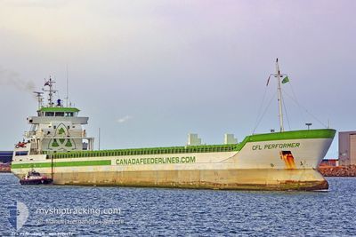
The vessel KATRE (IMO: 9376452, MMSI: 305666000) is a General Cargo that was built in 2007 ( 18 År gammal ). It's sailing under the flag of [AG] Antigua Barbuda.
In this page you can find informations about the vessels current position, last detected port calls, and current voyage information. If the vessels is not in coverage by AIS you will find the latest position.
The current position of KATRE is detected by our AIS receivers and we are not responsible for the reliability of the data. The last position was recorded while the vessel was in Coverage by the Ais receivers of our vessel tracking app.
The current draught of KATRE as reported by AIS is 6.3 meters
Weather
| Temperature | -5.1°C / 22.82°F |
|---|---|
| Wind Speed | 9 knots |
| Direction | 38° NE |
| Pressure | 1027.4 hPa |
| Humidity | 63.9 % |
| Cloud Coverage | --- |
Featured Company
Events
| Tid | Event | Detaljer | Position / Dest | Information |
|---|---|---|---|---|
| 2025-02-15 19:12 | STOPPAR förflyttning | 4.38 nm, South of HELSINGBORG |
55.96564 / 12.72806
SEHEL
|
Fart: Kurs: 30° |
| 2025-02-15 19:00 | Status ändrad | At anchor Under way using engine |
55.96663 / 12.73030
SEHEL
|
Fart: 0.8 kn Kurs: 15° |
| 2025-02-15 17:53 | Byter havsområde | Swedish part of the Kattegat Danish part of the Kattegat |
55.82036 / 12.72434
Kattegat
SEHEL
|
Fart: 9.7 kn Kurs: 24.3° |
| 2025-02-15 15:50 | Byter havsområde | Danish part of the Kattegat Swedish part of the Kattegat |
55.49200 / 12.71462
Kattegat
SEHEL
|
Fart: 9.7 kn Kurs: 8.6° |
| 2025-02-15 14:53 | Byter havsområde | Swedish part of the Kattegat Swedish part of the Baltic Sea |
55.34027 / 12.67866
Kattegat
SEHEL
|
Fart: 9.3 kn Kurs: 3.6° |
| 2025-02-15 06:38 | Byter havsområde | Swedish part of the Baltic Sea Danish part of the Kattegat |
55.50470 / 14.75218
Baltic Sea
SEHEL
|
Fart: 9.6 kn Kurs: 240.3° |
| 2025-02-15 04:50 | Upptäckt i hav | Danish part of the Kattegat |
55.64796 / 15.20496
Kattegat
SEHEL
|
Fart: 9.8 kn Kurs: 239.8° |
| 2025-02-14 22:52 | I täckningsområde |
56.13839 / 16.69415
Baltic Sea
SEHEL
|
Fart: 9.6 kn Kurs: 233.9° |
|
| 2025-02-14 13:15 | UTANFÖR täckningsområde |
57.16264 / 18.82945
Baltic Sea
SEHEL
|
Fart: 10.2 kn Kurs: 216.6° |
|
| 2025-02-14 09:09 | Destination ändrad | SEHEL HELSINBORG |
57.72866 / 19.60008
SEHEL
|
Fart: 9.8 kn Kurs: 216.4° |