
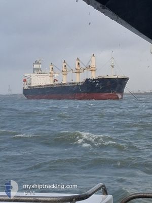
KEN YO
Bulk Carrier
Current Trip
| Time Travelled | 10 days |
|---|---|
| Remaining Time | 2 h, 55 mins |
| Distance Travelled | 1496.80 nm |
| Remaining Distance | 26.03 nm |
| AVG Speed | 8.4 Knop |
| MAX Speed | 14.6 Knop |
| AVG Wind | 16.4 knots |
| MAX Wind | 29.9 knots |
| MIN Temp | 12.8°C / 55.04°F |
| MAX Temp | 20.2°C / 68.36°F |
| Djupgående | 6.3 m |
| Position mottagen | 1 m sen |
Current Position
| Longitud | 152.16815° |
|---|---|
| Latitude | -33.23229° |
| Status | Under way using engine |
| Fart | 2.4 Knop |
| Kurs | 97° |
| Område | Tasman Sea |
| Station | T-AIS |
| Position mottagen | 1 m sen |
Information
The current position of KEN YO is in Tasman Sea with coordinates -33.23229° / 152.16815° as reported on 2025-05-30 22:01 by AIS to our vessel tracker app. The vessel's current speed is 2.4 Knop and is heading at the port of NEWCASTLE. The estimated time of arrival as calculated by MyShipTracking vessel tracking app is 2025-05-31 00:58 LT
The vessel KEN YO (IMO: 9547154, MMSI: 353579000) is a Bulk Carrier that was built in 2012 ( 13 År gammal ). It's sailing under the flag of [PA] Panama.
In this page you can find informations about the vessels current position, last detected port calls, and current voyage information. If the vessels is not in coverage by AIS you will find the latest position.
The current position of KEN YO is detected by our AIS receivers and we are not responsible for the reliability of the data. The last position was recorded while the vessel was in Coverage by the Ais receivers of our vessel tracking app.
The current draught of KEN YO as reported by AIS is 6.3 meters
Weather
| Temperature | 18.7°C / 65.66°F |
|---|---|
| Wind Speed | 12 knots |
| Direction | 184° S |
| Pressure | 1027.2 hPa |
| Humidity | 60.1 % |
| Cloud Coverage | 100 % |
Featured Company
Most Visited Ports (Last year)
| Port | Arrivals | |
|---|---|---|
| 2 | ||
| 2 | ||
| 2 | ||
| 2 | ||
| 2 | ||
| 1 |
Last Trips
Events
| Tid | Event | Detaljer | Position / Dest | Information |
|---|---|---|---|---|
| 2025-05-30 22:01 | Status ändrad | Under way using engine Default |
-33.23229 / 152.16815
AUNTL
|
Fart: 3.6 kn Kurs: 120° |
| 2025-05-30 21:34 | Status ändrad | Default Under way using engine |
-33.17818 / 152.16422
AUNTL
|
Fart: 9 kn Kurs: 181.5° |
| 2025-05-30 21:24 | Status ändrad | Under way using engine Default |
-33.15460 / 152.16499
AUNTL
|
Fart: 7.9 kn Kurs: 176° |
| 2025-05-30 21:21 | Status ändrad | Default Under way using engine |
-33.14838 / 152.16489
AUNTL
|
Fart: 9 kn Kurs: 187.5° |
| 2025-05-30 21:02 | Status ändrad | Under way using engine Default |
-33.10225 / 152.16839
AUNTL
|
Fart: 8.8 kn Kurs: 178° |
| 2025-05-30 20:57 | Status ändrad | Default Under way using engine |
-33.09000 / 152.16832
AUNTL
|
Fart: 9 kn Kurs: 181° |
| 2025-05-30 20:06 | STARTAR förflyttning | 15.55 nm, South of NELSON BAY |
-32.97749 / 152.16045
AUNTL
|
Fart: 3.1 kn Kurs: 98° |
| 2025-05-30 10:11 | Status ändrad | Under way using engine Default |
-33.24905 / 152.07572
AUNTL
|
Fart: 1.8 kn Kurs: 69° |
| 2025-05-30 10:08 | Status ändrad | Default Under way using engine |
-33.25025 / 152.07532
AUNTL
|
Fart: 1.1 kn Kurs: 71° |
| 2025-05-30 09:47 | Status ändrad | Under way using engine Default |
-33.25680 / 152.07379
AUNTL
|
Fart: 1.5 kn Kurs: 77° |