

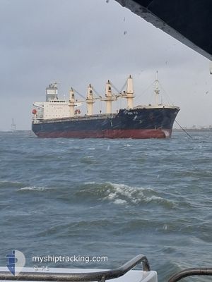
KEN YO
Bulk Carrier

Current Trip
| Time Travelled | 3 days |
|---|---|
| Remaining Time | 6 h, 23 mins |
| Distance Travelled | 1003.42 nm |
| Remaining Distance | 83.77 nm |
| AVG Speed | 11.8 Knots |
| MAX Speed | 14.6 Knots |
| AVG Wind | 12.1 knots |
| MAX Wind | 27 knots |
| MIN Temp | 12.8°C / 55.04°F |
| MAX Temp | 20.2°C / 68.36°F |
| Draught | 6.3 m |
| Position Received | 1 m ago |
Current Position
| Longitude | 151.85106° |
|---|---|
| Latitude | -34.09139° |
| Status | Under way using engine |
| Speed | 13.3 Knots |
| Course | 1.1° |
| Area | Tasman Sea |
| Station | T-AIS |
| Position Received | 1 m ago |
Information
The current position of KEN YO is in Tasman Sea with coordinates -34.09139° / 151.85106° as reported on 2025-05-23 15:55 by AIS to our vessel tracker app. The vessel's current speed is 13.3 Knots and is heading at the port of NEWCASTLE. The estimated time of arrival as calculated by MyShipTracking vessel tracking app is 2025-05-24 08:19 LT
The vessel KEN YO (IMO: 9547154, MMSI: 353579000) is a Bulk Carrier that was built in 2012 ( 13 years old ). It's sailing under the flag of [PA] Panama.
In this page you can find informations about the vessels current position, last detected port calls, and current voyage information. If the vessels is not in coverage by AIS you will find the latest position.
The current position of KEN YO is detected by our AIS receivers and we are not responsible for the reliability of the data. The last position was recorded while the vessel was in Coverage by the Ais receivers of our vessel tracking app.
The current draught of KEN YO as reported by AIS is 6.3 meters
Weather
| Temperature | 17.6°C / 63.68°F |
|---|---|
| Wind Speed | 20 knots |
| Direction | 298° WNW |
| Pressure | 1011.7 hPa |
| Humidity | 57.2 % |
| Cloud Coverage | 49 % |


Featured Company
Most Visited Ports (Last year)
| Port | Arrivals | |
|---|---|---|
| 2 | ||
| 2 | ||
| 2 | ||
| 2 | ||
| 2 | ||
| 1 |
Last Trips
Events
| Time | Event | Details | Position / Dest | Info |
|---|---|---|---|---|
| 2025-05-23 15:12 | Status Changed | Under way using engine Default |
-34.24851 / 151.84982
AUNTL
|
Speed: 12.7 kn Course: 356° |
| 2025-05-23 15:08 | Status Changed | Default Under way using engine |
-34.26218 / 151.84894
AUNTL
|
Speed: 13.1 kn Course: 6.8° |
| 2025-05-23 15:02 | Detected in Sea | Australian part of the Tasman Sea |
-34.28150 / 151.84787
Tasman Sea
AUNTL
|
Speed: 13.1 kn Course: 6.8° |
| 2025-05-23 15:02 | Status Changed | Under way using engine Default |
-34.28150 / 151.84787
AUNTL
|
Speed: 12.9 kn Course: 3° |
| 2025-05-23 14:42 | IN Coverage |
-34.28150 / 151.84787
Tasman Sea
AUNTL
|
Speed: 13.1 kn Course: 6.8° |
|
| 2025-05-21 20:29 | Status Changed | Default Under way using engine |
-39.27929 / 146.27884
AUNTL
|
Speed: 13.5 kn Course: 91.3° |
| 2025-05-21 20:24 | OUT of Coverage |
-39.27893 / 146.25303
Bass Strait
AUNTL
|
Speed: 13.5 kn Course: 91.3° |
|
| 2025-05-21 19:53 | Status Changed | Under way using engine Default |
-39.27449 / 146.10246
AUNTL
|
Speed: 13.6 kn Course: 96° |
| 2025-05-21 19:45 | Status Changed | Default Under way using engine |
-39.27170 / 146.06366
AUNTL
|
Speed: 13.7 kn Course: 95.9° |
| 2025-05-21 17:22 | Status Changed | Under way using engine Default |
-39.22656 / 145.35471
AUNTL
|
Speed: 14.1 kn Course: 92° |