
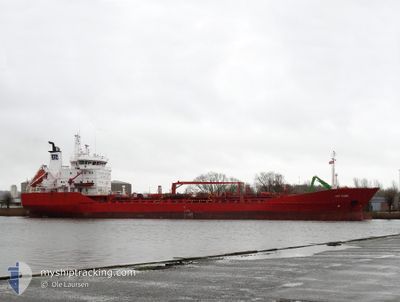
KEY FJORD
Oil/Chemical Tanker
Current Position
| Longitud | 10.16540° |
|---|---|
| Latitude | 54.36298° |
| Status | Under way using engine |
| Fart | 10.1 Knop |
| Kurs | 93° |
| Område | North Sea |
| Station | T-AIS |
| Position mottagen | Nu |
Info
Information
The current position of KEY FJORD is in North Sea with coordinates 54.36298° / 10.16540° as reported on 2025-02-06 05:09 by AIS to our vessel tracker app. The vessel's current speed is 10.1 Knop and is currently inside the port of KIEL.
The vessel KEY FJORD (IMO: 8913708, MMSI: 257136000) is a Oil/Chemical Tanker that was built in 1990 ( 35 År gammal ). It's sailing under the flag of [NO] Norway.
In this page you can find informations about the vessels current position, last detected port calls, and current voyage information. If the vessels is not in coverage by AIS you will find the latest position.
The current position of KEY FJORD is detected by our AIS receivers and we are not responsible for the reliability of the data. The last position was recorded while the vessel was in Coverage by the Ais receivers of our vessel tracking app.
The current draught of KEY FJORD as reported by AIS is 5 meters
Weather
| Temperature | 2°C / 35.6°F |
|---|---|
| Wind Speed | 4 knots |
| Direction | 353° N |
| Pressure | 1041 hPa |
| Humidity | 96.5 % |
| Cloud Coverage | 100 % |
Featured Company
Last Port Calls
| Port | Arrival | Departure | Time In Port |
|---|---|---|---|
| 2025-02-06 06:09 | |||
| 2025-01-31 08:39 | 2025-02-02 12:18 | 2 d | |
| 2025-01-27 06:32 | 2025-01-28 14:16 | 1 d | |
| 2025-01-23 20:28 | 2025-01-25 06:17 | 1 d | |
| 2025-01-19 23:49 | 2025-01-20 21:45 | 21 h | |
| 2025-01-14 07:15 | 2025-01-14 19:03 | 11 h | |
| 2025-01-13 21:21 | 2025-01-13 21:40 | 18 m | |
| 2025-01-12 04:45 | 2025-01-12 17:08 | 12 h | |
| 2025-01-03 16:29 | 2025-01-09 15:02 | 5 d | |
| 2024-12-30 07:31 | 2025-01-01 10:22 | 2 d |
Last Trips
| Origin | Departure | Destination | Arrival | Distance | |
|---|---|---|---|---|---|
| 2025-01-28 14:16 | 2025-01-31 08:39 | 746.63 nm | |||
| 2025-01-25 06:17 | 2025-01-27 06:32 | 223.44 nm | |||
| 2025-01-20 21:45 | 2025-01-23 20:28 | 789.81 nm | |||
| 2025-01-14 19:03 | 2025-01-19 23:49 | 1077.91 nm | |||
| 2025-01-13 21:40 | 2025-01-14 07:15 | 127.53 nm | |||
| 2025-01-12 17:08 | 2025-01-13 21:21 | 221.61 nm | |||
| 2025-01-09 15:02 | 2025-01-12 04:45 | 720.95 nm | |||
| 2025-01-01 10:22 | 2025-01-03 16:29 | 445.13 nm | |||
| 2024-12-29 23:44 | 2024-12-30 07:31 | 82.53 nm | |||
| 2024-12-29 00:21 | 2024-12-29 11:52 | 134.67 nm |
Events
| Tid | Event | Detaljer | Position / Dest | Information |
|---|---|---|---|---|
| 2025-02-06 05:09 | ANLÄNDER HAMN |
|
54.36308 / 10.16439
[DE] KIEL
|
Fart: 10.2 kn Kurs: 104° |
| 2025-02-06 05:03 | STARTAR förflyttning | 1.33 nm, South West of STICKENHΟRN SPORT |
54.36599 / 10.14329
LV LPX
|
Fart: 3.2 kn Kurs: 104° |
| 2025-02-06 03:28 | Status ändrad | Under way using engine Moored |
54.36708 / 10.12742
LV LPX
|
Fart: Kurs: 103° |
| 2025-02-06 01:51 | Status ändrad | Moored Under way using engine |
54.36708 / 10.12740
LV LPX
|
Fart: Kurs: 102° |
| 2025-02-06 01:32 | STOPPAR förflyttning | 1.76 nm, South West of STICKENHΟRN SPORT |
54.36785 / 10.12484
LV LPX
|
Fart: 0.3 kn Kurs: 100° |
| 2025-02-05 23:13 | STARTAR förflyttning | 1.98 nm, North East of BORGSTEDT |
54.34898 / 9.76600
LV LPX
|
Fart: 5.3 kn Kurs: 45.4° |
| 2025-02-05 22:58 | STOPPAR förflyttning | 1.87 nm, North East of BORGSTEDT |
54.34777 / 9.76354
LV LPX
|
Fart: 0.3 kn Kurs: 48° |
| 2025-02-05 17:31 | STARTAR förflyttning | 2.2 nm, North East of OSTERMOOR |
53.94625 / 9.23064
LV LPX
|
Fart: 4.4 kn Kurs: 30° |
| 2025-02-05 17:09 | STOPPAR förflyttning | 2.09 nm, North East of OSTERMOOR |
53.94465 / 9.22873
LV LPX
|
Fart: 0.3 kn Kurs: 35° |
| 2025-02-05 16:11 | STARTAR förflyttning | 0.62 nm, South West of BRUNSBUETTEL |
53.89529 / 9.14822
LV LPX
|
Fart: 3.1 kn Kurs: 48° |