
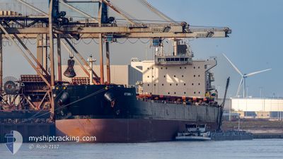
KYTHIRA I
Bulk Carrier
Current Trip
| Time Travelled | 21 days |
|---|---|
| Remaining Time | 15 h, 6 mins |
| Distance Travelled | 5314.74 nm |
| Remaining Distance | 686.05 nm |
| AVG Speed | 10.5 Knop |
| MAX Speed | 14.7 Knop |
| AVG Wind | 15 knots |
| MAX Wind | 29.7 knots |
| MIN Temp | 15.5°C / 59.9°F |
| MAX Temp | 35.5°C / 95.9°F |
| Djupgående | 9.8 m |
| Position mottagen | 4 d sen |
Current Position
| Longitud | -16.76371° |
|---|---|
| Latitude | 23.46768° |
| Status | Under way using engine |
| Fart | 9.4 Knop |
| Kurs | 16.7° |
| Område | North Atlantic Ocean |
| Station | T-AIS |
| Position mottagen | 4 d sen |
Info
Information
The current position of KYTHIRA I is in North Atlantic Ocean with coordinates 23.46768° / -16.76371° as reported on 2025-01-29 15:40 by AIS to our vessel tracker app. The vessel's current speed is 9.4 Knop and is heading at the port of CEUTA. The estimated time of arrival as calculated by MyShipTracking vessel tracking app is 2025-02-03 07:07 LT
The vessel KYTHIRA I (IMO: 9590046, MMSI: 636017090) is a Bulk Carrier that was built in 2011 ( 14 År gammal ). It's sailing under the flag of [LR] Liberia.
In this page you can find informations about the vessels current position, last detected port calls, and current voyage information. If the vessels is not in coverage by AIS you will find the latest position.
The current position of KYTHIRA I is detected by our AIS receivers and we are not responsible for the reliability of the data. The last position was recorded while the vessel was in Coverage by the Ais receivers of our vessel tracking app.
The current draught of KYTHIRA I as reported by AIS is 9.8 meters
Weather
| Temperature | 15.8°C / 60.44°F |
|---|---|
| Wind Speed | 7 knots |
| Direction | 335° NNW |
| Pressure | 1021.4 hPa |
| Humidity | 76.8 % |
| Cloud Coverage | 66 % |
Featured Company
Last Port Calls
| Port | Arrival | Departure | Time In Port |
|---|---|---|---|
| 2025-01-09 13:08 | 2025-01-12 06:18 | 2 d | |
| 2025-01-03 15:02 | 2025-01-08 21:46 | 5 d | |
| 2024-12-07 16:02 | 2024-12-08 20:31 | 1 d |
Most Visited Ports (Last year)
| Port | Arrivals | |
|---|---|---|
| 2 | ||
| 2 | ||
| 1 | ||
| 1 | ||
| 1 | ||
| 1 |
Last Trips
| Origin | Departure | Destination | Arrival | Distance | |
|---|---|---|---|---|---|
| 2025-01-08 18:46 | 2025-01-09 10:08 | 153.24 nm | |||
| 2024-12-08 15:31 | 2025-01-03 12:02 | 6174.52 nm | |||
| 2024-11-08 06:38 | 2024-12-07 11:02 | 5273.43 nm |
Events
| Tid | Event | Detaljer | Position / Dest | Information |
|---|---|---|---|---|
| 2025-01-29 15:45 | Status ändrad | Default Under way using engine |
23.48213 / -16.75909
ES CEU
|
Fart: 9.4 kn Kurs: 16.7° |
| 2025-01-29 15:40 | UTANFÖR täckningsområde |
23.46768 / -16.76371
North Atlantic Ocean
ES CEU
|
Fart: 9.4 kn Kurs: 16.7° |
|
| 2025-01-29 14:56 | Status ändrad | Under way using engine Default |
23.35813 / -16.79444
ES CEU
|
Fart: 9.1 kn Kurs: 16° |
| 2025-01-29 14:36 | I täckningsområde |
23.35813 / -16.79444
North Atlantic Ocean
ES CEU
|
Fart: 9.3 kn Kurs: 13.3° |
|
| 2025-01-29 13:15 | Status ändrad | Default Under way using engine |
23.10352 / -16.86365
ES CEU
|
Fart: 9.4 kn Kurs: 14.1° |
| 2025-01-29 13:09 | UTANFÖR täckningsområde |
23.08826 / -16.86794
North Atlantic Ocean
ES CEU
|
Fart: 9.4 kn Kurs: 14.1° |
|
| 2025-01-29 13:00 | ETA ändrat | 2025/02/02 11:00 2025/02/01 22:00 |
23.06575 / -16.87447
ES CEU
|
Fart: 9.7 kn Kurs: 15.4° |
| 2025-01-29 12:45 | Status ändrad | Under way using engine Default |
23.02764 / -16.88612
ES CEU
|
Fart: 9.4 kn Kurs: 16° |
| 2025-01-29 12:37 | Status ändrad | Default Under way using engine |
23.00612 / -16.89331
ES CEU
|
Fart: 9.2 kn Kurs: 19° |
| 2025-01-29 12:32 | Status ändrad | Under way using engine Default |
22.99415 / -16.89788
ES CEU
|
Fart: 9.3 kn Kurs: 20° |