
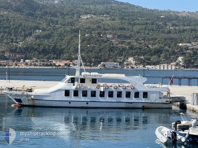
MEANDER EXPRESS
Passengers Ship
Current Trip
| Trip Time | 10 h, 52 mins |
|---|---|
| Trip Distance | 83.09 nm |
| AVG Speed | 14.6 Knop |
| MAX Speed | 16.2 Knop |
| Djupgående | 3 m |
| AVG Wind | 2.6 knots |
| MAX Wind | 4.8 knots |
| MIN Temp | 11.9°C / 53.42°F |
| MAX Temp | 15.4°C / 59.72°F |
| Position mottagen | 5 d sen |
Current Position
| Longitud | 27.14231° |
|---|---|
| Latitude | 37.78005° |
| Status | Under way using engine |
| Fart | 14.5 Knop |
| Kurs | 37.8° |
| Område | Aegean Sea |
| Station | T-AIS |
| Position mottagen | 5 d sen |
Info
Information
The current position of MEANDER EXPRESS is in Aegean Sea with coordinates 37.78005° / 27.14231° as reported on 2025-02-03 14:11 by AIS to our vessel tracker app. The vessel's current speed is 14.5 Knop and is currently inside the port of KUSADASI.
The vessel MEANDER EXPRESS (IMO: 9452426, MMSI: 271001059) is a Passengers Ship that was built in 2007 ( 18 År gammal ). It's sailing under the flag of [TR] Turkey.
In this page you can find informations about the vessels current position, last detected port calls, and current voyage information. If the vessels is not in coverage by AIS you will find the latest position.
The current position of MEANDER EXPRESS is detected by our AIS receivers and we are not responsible for the reliability of the data. The last position was recorded while the vessel was in Coverage by the Ais receivers of our vessel tracking app.
The current draught of MEANDER EXPRESS as reported by AIS is 3 meters
Weather
| Temperature | 8.9°C / 48.02°F |
|---|---|
| Wind Speed | 11 knots |
| Direction | 18° NNE |
| Pressure | 1023.6 hPa |
| Humidity | 52.3 % |
| Cloud Coverage | 5 % |
Featured Company
Last Port Calls
| Port | Arrival | Departure | Time In Port |
|---|---|---|---|
| 2025-02-03 14:39 | |||
| 2025-02-03 03:47 | |||
| 2024-12-28 07:19 | 2024-12-29 14:22 | 1 d | |
| 2024-12-28 06:00 | |||
| 2024-12-21 07:14 | 2024-12-22 14:16 | 1 d | |
| 2024-12-21 06:02 | |||
| 2024-12-14 07:31 | 2024-12-15 14:03 | 1 d | |
| 2024-12-14 05:57 | |||
| 2024-12-07 07:13 | 2024-12-08 14:00 | 1 d | |
| 2024-12-01 13:58 |
Most Visited Ports (Last year)
| Port | Arrivals | |
|---|---|---|
| 124 | ||
| 111 | ||
| 7 | ||
| 5 | ||
| 2 |
Last Trips
| Origin | Departure | Destination | Arrival | Distance | |
|---|---|---|---|---|---|
| 2025-02-03 06:47 | 2025-02-03 17:39 | 83.09 nm | |||
| 2024-12-28 09:00 | 2024-12-28 09:19 | 15.28 nm | |||
| 2024-12-21 09:02 | 2024-12-21 09:14 | 3.66 nm | |||
| 2024-12-14 08:57 | 2024-12-14 09:31 | 14.79 nm | |||
| 2024-12-01 15:58 | 2024-12-07 09:13 | 23.17 nm |
Events
| Tid | Event | Detaljer | Position / Dest | Information |
|---|---|---|---|---|
| 2025-02-03 15:08 | STOPPAR förflyttning |
37.86291 / 27.24946
[TR] KUSADASI
|
Fart: Kurs: -1° |
|
| 2025-02-03 14:39 | ANLÄNDER HAMN |
|
37.86291 / 27.24946
[TR] KUSADASI
|
Fart: 14.9 kn Kurs: 37° |
| 2025-02-03 14:12 | Status ändrad | Default Under way using engine |
37.78530 / 27.14739
TRKUS
|
Fart: 14.5 kn Kurs: 37.8° |
| 2025-02-03 14:11 | UTANFÖR täckningsområde |
37.78005 / 27.14231
Aegean Sea
TRKUS
|
Fart: 14.5 kn Kurs: 37.8° |
|
| 2025-02-03 13:21 | Destination ändrad | TRKUS GRPM |
37.64390 / 26.94844
TRKUS
|
Fart: 14.7 kn Kurs: 51.2° |
| 2025-02-03 13:21 | ETA ändrat | 2025/02/03 18:00 2025/03/02 10:15 |
37.64390 / 26.94844
TRKUS
|
Fart: 14.7 kn Kurs: 51.2° |
| 2025-02-03 11:27 | I täckningsområde |
37.32245 / 26.55583
Aegean Sea
GRPM
|
Fart: 11.7 kn Kurs: 86.1° |
|
| 2025-02-03 07:00 | UTANFÖR täckningsområde |
37.32357 / 26.56832
Aegean Sea
GRPM
|
Fart: 14.6 kn Kurs: 256.3° |
|
| 2025-02-03 06:24 | Status ändrad | Under way using engine Default |
37.42904 / 26.68286
GRPM
|
Fart: 14.4 kn Kurs: 225° |
| 2025-02-03 05:59 | Status ändrad | Default Under way using engine |
37.50151 / 26.76676
GRPM
|
Fart: 14.6 kn Kurs: 231.5° |