
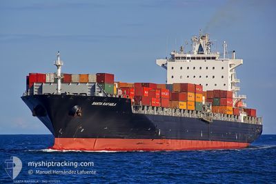
MSC ANISHA R.
Container Ship
Current Trip
| Time Travelled | 1 day |
|---|---|
| Remaining Time | 5 days |
| Distance Travelled | 521.41 nm |
| Remaining Distance | 2834.28 nm |
| AVG Speed | 18 Knop |
| MAX Speed | 20.6 Knop |
| AVG Wind | 18.5 knots |
| MAX Wind | 23 knots |
| MIN Temp | 3.6°C / 38.48°F |
| MAX Temp | 13.3°C / 55.94°F |
| Djupgående | 12.4 m |
| Position mottagen | 19 h, 57 m sen |
Current Position
| Longitud | -5.31258° |
|---|---|
| Latitude | 49.24818° |
| Status | Under way using engine |
| Fart | 17.9 Knop |
| Kurs | 248.4° |
| Område | Celtic Sea |
| Station | T-AIS |
| Position mottagen | 19 h, 57 m sen |
Info
Information
The current position of MSC ANISHA R. is in Celtic Sea with coordinates 49.24818° / -5.31258° as reported on 2025-02-18 21:20 by AIS to our vessel tracker app. The vessel's current speed is 17.9 Knop and is heading at the port of BOSTON. The estimated time of arrival as calculated by MyShipTracking vessel tracking app is 2025-02-25 16:50 LT
The vessel MSC ANISHA R. (IMO: 9227297, MMSI: 636016434) is a Container Ship that was built in 2002 ( 23 År gammal ). It's sailing under the flag of [LR] Liberia.
In this page you can find informations about the vessels current position, last detected port calls, and current voyage information. If the vessels is not in coverage by AIS you will find the latest position.
The current position of MSC ANISHA R. is detected by our AIS receivers and we are not responsible for the reliability of the data. The last position was recorded while the vessel was in Coverage by the Ais receivers of our vessel tracking app.
The current draught of MSC ANISHA R. as reported by AIS is 12.4 meters
Weather
| Temperature | 13.7°C / 56.66°F |
|---|---|
| Wind Speed | 22 knots |
| Direction | 206° SSW |
| Pressure | 1016.1 hPa |
| Humidity | 92.3 % |
| Cloud Coverage | 100 % |
Featured Company
Last Port Calls
| Port | Arrival | Departure | Time In Port |
|---|---|---|---|
| 2025-02-17 11:23 | 2025-02-18 08:26 | 21 h | |
| 2025-02-14 02:55 | 2025-02-15 01:48 | 22 h | |
| 2025-02-09 16:52 | 2025-02-10 05:37 | 12 h | |
| 2025-02-08 09:52 | 2025-02-08 23:36 | 13 h | |
| 2025-02-06 06:26 | 2025-02-06 17:58 | 11 h | |
| 2025-02-04 03:10 | 2025-02-05 09:59 | 1 d | |
| 2025-02-02 06:29 | 2025-02-03 23:31 | 1 d | |
| 2025-01-18 15:25 | 2025-01-19 13:51 | 22 h | |
| 2025-01-13 12:15 | 2025-01-14 19:24 | 1 d | |
| 2025-01-12 00:53 | 2025-01-12 21:25 | 20 h |
Last Trips
| Origin | Departure | Destination | Arrival | Distance | |
|---|---|---|---|---|---|
| 2025-02-15 01:48 | 2025-02-17 12:23 | 296.74 nm | |||
| 2025-02-10 06:37 | 2025-02-14 02:55 | 565.29 nm | |||
| 2025-02-09 00:36 | 2025-02-09 17:52 | 167.78 nm | |||
| 2025-02-06 18:58 | 2025-02-08 10:52 | 280.27 nm | |||
| 2025-02-05 10:59 | 2025-02-06 07:26 | 140.50 nm | |||
| 2025-02-04 00:31 | 2025-02-04 04:10 | 53.28 nm | |||
| 2025-01-19 08:51 | 2025-02-02 07:29 | 5331.94 nm | |||
| 2025-01-14 14:24 | 2025-01-18 10:25 | 903.64 nm | |||
| 2025-01-12 16:25 | 2025-01-13 07:15 | 110.47 nm | |||
| 2025-01-10 02:33 | 2025-01-11 19:53 | 202.99 nm |
Events
| Tid | Event | Detaljer | Position / Dest | Information |
|---|---|---|---|---|
| 2025-02-18 21:27 | Status ändrad | Default Under way using engine |
49.23418 / -5.36725
USBOS
|
Fart: 17.9 kn Kurs: 248.4° |
| 2025-02-18 21:20 | UTANFÖR täckningsområde |
49.24818 / -5.31258
Celtic Sea
USBOS
|
Fart: 17.9 kn Kurs: 248.4° |
|
| 2025-02-18 20:52 | Byter havsområde | United Kingdom part of the Celtic Sea United Kingdom part of the English Channel |
49.30224 / -5.12448
Celtic Sea
USBOS
|
Fart: 17 kn Kurs: 246.1° |
| 2025-02-18 19:01 | Status ändrad | Under way using engine Default |
49.52880 / -4.37058
USBOS
|
Fart: 17.8 kn Kurs: 243° |
| 2025-02-18 18:55 | Status ändrad | Default Under way using engine |
49.54103 / -4.33289
USBOS
|
Fart: 17.8 kn Kurs: 242° |
| 2025-02-18 16:02 | Byter havsområde | United Kingdom part of the English Channel Guernsey part of the English Channel |
49.94085 / -3.04377
English Channel
USBOS
|
Fart: 20 kn Kurs: 244.6° |
| 2025-02-18 14:32 | Status ändrad | Under way using engine Default |
50.07812 / -2.30117
USBOS
|
Fart: 19.4 kn Kurs: 257° |
| 2025-02-18 14:32 | Status ändrad | Default Under way using engine |
50.07916 / -2.29402
USBOS
|
Fart: 19.5 kn Kurs: 256.6° |
| 2025-02-18 14:20 | Status ändrad | Under way using engine Default |
50.08709 / -2.20098
USBOS
|
Fart: 19.2 kn Kurs: 266° |
| 2025-02-18 14:19 | Status ändrad | Default Under way using engine |
50.08744 / -2.19423
USBOS
|
Fart: 19.1 kn Kurs: 266.5° |