
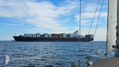
MSC TIANJIN
Container Ship
Current Trip
| Time Travelled | 23 h, 58 mins |
|---|---|
| Remaining Time | 8 h, 44 mins |
| Distance Travelled | 295.73 nm |
| Remaining Distance | 291.54 nm |
| AVG Speed | 17.4 Knop |
| MAX Speed | 21.3 Knop |
| AVG Wind | 8.3 knots |
| MAX Wind | 17.5 knots |
| MIN Temp | 11.8°C / 53.24°F |
| MAX Temp | 20.3°C / 68.54°F |
| Djupgående | 13.8 m |
| Position mottagen | 9 h, 39 m sen |
Current Position
| Longitud | 32.68570° |
|---|---|
| Latitude | 29.36035° |
| Status | Under way using engine |
| Fart | 17.6 Knop |
| Kurs | 326° |
| Område | Gulf of Suez |
| Station | T-AIS |
| Position mottagen | 9 h, 39 m sen |
Info
Information
The current position of MSC TIANJIN is in Gulf of Suez with coordinates 29.36035° / 32.68570° as reported on 2025-02-02 17:03 by AIS to our vessel tracker app. The vessel's current speed is 17.6 Knop and is heading at the port of AQABA. The estimated time of arrival as calculated by MyShipTracking vessel tracking app is 2025-02-03 11:27 LT
The vessel MSC TIANJIN (IMO: 9285471, MMSI: 636019332) is a Container Ship that was built in 2005 ( 20 År gammal ). It's sailing under the flag of [LR] Liberia.
In this page you can find informations about the vessels current position, last detected port calls, and current voyage information. If the vessels is not in coverage by AIS you will find the latest position.
The current position of MSC TIANJIN is detected by our AIS receivers and we are not responsible for the reliability of the data. The last position was recorded while the vessel was in Coverage by the Ais receivers of our vessel tracking app.
The current draught of MSC TIANJIN as reported by AIS is 13.8 meters
Weather
| Temperature | 15.5°C / 59.9°F |
|---|---|
| Wind Speed | 5 knots |
| Direction | 4° N |
| Pressure | 1018 hPa |
| Humidity | 47.9 % |
| Cloud Coverage | 100 % |
Featured Company
Last Port Calls
| Port | Arrival | Departure | Time In Port |
|---|---|---|---|
| 2025-01-31 20:21 | 2025-02-02 02:45 | 1 d | |
| 2025-01-29 08:25 | 2025-01-30 03:47 | 19 h | |
| 2025-01-27 03:30 | 2025-01-29 02:08 | 1 d | |
| 2025-01-26 02:25 | 2025-01-26 21:36 | 19 h | |
| 2025-01-24 05:05 | 2025-01-24 14:03 | 8 h | |
| 2025-01-22 10:35 | 2025-01-23 10:14 | 23 h | |
| 2025-01-19 23:30 | 2025-01-20 17:42 | 18 h | |
| 2025-01-15 16:13 | 2025-01-16 21:23 | 1 d | |
| 2025-01-12 20:27 | 2025-01-13 20:54 | 1 d | |
| 2025-01-10 00:17 | 2025-01-12 05:32 | 2 d |
Most Visited Ports (Last year)
| Port | Arrivals | |
|---|---|---|
| 5 | ||
| 5 | ||
| 4 | ||
| 4 | ||
| 3 | ||
| 3 |
Last Trips
| Origin | Departure | Destination | Arrival | Distance | |
|---|---|---|---|---|---|
| 2025-01-30 06:47 | 2025-01-31 22:21 | 547.03 nm | |||
| 2025-01-29 05:08 | 2025-01-29 11:25 | 85.34 nm | |||
| 2025-01-27 00:36 | 2025-01-27 06:30 | 87.32 nm | |||
| 2025-01-23 12:14 | 2025-01-26 05:25 | 868.97 nm | |||
| 2025-01-23 12:14 | 2025-01-24 07:05 | 177.76 nm | |||
| 2025-01-20 18:42 | 2025-01-22 12:35 | 825.99 nm | |||
| 2025-01-16 22:23 | 2025-01-20 00:30 | 313.91 nm | |||
| 2025-01-13 21:54 | 2025-01-15 17:13 | 764.61 nm | |||
| 2025-01-12 06:32 | 2025-01-12 21:27 | 198.21 nm | |||
| 2025-01-05 03:20 | 2025-01-10 01:17 | 1718.48 nm |
Events
| Tid | Event | Detaljer | Position / Dest | Information |
|---|---|---|---|---|
| 2025-02-02 19:09 | STOPPAR förflyttning | 5.27 nm, South East of AL ADABIYAH |
29.83150 / 32.55900
JOAQJ
|
Fart: 0.2 kn Kurs: 2° |
| 2025-02-02 17:12 | Status ändrad | Default Under way using engine |
29.39648 / 32.66075
JOAQJ
|
Fart: 17.6 kn Kurs: 326° |
| 2025-02-02 17:03 | Byter havsområde | Egyptian part of the Gulf of Suez Egyptian part of the Red Sea |
29.36035 / 32.68570
Gulf of Suez
|
Fart: 17.6 kn Kurs: 326° |
| 2025-02-02 17:03 | Status ändrad | Under way using engine Default |
29.36035 / 32.68570
JOAQJ
|
Fart: 17.9 kn Kurs: 347° |
| 2025-02-02 17:03 | I täckningsområde |
29.36035 / 32.68570
Gulf of Suez
|
Fart: 17.6 kn Kurs: 326° |
|
| 2025-02-02 17:03 | UTANFÖR täckningsområde |
29.36035 / 32.68570
Gulf of Suez
|
Fart: 17.6 kn Kurs: 326° |
|
| 2025-02-02 02:49 | STARTAR förflyttning | 0.12 nm, North West of MOTA BERTH |
29.46877 / 34.97207
JOAQJ
|
Fart: 4 kn Kurs: 297° |
| 2025-02-02 02:45 | AVGÅTT HAMN |
|
29.46877 / 34.97207
JOAQJ
|
Fart: Kurs: 10° |
| 2025-01-31 20:25 | STOPPAR förflyttning |
29.46517 / 34.97400
[JO] MOTA BERTH
|
Fart: 0.3 kn Kurs: 11° |
|
| 2025-01-31 20:21 | ANLÄNDER HAMN |
|
29.46517 / 34.97350
[JO] MOTA BERTH
|
Fart: 0.8 kn Kurs: 19° |