
MSC TRADER II
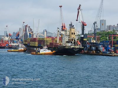
Container Ship
Current Trip
| Trip Time | 1 day |
|---|---|
| Trip Distance | 410.14 nm |
| AVG Speed | 12.8 Knop |
| MAX Speed | 17.6 Knop |
| Djupgående | 8.9 m |
| AVG Wind | 20.2 knots |
| MAX Wind | 26.8 knots |
| MIN Temp | 16.6°C / 61.88°F |
| MAX Temp | 20.3°C / 68.54°F |
| Position mottagen | 2 d sen |
Current Position
| Longitud | 114.11614° |
|---|---|
| Latitude | 22.24970° |
| Status | Under way using engine |
| Fart | 13.8 Knop |
| Kurs | 149.7° |
| Område | South China Sea |
| Station | T-AIS |
| Position mottagen | 2 d sen |
Info
Information
The current position of MSC TRADER II is in South China Sea with coordinates 22.24970° / 114.11614° as reported on 2025-12-16 16:53 by AIS to our vessel tracker app. The vessel's current speed is 13.8 Knop and is currently inside the port of JIANGYIN.
The vessel MSC TRADER II (IMO: 9230775, MMSI: 636020978) is a Container Ship that was built in 2001 ( 24 År gammal ). It's sailing under the flag of [LR] Liberia.
In this page you can find informations about the vessels current position, last detected port calls, and current voyage information. If the vessels is not in coverage by AIS you will find the latest position.
The current position of MSC TRADER II is detected by our AIS receivers and we are not responsible for the reliability of the data. The last position was recorded while the vessel was in Coverage by the Ais receivers of our vessel tracking app.
The current draught of MSC TRADER II as reported by AIS is 8.9 meters
Weather
| Temperature | 16.7°C / 62.06°F |
|---|---|
| Wind Speed | 3 knots |
| Direction | 45° NE |
| Pressure | 1018 hPa |
| Humidity | 83.8 % |
| Cloud Coverage | 54 % |
Featured Company
Last Port Calls
| Port | Arrival | Departure | Time In Port |
|---|---|---|---|
| 2025-12-19 09:30 | |||
| 2025-12-17 07:26 | 2025-12-18 01:22 | 17 h | |
| 2025-12-06 14:37 | 2025-12-07 09:59 | 19 h | |
| 2025-12-05 11:11 | 2025-12-05 18:45 | 7 h | |
| 2025-11-30 01:34 | 2025-12-01 03:48 | 1 d | |
| 2025-11-27 09:10 | 2025-11-28 10:36 | 1 d | |
| 2025-11-16 19:14 | 2025-11-18 03:21 | 1 d | |
| 2025-11-14 20:17 | 2025-11-15 15:42 | 19 h | |
| 2025-11-12 16:04 | 2025-11-13 13:32 | 21 h | |
| 2025-11-11 04:16 | 2025-11-12 00:48 | 20 h |
Most Visited Ports (Last year)
| Port | Arrivals | |
|---|---|---|
| 8 | ||
| 8 | ||
| 7 | ||
| 7 | ||
| 6 | ||
| 2 |
Last Trips
| Origin | Departure | Destination | Arrival | Distance | |
|---|---|---|---|---|---|
| 2025-12-18 01:22 | 2025-12-19 09:30 | 410.14 nm | |||
| 2025-12-07 09:59 | 2025-12-17 07:26 | 2410.46 nm | |||
| 2025-12-05 18:45 | 2025-12-06 14:37 | 104.75 nm | |||
| 2025-12-01 03:48 | 2025-12-05 11:11 | 1586.71 nm | |||
| 2025-11-28 10:36 | 2025-11-30 01:34 | 599.43 nm | |||
| 2025-11-18 03:21 | 2025-11-27 09:10 | 1406.79 nm | |||
| 2025-11-15 15:42 | 2025-11-16 19:14 | 166.30 nm | |||
| 2025-11-13 13:32 | 2025-11-14 20:17 | 444.96 nm | |||
| 2025-11-12 00:48 | 2025-11-12 16:04 | 216.12 nm | |||
| 2025-10-29 04:12 | 2025-11-11 04:16 | 2630.66 nm |
Events
| Tid | Event | Detaljer | Position / Dest | Information |
|---|---|---|---|---|
| 2025-12-19 01:37 | STOPPAR förflyttning |
25.41855 / 119.28092
[CN] JIANGYIN
|
Fart: 0.1 kn Kurs: 118° |
|
| 2025-12-19 01:30 | ANLÄNDER HAMN |
|
25.41823 / 119.28064
[CN] JIANGYIN
|
Fart: 4.7 kn Kurs: 335° |
| 2025-12-17 17:22 | AVGÅTT HAMN |
|
22.56154 / 114.28201
CNYTN
|
Fart: 8.2 kn Kurs: 126° |
| 2025-12-17 17:14 | STARTAR förflyttning |
22.57022 / 114.26484
[CN] YANTIAN
|
Fart: 5.1 kn Kurs: 140° |
|
| 2025-12-16 23:50 | STOPPAR förflyttning |
22.57177 / 114.26099
[CN] YANTIAN
|
Fart: 0.3 kn Kurs: 49° |
|
| 2025-12-16 23:26 | ANLÄNDER HAMN |
|
22.56257 / 114.27309
[CN] YANTIAN
|
Fart: 8.6 kn Kurs: 279° |
| 2025-12-16 16:54 | Status ändrad | Default Under way using engine |
22.24746 / 114.11751
CNYTN
|
Fart: 13.8 kn Kurs: 149.7° |
| 2025-12-16 16:53 | UTANFÖR täckningsområde |
22.24970 / 114.11614
South China Sea
|
Fart: 13.8 kn Kurs: 149.7° |
|
| 2025-12-16 15:12 | STARTAR förflyttning | 0.76 nm, North West of CHIWAN |
22.46634 / 113.87228
CNYTN
|
Fart: 3.2 kn Kurs: 163° |
| 2025-12-16 14:38 | Status ändrad | Under way using engine Moored |
22.46982 / 113.87391
CNYTN
|
Fart: Kurs: 333° |