
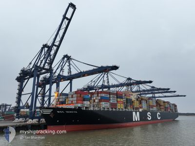
MSC VANDYA
Container Ship
Current Trip
CNYTN
| Time Travelled | 4 days |
|---|---|
| Remaining Time | --- |
| Distance Travelled | 1329.99 nm |
| Remaining Distance | --- |
| AVG Speed | 14.4 Knop |
| MAX Speed | 19.9 Knop |
| AVG Wind | 14.1 knots |
| MAX Wind | 28 knots |
| MIN Temp | 24.3°C / 75.74°F |
| MAX Temp | 30°C / 86°F |
| Djupgående | 13.2 m |
| Position mottagen | 5 d sen |
Current Position
| Longitud | 113.80940° |
|---|---|
| Latitude | 22.26058° |
| Status | Under way using engine |
| Fart | 15.6 Knop |
| Kurs | 169.8° |
| Område | South China Sea |
| Station | T-AIS |
| Position mottagen | 5 d sen |
Information
The current position of MSC VANDYA is in South China Sea with coordinates 22.26058° / 113.80940° as reported on 2025-05-30 07:47 by AIS to our vessel tracker app. The vessel's current speed is 15.6 Knop
The vessel MSC VANDYA (IMO: 9484467, MMSI: 373005000) is a Container Ship that was built in 2012 ( 13 År gammal ). It's sailing under the flag of [PA] Panama.
In this page you can find informations about the vessels current position, last detected port calls, and current voyage information. If the vessels is not in coverage by AIS you will find the latest position.
The current position of MSC VANDYA is detected by our AIS receivers and we are not responsible for the reliability of the data. The last position was recorded while the vessel was in Coverage by the Ais receivers of our vessel tracking app.
The current draught of MSC VANDYA as reported by AIS is 13.2 meters
Weather
| Temperature | 29.6°C / 85.28°F |
|---|---|
| Wind Speed | 9 knots |
| Direction | 168° SSE |
| Pressure | 1009.5 hPa |
| Humidity | 73.2 % |
| Cloud Coverage | 14 % |
Featured Company
Last Port Calls
| Port | Arrival | Departure | Time In Port |
|---|---|---|---|
| 2025-05-30 14:42 | 2025-05-31 11:50 | 21 h | |
| 2025-05-29 10:43 | 2025-05-30 05:42 | 18 h | |
| 2025-05-19 13:33 | 2025-05-21 09:06 | 1 d | |
| 2025-05-01 04:24 | 2025-05-04 04:34 | 3 d | |
| 2025-04-20 01:29 | 2025-04-22 12:16 | 2 d | |
| 2025-04-14 05:55 | 2025-04-18 08:33 | 4 d | |
| 2025-04-14 04:44 | 2025-04-14 04:53 | 9 m | |
| 2025-04-03 02:10 | 2025-04-04 16:24 | 1 d |
Most Visited Ports (Last year)
| Port | Arrivals | |
|---|---|---|
| 3 | ||
| 3 | ||
| 3 | ||
| 2 | ||
| 2 | ||
| 2 |
Last Trips
| Origin | Departure | Destination | Arrival | Distance | |
|---|---|---|---|---|---|
| 2025-05-30 13:42 | 2025-05-30 22:42 | 126.29 nm | |||
| 2025-05-21 18:06 | 2025-05-29 18:43 | 1526.94 nm | |||
| 2025-05-03 21:34 | 2025-05-19 22:33 | 4756.08 nm | |||
| 2025-04-22 05:16 | 2025-04-30 21:24 | 732.29 nm | |||
| 2025-04-18 01:33 | 2025-04-19 18:29 | 612.06 nm | |||
| 2025-04-13 21:53 | 2025-04-13 22:55 | 1.46 nm | |||
| 2025-04-05 01:24 | 2025-04-13 21:44 | 4235.83 nm | |||
| 2025-03-28 20:53 | 2025-04-03 11:10 | 52.21 nm |
Events
| Tid | Event | Detaljer | Position / Dest | Information |
|---|---|---|---|---|
| 2025-05-31 11:50 | AVGÅTT HAMN |
|
22.56398 / 114.30475
CNYTN
|
Fart: 7.6 kn Kurs: 123° |
| 2025-05-31 11:42 | STARTAR förflyttning |
22.57349 / 114.28870
[CN] YANTIAN
|
Fart: 5.1 kn Kurs: 135° |
|
| 2025-05-30 15:15 | STOPPAR förflyttning |
22.57843 / 114.27834
[CN] YANTIAN
|
Fart: Kurs: 318° |
|
| 2025-05-30 14:42 | ANLÄNDER HAMN |
|
22.56978 / 114.29369
[CN] YANTIAN
|
Fart: 4.9 kn Kurs: 301° |
| 2025-05-30 07:54 | Status ändrad | Default Under way using engine |
22.22767 / 113.81361
CNYTN
|
Fart: 15.6 kn Kurs: 169.8° |
| 2025-05-30 07:47 | UTANFÖR täckningsområde |
22.26058 / 113.80940
South China Sea
CNYTN
|
Fart: 15.6 kn Kurs: 169.8° |
|
| 2025-05-30 05:55 | STARTAR förflyttning | 1.62 nm, South East of NANSHA |
22.64792 / 113.68721
CNYTN
|
Fart: 3.1 kn Kurs: 152° |
| 2025-05-30 05:42 | AVGÅTT HAMN |
|
22.64872 / 113.68442
CNYTN
|
Fart: 2 kn Kurs: 23° |
| 2025-05-30 05:40 | ETA ändrat | 2025/05/30 14:00 2025/05/30 17:00 |
22.64757 / 113.68371
[CN] NANSHA
|
Fart: 1.6 kn Kurs: 8° |
| 2025-05-30 04:45 | Status ändrad | Under way using engine Default |
22.64493 / 113.68228
[CN] NANSHA
|
Fart: Kurs: 347° |