
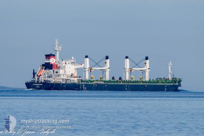
MYKONOS DAWN
Not available
Current Trip
| Time Travelled | 9 days |
|---|---|
| Remaining Time | --- |
| Distance Travelled | 1017.58 nm |
| Remaining Distance | --- |
| AVG Speed | 12.1 Knop |
| MAX Speed | 14.2 Knop |
| AVG Wind | 7.6 knots |
| MAX Wind | 21 knots |
| MIN Temp | 21.6°C / 70.88°F |
| MAX Temp | 27.4°C / 81.32°F |
| Djupgående | 9 m |
| Position mottagen | 2 d sen |
Current Position
| Longitud | -38.49893° |
|---|---|
| Latitude | -12.82415° |
| Status | Moored |
| Fart | |
| Kurs | 180° |
| Område | South Atlantic Ocean |
| Station | T-AIS |
| Position mottagen | 2 d sen |
Information
The current position of MYKONOS DAWN is in South Atlantic Ocean with coordinates -12.82415° / -38.49893° as reported on 2025-06-07 00:16 by AIS to our vessel tracker app. The vessel's current speed is 0 Knop and is heading at the port of SAN LORENZO.
The vessel MYKONOS DAWN (MMSI: 538006085) is a Not available It's sailing under the flag of [MH] Marshall Is.
In this page you can find informations about the vessels current position, last detected port calls, and current voyage information. If the vessels is not in coverage by AIS you will find the latest position.
The current position of MYKONOS DAWN is detected by our AIS receivers and we are not responsible for the reliability of the data. The last position was recorded while the vessel was in Coverage by the Ais receivers of our vessel tracking app.
The current draught of MYKONOS DAWN as reported by AIS is 9 meters
Weather
| Temperature | 25.5°C / 77.9°F |
|---|---|
| Wind Speed | 20 knots |
| Direction | 353° N |
| Pressure | 1013 hPa |
| Humidity | 80.1 % |
| Cloud Coverage | 96 % |
Featured Company
Last Port Calls
| Port | Arrival | Departure | Time In Port |
|---|---|---|---|
| 2025-05-26 14:32 | 2025-05-30 05:42 | 3 d | |
| 2025-05-02 19:13 | 2025-05-05 11:54 | 2 d | |
| 2025-04-14 20:09 | 2025-04-15 22:03 | 1 d | |
| 2025-04-09 23:32 |
Most Visited Ports (Last year)
| Port | Arrivals | |
|---|---|---|
| 2 | ||
| 2 | ||
| 2 | ||
| 1 | ||
| 1 | ||
| 1 |
Last Trips
| Origin | Departure | Destination | Arrival | Distance | |
|---|---|---|---|---|---|
| 2025-05-05 11:54 | 2025-05-26 14:32 | 5620.62 nm | |||
| 2025-04-15 22:03 | 2025-05-02 19:13 | 3033.77 nm | |||
| 2025-04-09 23:32 | 2025-04-14 20:09 | 422.02 nm |
Events
| Tid | Event | Detaljer | Position / Dest | Information |
|---|---|---|---|---|
| 2025-06-07 03:36 | STARTAR förflyttning | 3.13 nm, South West of ARATU |
-12.82805 / -38.50454
AR SLO
|
Fart: 8.1 kn Kurs: 227° |
| 2025-06-07 00:22 | Status ändrad | Default Moored |
-12.82420 / -38.49892
AR SLO
|
Fart: Kurs: 180° |
| 2025-06-07 00:16 | UTANFÖR täckningsområde |
-12.82415 / -38.49893
South Atlantic Ocean
|
Fart: Kurs: 181° |
|
| 2025-06-06 21:52 | Status ändrad | Moored Default |
-12.82417 / -38.49895
AR SLO
|
Fart: Kurs: 180° |
| 2025-06-06 21:49 | Status ändrad | Default Moored |
-12.82414 / -38.49894
AR SLO
|
Fart: Kurs: 180° |
| 2025-06-06 20:52 | Status ändrad | Moored Default |
-12.82415 / -38.49894
AR SLO
|
Fart: Kurs: 180° |
| 2025-06-06 20:49 | Status ändrad | Default Moored |
-12.82418 / -38.49893
AR SLO
|
Fart: Kurs: 180° |
| 2025-06-06 20:34 | Status ändrad | Moored Default |
-12.82421 / -38.49893
AR SLO
|
Fart: Kurs: 180° |
| 2025-06-06 20:31 | Status ändrad | Default Moored |
-12.82417 / -38.49892
AR SLO
|
Fart: Kurs: 180° |
| 2025-06-06 20:12 | Destination ändrad | AR SLO BR SSA |
-12.82419 / -38.49894
AR SLO
|
Fart: Kurs: 180° |