
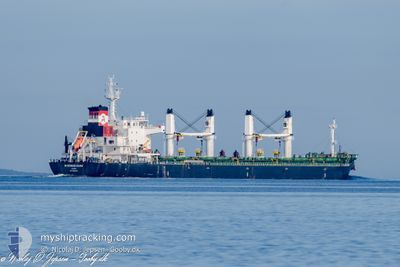
MYKONOS DAWN
Cargo
Current Trip
BR PNG
| Time Travelled | 7 days |
|---|---|
| Remaining Time | --- |
| Distance Travelled | 846.33 nm |
| Remaining Distance | --- |
| AVG Speed | 11.1 Knopen |
| MAX Speed | 12.8 Knopen |
| AVG Wind | 11.2 knots |
| MAX Wind | 44.2 knots |
| MIN Temp | 18.8°C / 65.84°F |
| MAX Temp | 27.8°C / 82.04°F |
| Diepgang | 10.6 M |
| Positie ontvangen | 6 h, 53 m geleden |
Current Position
| Lengtegraad | -55.24386° |
|---|---|
| Breedtegraat | -35.02389° |
| Status | Under way using engine |
| Snelheid | 11.5 Knopen |
| Koers | 67.3° |
| Gebied | Rio de La Plata |
| Station | T-AIS |
| Positie ontvangen | 6 h, 53 m geleden |
Info
Information
The current position of MYKONOS DAWN is in Rio de La Plata with coordinates -35.02389° / -55.24386° as reported on 2025-02-07 15:04 by AIS to our vessel tracker app. The vessel's current speed is 11.5 Knopen
The vessel MYKONOS DAWN (IMO: 9762481, MMSI: 538006085) is a Cargo It's sailing under the flag of [MH] Marshall Is.
In this page you can find informations about the vessels current position, last detected port calls, and current voyage information. If the vessels is not in coverage by AIS you will find the latest position.
The current position of MYKONOS DAWN is detected by our AIS receivers and we are not responsible for the reliability of the data. The last position was recorded while the vessel was in Coverage by the Ais receivers of our vessel tracking app.
The current draught of MYKONOS DAWN as reported by AIS is 10.6 meters
Weather
| Temperature | 23.4°C / 74.12°F |
|---|---|
| Wind Speed | 17 knots |
| Direction | 96° E |
| Pressure | 1016.4 hPa |
| Humidity | 74.3 % |
| Cloud Coverage | --- |
Featured Company
Last Trips
| Origin | Departure | Destination | Arrival | Distance | |
|---|---|---|---|---|---|
| 2024-11-16 08:50 | 2025-01-24 11:55 | 5413.20 nm |
Events
| Tijd | Evenement | Details | Positie / Bestemming | Info |
|---|---|---|---|---|
| 2025-02-07 21:13 | Start beweging | 7.87 nm, West of PUNTA DEL ESTE |
-34.98697 / -55.10535
BR PNG
|
Snelheid: 9.4 kn Koers: 238° |
| 2025-02-07 16:13 | Stop beweging | 6.82 nm, West of PUNTA DEL ESTE |
-34.97343 / -55.08630
BR PNG
|
Snelheid: 0.2 kn Koers: 357° |
| 2025-02-07 15:11 | Status Changed | Default Under way using engine |
-35.01555 / -55.21989
BR PNG
|
Snelheid: 11.5 kn Koers: 67.3° |
| 2025-02-07 15:04 | Buitenbereik |
-35.02389 / -55.24386
Rio de La Plata
|
Snelheid: 11.5 kn Koers: 67.3° |
|
| 2025-02-07 14:56 | Status Changed | Under way using engine Default |
-35.03455 / -55.27425
BR PNG
|
Snelheid: 11.4 kn Koers: 66° |
| 2025-02-07 14:50 | Status Changed | Default Under way using engine |
-35.04100 / -55.29253
BR PNG
|
Snelheid: 11.4 kn Koers: 67.4° |
| 2025-02-07 14:50 | Status Changed | Under way using engine Default |
-35.04163 / -55.29433
BR PNG
|
Snelheid: 11.3 kn Koers: 68° |
| 2025-02-07 14:34 | Status Changed | Default Under way using engine |
-35.06100 / -55.34993
BR PNG
|
Snelheid: 11.6 kn Koers: 73.7° |
| 2025-02-07 14:27 | Status Changed | Under way using engine Default |
-35.06970 / -55.37649
BR PNG
|
Snelheid: 11.7 kn Koers: 80° |
| 2025-02-07 14:27 | Binnenbereik |
-35.06970 / -55.37649
Rio de La Plata
|
Snelheid: 11.6 kn Koers: 73.7° |