
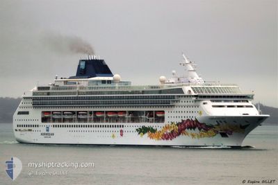
NORWEGIAN SKY
Passengers Ship
Current Trip
| Time Travelled | 13 h, 8 mins |
|---|---|
| Remaining Time | --- |
| Distance Travelled | 128.15 nm |
| Remaining Distance | --- |
| AVG Speed | 16.1 Knop |
| MAX Speed | 18.4 Knop |
| AVG Wind | 17.5 knots |
| MAX Wind | 21.9 knots |
| MIN Temp | 23.5°C / 74.3°F |
| MAX Temp | 24.6°C / 76.28°F |
| Djupgående | 8 m |
| Position mottagen | 3 d sen |
Current Position
| Longitud | 115.12747° |
|---|---|
| Latitude | 5.09665° |
| Status | Under way using engine |
| Fart | 11.4 Knop |
| Kurs | 355.8° |
| Område | South China Sea |
| Station | T-AIS |
| Position mottagen | 3 d sen |
Info
Information
The current position of NORWEGIAN SKY is in South China Sea with coordinates 5.09665° / 115.12747° as reported on 2025-02-03 09:19 by AIS to our vessel tracker app. The vessel's current speed is 11.4 Knop and is heading at the port of MUARA. The estimated time of arrival as calculated by MyShipTracking vessel tracking app is 2025-02-02 21:30 LT
The vessel NORWEGIAN SKY (IMO: 9128532, MMSI: 308865000) is a Passengers Ship that was built in 1999 ( 26 År gammal ). It's sailing under the flag of [BS] Bahamas.
In this page you can find informations about the vessels current position, last detected port calls, and current voyage information. If the vessels is not in coverage by AIS you will find the latest position.
The current position of NORWEGIAN SKY is detected by our AIS receivers and we are not responsible for the reliability of the data. The last position was recorded while the vessel was in Coverage by the Ais receivers of our vessel tracking app.
The current draught of NORWEGIAN SKY as reported by AIS is 8 meters
Weather
| Temperature | 24°C / 75.2°F |
|---|---|
| Wind Speed | 13 knots |
| Direction | 54° NE |
| Pressure | 1010.5 hPa |
| Humidity | 89.3 % |
| Cloud Coverage | 99 % |
Featured Company
Last Port Calls
| Port | Arrival | Departure | Time In Port |
|---|---|---|---|
| 2025-02-05 23:56 | 2025-02-06 12:03 | 12 h | |
| 2025-02-02 22:13 | 2025-02-03 08:53 | 10 h | |
| 2025-01-29 22:09 | 2025-01-30 10:05 | 11 h | |
| 2025-01-27 23:55 | 2025-01-28 09:59 | 10 h | |
| 2025-01-26 00:13 | 2025-01-27 11:13 | 1 d | |
| 2025-01-20 23:13 | 2025-01-21 07:36 | 8 h | |
| 2025-01-18 23:22 | 2025-01-19 10:06 | 10 h | |
| 2025-01-16 22:09 | 2025-01-17 12:41 | 14 h | |
| 2025-01-12 22:41 | 2025-01-13 11:01 | 12 h | |
| 2025-01-08 21:55 | 2025-01-09 13:33 | 15 h |
Most Visited Ports (Last year)
| Port | Arrivals | |
|---|---|---|
| 20 | ||
| 13 | ||
| 13 | ||
| 10 | ||
| 9 | ||
| 9 |
Last Trips
| Origin | Departure | Destination | Arrival | Distance | |
|---|---|---|---|---|---|
| 2025-02-03 16:53 | 2025-02-06 06:56 | 795.41 nm | |||
| 2025-01-30 18:05 | 2025-02-03 06:13 | 876.62 nm | |||
| 2025-01-28 17:59 | 2025-01-30 06:09 | 570.65 nm | |||
| 2025-01-27 19:13 | 2025-01-28 07:55 | 246.62 nm | |||
| 2025-01-21 15:36 | 2025-01-26 08:13 | 940.34 nm | |||
| 2025-01-19 18:06 | 2025-01-21 07:13 | 651.73 nm | |||
| 2025-01-17 20:41 | 2025-01-19 07:22 | 339.17 nm | |||
| 2025-01-13 19:01 | 2025-01-17 06:09 | 903.91 nm | |||
| 2025-01-09 20:33 | 2025-01-13 06:41 | 1374.41 nm | |||
| 2025-01-06 19:04 | 2025-01-09 04:55 | 879.65 nm |
Events
| Tid | Event | Detaljer | Position / Dest | Information |
|---|---|---|---|---|
| 2025-02-06 12:06 | STARTAR förflyttning | 0.1 nm, North West of CAI MEP |
10.54164 / 107.02595
BN MUA
|
Fart: 7 kn Kurs: 162° |
| 2025-02-06 12:03 | AVGÅTT HAMN |
|
10.54501 / 107.02452
BN MUA
|
Fart: 2.3 kn Kurs: 349° |
| 2025-02-05 23:56 | STOPPAR förflyttning |
10.54134 / 107.02882
[VN] CAI MEP
|
Fart: 0.2 kn Kurs: 9° |
|
| 2025-02-05 23:56 | ANLÄNDER HAMN |
|
10.54134 / 107.02882
[VN] CAI MEP
|
Fart: 2.6 kn Kurs: 24° |
| 2025-02-05 09:01 | STARTAR förflyttning | 4.49 nm, East of BA NGOI |
11.87073 / 109.21931
BN MUA
|
Fart: 8.4 kn Kurs: 258° |
| 2025-02-04 23:35 | STOPPAR förflyttning | 4.94 nm, East of BA NGOI |
11.87666 / 109.22833
BN MUA
|
Fart: Kurs: -1° |
| 2025-02-03 09:25 | Status ändrad | Default Under way using engine |
5.11390 / 115.11831
BN MUA
|
Fart: 11.4 kn Kurs: 355.8° |
| 2025-02-03 09:19 | UTANFÖR täckningsområde |
5.09665 / 115.12747
South China Sea
|
Fart: 11.4 kn Kurs: 355.8° |
|
| 2025-02-03 09:19 | Status ändrad | Under way using engine Default |
5.09569 / 115.12753
BN MUA
|
Fart: 11 kn Kurs: 10° |
| 2025-02-03 09:05 | Status ändrad | Default Under way using engine |
5.06831 / 115.11251
BN MUA
|
Fart: 14.7 kn Kurs: 30° |