

POZONI
General Cargo
Current Trip
| Time Travelled | 18 h, 22 mins |
|---|---|
| Remaining Time | --- |
| Distance Travelled | 154.24 nm |
| Remaining Distance | --- |
| AVG Speed | 8.5 Knop |
| MAX Speed | 8.9 Knop |
| AVG Wind | 7.6 knots |
| MAX Wind | 14.3 knots |
| MIN Temp | 16.3°C / 61.34°F |
| MAX Temp | 18.3°C / 64.94°F |
| Djupgående | 5.6 m |
| Position mottagen | 11 h, 28 m sen |
Current Position
| Longitud | 28.81238° |
|---|---|
| Latitude | 43.16740° |
| Status | Under way using engine |
| Fart | 8.4 Knop |
| Kurs | 179.1° |
| Område | Black Sea |
| Station | T-AIS |
| Position mottagen | 11 h, 28 m sen |
Information
The current position of POZONI is in Black Sea with coordinates 43.16740° / 28.81238° as reported on 2025-05-28 17:18 by AIS to our vessel tracker app. The vessel's current speed is 8.4 Knop
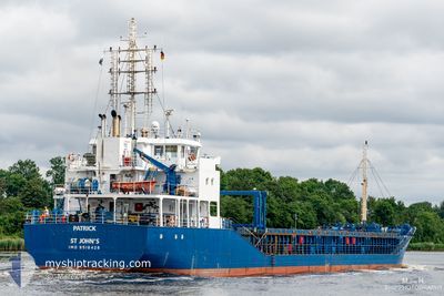
The vessel POZONI (IMO: 9518426, MMSI: 229962000) is a General Cargo that was built in 2010 ( 15 År gammal ). It's sailing under the flag of [MT] Malta.
In this page you can find informations about the vessels current position, last detected port calls, and current voyage information. If the vessels is not in coverage by AIS you will find the latest position.
The current position of POZONI is detected by our AIS receivers and we are not responsible for the reliability of the data. The last position was recorded while the vessel was in Coverage by the Ais receivers of our vessel tracking app.
The current draught of POZONI as reported by AIS is 5.6 meters
Weather
| Temperature | 17°C / 62.6°F |
|---|---|
| Wind Speed | 5 knots |
| Direction | 321° NW |
| Pressure | 1010.5 hPa |
| Humidity | 78.5 % |
| Cloud Coverage | 87 % |
Featured Company
Last Port Calls
| Port | Arrival | Departure | Time In Port |
|---|---|---|---|
| 2025-05-26 14:23 | 2025-05-28 13:24 | 1 d | |
| 2025-05-14 10:31 | 2025-05-15 22:47 | 1 d | |
| 2025-05-05 10:30 | 2025-05-05 23:22 | 12 h | |
| 2025-04-30 11:22 | 2025-04-30 18:48 | 7 h | |
| 2025-04-25 23:16 | |||
| 2025-04-04 21:32 | 2025-04-09 17:06 | 4 d | |
| 2025-03-27 09:11 | 2025-03-27 15:05 | 5 h | |
| 2025-03-27 06:32 | 2025-03-27 07:24 | 51 m | |
| 2025-03-19 00:47 | 2025-03-21 21:32 | 2 d | |
| 2025-03-05 19:16 |
Most Visited Ports (Last year)
| Port | Arrivals | |
|---|---|---|
| 4 | ||
| 4 | ||
| 2 | ||
| 2 | ||
| 2 | ||
| 1 |
Last Trips
| Origin | Departure | Destination | Arrival | Distance | |
|---|---|---|---|---|---|
| 2025-05-15 22:47 | 2025-05-26 14:23 | 275.82 nm | |||
| 2025-05-05 23:22 | 2025-05-14 10:31 | 1588.14 nm | |||
| 2025-04-30 18:48 | 2025-05-05 10:30 | 823.78 nm | |||
| 2025-04-25 23:16 | 2025-04-30 11:22 | 905.18 nm | |||
| 2025-03-27 15:05 | 2025-04-04 21:32 | 1545.80 nm | |||
| 2025-03-27 07:24 | 2025-03-27 09:11 | 7.56 nm | |||
| 2025-03-21 21:32 | 2025-03-27 06:32 | 867.84 nm | |||
| 2025-03-05 19:16 | 2025-03-19 00:47 | 2982.47 nm |
Events
| Tid | Event | Detaljer | Position / Dest | Information |
|---|---|---|---|---|
| 2025-05-28 17:26 | Status ändrad | Default Under way using engine |
43.14884 / 28.81297
IT PVE
|
Fart: 8.4 kn Kurs: 179.1° |
| 2025-05-28 17:18 | UTANFÖR täckningsområde |
43.16740 / 28.81238
Black Sea
IT PVE
|
Fart: 8.4 kn Kurs: 179.1° |
|
| 2025-05-28 17:11 | Status ändrad | Under way using engine Default |
43.18324 / 28.81196
IT PVE
|
Fart: 8.4 kn Kurs: 179° |
| 2025-05-28 17:06 | Status ändrad | Default Under way using engine |
43.19453 / 28.81166
IT PVE
|
Fart: 8.4 kn Kurs: 179.3° |
| 2025-05-28 17:00 | Upptäckt i hav | Bulgarian part of the Black Sea |
43.20887 / 28.81138
Black Sea
IT PVE
|
Fart: 8.4 kn Kurs: 179.3° |
| 2025-05-28 17:00 | Status ändrad | Under way using engine Default |
43.20887 / 28.81138
IT PVE
|
Fart: 8.5 kn Kurs: 181° |
| 2025-05-28 17:00 | I täckningsområde |
43.20887 / 28.81138
Black Sea
IT PVE
|
Fart: 8.4 kn Kurs: 179.3° |
|
| 2025-05-28 11:34 | Status ändrad | Default Under way using engine |
43.95122 / 28.81322
IT PVE
|
Fart: 8.5 kn Kurs: 160.5° |
| 2025-05-28 11:23 | UTANFÖR täckningsområde |
43.97676 / 28.80852
Black Sea
IT PVE
|
Fart: 8.5 kn Kurs: 160.5° |
|
| 2025-05-28 10:24 | AVGÅTT HAMN |
|
44.09777 / 28.70312
IT PVE
|
Fart: 9 kn Kurs: 160° |