
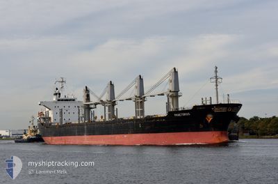
PRAETORIUS
Bulk Carrier
Current Trip
| Time Travelled | 20 days |
|---|---|
| Remaining Time | 1 day |
| Distance Travelled | 3866.37 nm |
| Remaining Distance | 352.04 nm |
| AVG Speed | 10.5 Knop |
| MAX Speed | 15.3 Knop |
| AVG Wind | 20.2 knots |
| MAX Wind | 35 knots |
| MIN Temp | 3.4°C / 38.12°F |
| MAX Temp | 19.6°C / 67.28°F |
| Djupgående | 7.1 m |
| Position mottagen | 3 h, 38 m sen |
Current Position
| Longitud | 29.54867° |
|---|---|
| Latitude | 41.36035° |
| Status | Under way using engine |
| Fart | 12.3 Knop |
| Kurs | 75.6° |
| Område | Black Sea |
| Station | T-AIS |
| Position mottagen | 3 h, 38 m sen |
Info
Information
The current position of PRAETORIUS is in Black Sea with coordinates 41.36035° / 29.54867° as reported on 2026-01-08 05:42 by AIS to our vessel tracker app. The vessel's current speed is 12.3 Knop and is heading at the port of SAMSUN. The estimated time of arrival as calculated by MyShipTracking vessel tracking app is 2026-01-09 14:37 LT
The vessel PRAETORIUS (IMO: 9470856, MMSI: 538008454) is a Bulk Carrier that was built in 2008 ( 18 År gammal ). It's sailing under the flag of [MH] Marshall Is.
In this page you can find informations about the vessels current position, last detected port calls, and current voyage information. If the vessels is not in coverage by AIS you will find the latest position.
The current position of PRAETORIUS is detected by our AIS receivers and we are not responsible for the reliability of the data. The last position was recorded while the vessel was in Coverage by the Ais receivers of our vessel tracking app.
The current draught of PRAETORIUS as reported by AIS is 7.1 meters
Weather
| Temperature | 13.4°C / 56.12°F |
|---|---|
| Wind Speed | 20 knots |
| Direction | 180° S |
| Pressure | 1002.9 hPa |
| Humidity | 75.7 % |
| Cloud Coverage | 100 % |
Featured Company
Last Port Calls
| Port | Arrival | Departure | Time In Port |
|---|---|---|---|
| 2025-12-18 20:23 | 2025-12-18 21:34 | 1 h | |
| 2025-12-15 03:05 | 2025-12-18 18:35 | 3 d | |
| 2025-12-01 01:35 | 2025-12-01 04:49 | 3 h | |
| 2025-12-01 00:38 | 2025-12-01 00:54 | 16 m | |
| 2025-11-30 12:54 | 2025-11-30 23:52 | 10 h | |
| 2025-11-27 02:01 | 2025-11-30 12:06 | 3 d | |
| 2025-11-27 00:55 | 2025-11-27 01:27 | 31 m | |
| 2025-11-26 18:04 | 2025-11-27 00:32 | 6 h | |
| 2025-11-26 15:27 | 2025-11-26 17:50 | 2 h | |
| 2025-11-13 15:49 | 2025-11-21 15:07 | 7 d |
Most Visited Ports (Last year)
| Port | Arrivals | |
|---|---|---|
| 7 | ||
| 3 | ||
| 2 | ||
| 2 | ||
| 2 | ||
| 1 |
Last Trips
| Origin | Departure | Destination | Arrival | Distance | |
|---|---|---|---|---|---|
| 2025-12-18 18:35 | 2025-12-18 20:23 | 10.04 nm | |||
| 2025-12-01 04:49 | 2025-12-15 03:05 | 3485.43 nm | |||
| 2025-12-01 00:54 | 2025-12-01 01:35 | 19.21 nm | |||
| 2025-11-30 23:52 | 2025-12-01 00:38 | 1.94 nm | |||
| 2025-11-30 12:06 | 2025-11-30 12:54 | 1.28 nm | |||
| 2025-11-27 01:27 | 2025-11-27 02:01 | 7.89 nm | |||
| 2025-11-27 00:32 | 2025-11-27 00:55 | 3.06 nm | |||
| 2025-11-26 17:50 | 2025-11-26 18:04 | 2.01 nm | |||
| 2025-11-21 15:07 | 2025-11-26 15:27 | 1098.22 nm | |||
| 2025-11-04 20:05 | 2025-11-13 15:49 | 2191.51 nm |
Events
| Tid | Event | Detaljer | Position / Dest | Information |
|---|---|---|---|---|
| 2026-01-08 05:49 | Status ändrad | Default Under way using engine |
41.36725 / 29.58200
TRSSX
|
Fart: 12.3 kn Kurs: 75.6° |
| 2026-01-08 05:42 | UTANFÖR täckningsområde |
41.36035 / 29.54867
Black Sea
TRSSX
|
Fart: 12.3 kn Kurs: 75.6° |
|
| 2026-01-08 04:05 | Byter havsområde | Turkish part of the Black Sea Turkish part of the Sea of Marmara |
41.23630 / 29.15680
Black Sea
TRSSX
|
Fart: 11.9 kn Kurs: 46.5° |
| 2026-01-07 18:37 | Status ändrad | Under way using engine Default |
40.72436 / 27.71642
TRSSX
|
Fart: 11 kn Kurs: 82° |
| 2026-01-07 18:33 | Status ändrad | Default Under way using engine |
40.72263 / 27.70048
TRSSX
|
Fart: 10.8 kn Kurs: 80.4° |
| 2026-01-07 18:21 | Status ändrad | Under way using engine Default |
40.71771 / 27.65338
TRSSX
|
Fart: 10.8 kn Kurs: 80° |
| 2026-01-07 18:09 | I täckningsområde |
40.71771 / 27.65338
Sea of Marmara
TRSSX
|
Fart: 10.8 kn Kurs: 80.4° |
|
| 2026-01-07 13:12 | Status ändrad | Default Under way using engine |
40.26716 / 26.54000
TRSSX
|
Fart: 12.2 kn Kurs: 48.7° |
| 2026-01-07 13:11 | UTANFÖR täckningsområde |
40.26646 / 26.53893
Sea of Marmara
TRSSX
|
Fart: 12.2 kn Kurs: 48.7° |
|
| 2026-01-07 11:07 | Byter havsområde | Turkish part of the Sea of Marmara Turkish part of the Aegean Sea |
40.01752 / 26.19129
Sea of Marmara
TRSSX
|
Fart: 10.3 kn Kurs: 83.5° |