
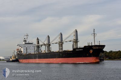
PRAETORIUS
Bulk Carrier
Current Trip
| Time Travelled | 13 days |
|---|---|
| Remaining Time | 1 h, 57 mins |
| Distance Travelled | 3461.61 nm |
| Remaining Distance | 19.79 nm |
| AVG Speed | 9.9 Knots |
| MAX Speed | 14.1 Knots |
| AVG Wind | 13.1 knots |
| MAX Wind | 34.7 knots |
| MIN Temp | 8.7°C / 47.66°F |
| MAX Temp | 21.5°C / 70.7°F |
| Draught | 8.7 m |
| Position Received | 1 m ago |
Current Position
| Longitude | 4.27287° |
|---|---|
| Latitude | 52.47582° |
| Status | Under way using engine |
| Speed | 6.5 Knots |
| Course | 98° |
| Area | North Sea |
| Station | T-AIS |
| Position Received | 1 m ago |
Info
Information
The current position of PRAETORIUS is in North Sea with coordinates 52.47582° / 4.27287° as reported on 2025-12-14 22:17 by AIS to our vessel tracker app. The vessel's current speed is 6.5 Knots and is heading at the port of AMSTERDAM. The estimated time of arrival as calculated by MyShipTracking vessel tracking app is 2025-12-15 01:15 LT
The vessel PRAETORIUS (IMO: 9470856, MMSI: 538008454) is a Bulk Carrier that was built in 2008 ( 17 years old ). It's sailing under the flag of [MH] Marshall Is.
In this page you can find informations about the vessels current position, last detected port calls, and current voyage information. If the vessels is not in coverage by AIS you will find the latest position.
The current position of PRAETORIUS is detected by our AIS receivers and we are not responsible for the reliability of the data. The last position was recorded while the vessel was in Coverage by the Ais receivers of our vessel tracking app.
The current draught of PRAETORIUS as reported by AIS is 8.7 meters
Weather
| Temperature | 8.7°C / 47.66°F |
|---|---|
| Wind Speed | 24 knots |
| Direction | 203° SSW |
| Pressure | 1015.6 hPa |
| Humidity | 88.8 % |
| Cloud Coverage | 51 % |
Featured Company
Last Port Calls
| Port | Arrival | Departure | Time In Port |
|---|---|---|---|
| 2025-12-01 01:35 | 2025-12-01 04:49 | 3 h | |
| 2025-12-01 00:38 | 2025-12-01 00:54 | 16 m | |
| 2025-11-30 12:54 | 2025-11-30 23:52 | 10 h | |
| 2025-11-27 02:01 | 2025-11-30 12:06 | 3 d | |
| 2025-11-27 00:55 | 2025-11-27 01:27 | 31 m | |
| 2025-11-26 18:04 | 2025-11-27 00:32 | 6 h | |
| 2025-11-26 15:27 | 2025-11-26 17:50 | 2 h | |
| 2025-11-13 15:49 | 2025-11-21 15:07 | 7 d | |
| 2025-11-03 12:02 | 2025-11-04 20:05 | 1 d | |
| 2025-10-29 21:50 | 2025-11-01 22:18 | 3 d |
Most Visited Ports (Last year)
| Port | Arrivals | |
|---|---|---|
| 7 | ||
| 3 | ||
| 2 | ||
| 2 | ||
| 2 | ||
| 1 |
Last Trips
| Origin | Departure | Destination | Arrival | Distance | |
|---|---|---|---|---|---|
| 2025-12-01 00:54 | 2025-12-01 01:35 | 19.21 nm | |||
| 2025-11-30 23:52 | 2025-12-01 00:38 | 1.94 nm | |||
| 2025-11-30 12:06 | 2025-11-30 12:54 | 1.28 nm | |||
| 2025-11-27 01:27 | 2025-11-27 02:01 | 7.89 nm | |||
| 2025-11-27 00:32 | 2025-11-27 00:55 | 3.06 nm | |||
| 2025-11-26 17:50 | 2025-11-26 18:04 | 2.01 nm | |||
| 2025-11-21 15:07 | 2025-11-26 15:27 | 1098.22 nm | |||
| 2025-11-04 20:05 | 2025-11-13 15:49 | 2191.51 nm | |||
| 2025-11-01 22:18 | 2025-11-03 12:02 | 101.19 nm | |||
| 2025-10-24 14:18 | 2025-10-29 21:50 | 1276.95 nm |
Events
| Time | Event | Details | Position / Dest | Info |
|---|---|---|---|---|
| 2025-12-14 21:20 | START Moving | 19.48 nm, West of IJMUIDEN |
52.45590 / 4.05718
NLAMS
|
Speed: 5.1 kn Course: 334° |
| 2025-12-14 21:11 | Status Changed | Under way using engine At anchor |
52.45407 / 4.06020
NLAMS
|
Speed: 0.3 kn Course: 207° |
| 2025-12-14 20:39 | Status Changed | At anchor Default |
52.45537 / 4.06167
NLAMS
|
Speed: 0.4 kn Course: 223° |
| 2025-12-14 20:36 | Status Changed | Default At anchor |
52.45520 / 4.06202
NLAMS
|
Speed: 0.1 kn Course: 228° |
| 2025-12-14 19:48 | Status Changed | At anchor Default |
52.45513 / 4.06215
NLAMS
|
Speed: 0.1 kn Course: 231° |
| 2025-12-14 19:45 | Status Changed | Default At anchor |
52.45497 / 4.06243
NLAMS
|
Speed: 0.3 kn Course: 214° |
| 2025-12-14 17:39 | Status Changed | At anchor Default |
52.45498 / 4.06213
NLAMS
|
Speed: Course: 235° |
| 2025-12-14 17:36 | Status Changed | Default At anchor |
52.45497 / 4.06230
NLAMS
|
Speed: Course: 232° |
| 2025-12-14 16:09 | Status Changed | At anchor Under way using engine |
52.45420 / 4.05922
NLAMS
|
Speed: 0.7 kn Course: 132° |
| 2025-12-14 16:03 | STOP Moving | 19.46 nm, West of IJMUIDEN |
52.45413 / 4.05778
NLAMS
|
Speed: 0.3 kn Course: 156° |