
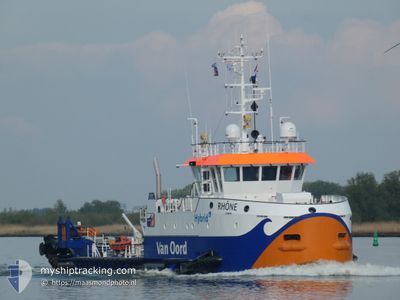
RHONE
Dredging or underwater ops
Current Trip
DREDING OPS LIVERPOL
| Time Travelled | 4 days |
|---|---|
| Remaining Time | --- |
| Distance Travelled | 82.05 nm |
| Remaining Distance | --- |
| AVG Speed | 8.5 Knop |
| MAX Speed | 11.4 Knop |
| AVG Wind | 10 knots |
| MAX Wind | 22 knots |
| MIN Temp | 3°C / 37.4°F |
| MAX Temp | 7.4°C / 45.32°F |
| Djupgående | 2 m |
| Position mottagen | Nu |
Current Position
| Longitud | -3.09466° |
|---|---|
| Latitude | 53.50350° |
| Status | Restricted manoeuverability |
| Fart | 1.4 Knop |
| Kurs | 335° |
| Område | Irish Sea and St. George's Channel |
| Station | T-AIS |
| Position mottagen | Nu |
Info
Information
The current position of RHONE is in Irish Sea and St. George's Channel with coordinates 53.50350° / -3.09466° as reported on 2025-02-10 05:31 by AIS to our vessel tracker app. The vessel's current speed is 1.4 Knop
The vessel RHONE (IMO: 9989596, MMSI: 244264000) is a Dredging or underwater ops It's sailing under the flag of [NL] Netherlands.
In this page you can find informations about the vessels current position, last detected port calls, and current voyage information. If the vessels is not in coverage by AIS you will find the latest position.
The current position of RHONE is detected by our AIS receivers and we are not responsible for the reliability of the data. The last position was recorded while the vessel was in Coverage by the Ais receivers of our vessel tracking app.
The current draught of RHONE as reported by AIS is 2 meters
Weather
| Temperature | 4.7°C / 40.46°F |
|---|---|
| Wind Speed | 12 knots |
| Direction | 54° NE |
| Pressure | 1032 hPa |
| Humidity | 79.9 % |
| Cloud Coverage | 100 % |
Featured Company
Last Port Calls
| Port | Arrival | Departure | Time In Port |
|---|---|---|---|
| 2025-02-05 01:28 | 2025-02-05 07:38 | 6 h | |
| 2025-02-04 11:05 | 2025-02-04 19:12 | 8 h | |
| 2025-02-03 07:34 | 2025-02-03 18:51 | 11 h | |
| 2025-01-31 10:19 | 2025-01-31 15:43 | 5 h | |
| 2025-01-29 09:57 | 2025-01-29 14:32 | 4 h | |
| 2025-01-28 13:57 | 2025-01-28 14:53 | 55 m | |
| 2025-01-26 10:06 | 2025-01-26 10:22 | 15 m | |
| 2025-01-23 13:46 | 2025-01-25 13:10 | 1 d | |
| 2025-01-21 16:32 | 2025-01-21 18:06 | 1 h | |
| 2025-01-21 10:07 | 2025-01-21 16:16 | 6 h |
Last Trips
| Origin | Departure | Destination | Arrival | Distance | |
|---|---|---|---|---|---|
| 2025-02-04 19:12 | 2025-02-05 01:28 | 12.92 nm | |||
| 2025-02-03 18:51 | 2025-02-04 11:05 | 21.35 nm | |||
| 2025-01-31 15:43 | 2025-02-03 07:34 | 42.73 nm | |||
| 2025-01-29 14:32 | 2025-01-31 10:19 | 41.62 nm | |||
| 2025-01-28 14:53 | 2025-01-29 09:57 | 24.21 nm | |||
| 2025-01-26 10:22 | 2025-01-28 13:57 | 43.37 nm | |||
| 2025-01-25 13:10 | 2025-01-26 10:06 | 20.75 nm | |||
| 2025-01-21 18:06 | 2025-01-23 13:46 | 33.46 nm | |||
| 2025-01-21 16:16 | 2025-01-21 16:32 | 0.96 nm | |||
| 2025-01-18 17:38 | 2025-01-21 10:07 | 61.51 nm |
Events
| Tid | Event | Detaljer | Position / Dest | Information |
|---|---|---|---|---|
| 2025-02-08 10:19 | Status ändrad | Restricted manoeuverability Under way using engine |
53.52168 / -3.12533
DREDING OPS LIVERPOL
|
Fart: 0.3 kn Kurs: 140° |
| 2025-02-08 10:17 | STOPPAR förflyttning | 7.18 nm, North West of LIVERPOOL |
53.52181 / -3.12557
DREDING OPS LIVERPOL
|
Fart: 0.2 kn Kurs: 127° |
| 2025-02-08 09:46 | STARTAR förflyttning | 6.78 nm, North East of LIVERPOOL ANCH |
53.51990 / -3.22521
DREDING OPS LIVERPOL
|
Fart: 3.7 kn Kurs: 86° |
| 2025-02-08 09:42 | Status ändrad | Under way using engine Restricted manoeuverability |
53.52023 / -3.22720
DREDING OPS LIVERPOL
|
Fart: 1.2 kn Kurs: 80° |
| 2025-02-06 03:27 | Status ändrad | Restricted manoeuverability Under way using engine |
53.51608 / -3.22631
DREDING OPS LIVERPOL
|
Fart: 0.7 kn Kurs: 267° |
| 2025-02-05 21:03 | STOPPAR förflyttning | 8.3 nm, East of LIVERPOOL ANCH |
53.52460 / -3.18264
DREDING OPS LIVERPOL
|
Fart: 0.3 kn Kurs: 79° |
| 2025-02-05 20:42 | STARTAR förflyttning | 6.41 nm, North West of LIVERPOOL |
53.51353 / -3.10784
DREDING OPS LIVERPOL
|
Fart: 3.1 kn Kurs: 284° |
| 2025-02-05 08:07 | STOPPAR förflyttning | 5.91 nm, North West of LIVERPOOL |
53.50602 / -3.10168
DREDING OPS LIVERPOL
|
Fart: 0.2 kn Kurs: 152° |
| 2025-02-05 07:38 | AVGÅTT HAMN |
|
53.44762 / -3.02541
DREDING OPS LIVERPOL
|
Fart: 10.7 kn Kurs: 309° |
| 2025-02-05 07:33 | STARTAR förflyttning |
53.43794 / -3.01014
[GB] LIVERPOOL
|
Fart: 3.5 kn Kurs: 322° |