
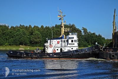
ROBIN HOOD
Tug
Current Trip
| Trip Time | 1 day |
|---|---|
| Trip Distance | 123.35 nm |
| AVG Speed | 3.9 Knop |
| MAX Speed | 6.2 Knop |
| Djupgående | 3.5 m |
| AVG Wind | 9.1 knots |
| MAX Wind | 16 knots |
| MIN Temp | -1.5°C / 29.3°F |
| MAX Temp | 4.7°C / 40.46°F |
| Position mottagen | 1 d sen |
Current Position
| Longitud | 13.11087° |
|---|---|
| Latitude | 54.30227° |
| Status | Moored |
| Fart | |
| Kurs | 287° |
| Område | Baltic Sea |
| Station | T-AIS |
| Position mottagen | 1 d sen |
Info
Information
The current position of ROBIN HOOD is in Baltic Sea with coordinates 54.30227° / 13.11087° as reported on 2025-02-01 20:17 by AIS to our vessel tracker app. The vessel's current speed is 0 Knop and is currently inside the port of STRALSUND.
The vessel ROBIN HOOD (IMO: 9096454, MMSI: 211118520) is a Tug It's sailing under the flag of [DE] Germany.
In this page you can find informations about the vessels current position, last detected port calls, and current voyage information. If the vessels is not in coverage by AIS you will find the latest position.
The current position of ROBIN HOOD is detected by our AIS receivers and we are not responsible for the reliability of the data. The last position was recorded while the vessel was in Coverage by the Ais receivers of our vessel tracking app.
The current draught of ROBIN HOOD as reported by AIS is 3.5 meters
Weather
| Temperature | 1.6°C / 34.88°F |
|---|---|
| Wind Speed | 4 knots |
| Direction | 290° WNW |
| Pressure | 1026.5 hPa |
| Humidity | 92.9 % |
| Cloud Coverage | 100 % |
Featured Company
Last Port Calls
| Port | Arrival | Departure | Time In Port |
|---|---|---|---|
| 2025-01-22 06:22 | |||
| 2025-01-16 15:19 | 2025-01-20 07:15 | 3 d | |
| 2025-01-15 15:46 | 2025-01-16 06:52 | 15 h | |
| 2025-01-13 18:32 | 2025-01-15 10:38 | 1 d | |
| 2024-12-13 06:15 | |||
| 2024-12-12 07:31 | 2024-12-12 07:58 | 27 m | |
| 2024-12-10 10:00 | 2024-12-11 06:36 | 20 h | |
| 2024-12-09 22:04 | 2024-12-10 05:08 | 7 h |
Last Trips
| Origin | Departure | Destination | Arrival | Distance | |
|---|---|---|---|---|---|
| 2025-01-20 08:15 | 2025-01-22 07:22 | 123.35 nm | |||
| 2025-01-16 07:52 | 2025-01-16 16:19 | 83.41 nm | |||
| 2025-01-15 11:38 | 2025-01-15 16:46 | 45.63 nm | |||
| 2024-12-12 08:58 | 2025-01-13 19:32 | 206.97 nm | |||
| 2024-12-12 08:58 | 2024-12-13 07:15 | 196.79 nm | |||
| 2024-12-11 07:36 | 2024-12-12 08:31 | 157.67 nm | |||
| 2024-12-10 06:08 | 2024-12-10 11:00 | 45.27 nm | |||
| 2024-11-09 08:43 | 2024-12-09 23:04 | 128.63 nm |
Events
| Tid | Event | Detaljer | Position / Dest | Information |
|---|---|---|---|---|
| 2025-02-01 20:17 | UTANFÖR täckningsområde |
54.30227 / 13.11087
Baltic Sea
[DE] STRALSUND
|
Fart: Kurs: 29.3° |
|
| 2025-02-01 20:17 | Status ändrad | Moored Default |
54.30227 / 13.11087
[DE] STRALSUND
|
Fart: Kurs: 287° |
| 2025-02-01 20:02 | I täckningsområde |
54.30227 / 13.11087
Baltic Sea
[DE] STRALSUND
|
Fart: Kurs: 29.3° |
|
| 2025-02-01 14:20 | Status ändrad | Default Moored |
54.30222 / 13.11073
[DE] STRALSUND
|
Fart: Kurs: 285° |
| 2025-02-01 14:20 | Status ändrad | Moored Default |
54.30222 / 13.11073
[DE] STRALSUND
|
Fart: Kurs: 285° |
| 2025-02-01 14:20 | UTANFÖR täckningsområde |
54.30222 / 13.11073
Baltic Sea
[DE] STRALSUND
|
Fart: Kurs: 29.3° |
|
| 2025-02-01 14:20 | ETA ändrat | 2026/01/21 14:30 2025/01/21 14:30 |
54.30215 / 13.11071
[DE] STRALSUND
|
Fart: Kurs: 285° |
| 2025-02-01 14:02 | I täckningsområde |
54.30222 / 13.11073
Baltic Sea
[DE] STRALSUND
|
Fart: Kurs: 29.3° |
|
| 2025-02-01 09:59 | Status ändrad | Default Moored |
54.30217 / 13.11057
[DE] STRALSUND
|
Fart: Kurs: 285° |
| 2025-02-01 09:56 | UTANFÖR täckningsområde |
54.30213 / 13.11040
Baltic Sea
[DE] STRALSUND
|
Fart: Kurs: 29.3° |