
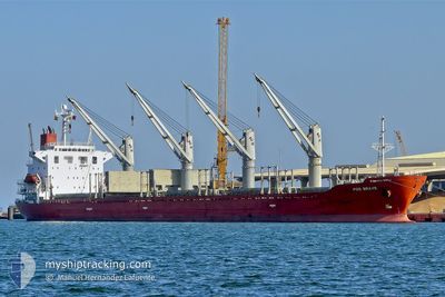
SEA BRAVE
Bulk Carrier
Current Trip
| Time Travelled | 1 day |
|---|---|
| Remaining Time | --- |
| Distance Travelled | 205.45 nm |
| Remaining Distance | 1.37 nm |
| AVG Speed | 10.3 Knop |
| MAX Speed | 12.6 Knop |
| AVG Wind | 22.6 knots |
| MAX Wind | 32 knots |
| MIN Temp | 13.5°C / 56.3°F |
| MAX Temp | 17°C / 62.6°F |
| Djupgående | 7.9 m |
| Position mottagen | 1 m sen |
Current Position
| Longitud | -5.32670° |
|---|---|
| Latitude | 35.92066° |
| Status | At anchor |
| Fart | 0.3 Knop |
| Kurs | 211° |
| Område | Strait of Gibraltar |
| Station | T-AIS |
| Position mottagen | 1 m sen |
Info
Information
The current position of SEA BRAVE is in Strait of Gibraltar with coordinates 35.92066° / -5.32670° as reported on 2025-03-12 10:10 by AIS to our vessel tracker app. The vessel's current speed is 0.3 Knop and is heading at the port of CEUTA. The estimated time of arrival as calculated by MyShipTracking vessel tracking app is 2025-03-12 03:00 LT
The vessel SEA BRAVE (IMO: 9279551, MMSI: 538003930) is a Bulk Carrier that was built in 2004 ( 21 År gammal ). It's sailing under the flag of [MH] Marshall Is.
In this page you can find informations about the vessels current position, last detected port calls, and current voyage information. If the vessels is not in coverage by AIS you will find the latest position.
The current position of SEA BRAVE is detected by our AIS receivers and we are not responsible for the reliability of the data. The last position was recorded while the vessel was in Coverage by the Ais receivers of our vessel tracking app.
The current draught of SEA BRAVE as reported by AIS is 7.9 meters
Weather
| Temperature | 15.5°C / 59.9°F |
|---|---|
| Wind Speed | 18 knots |
| Direction | 262° W |
| Pressure | 1011 hPa |
| Humidity | 78.1 % |
| Cloud Coverage | 100 % |
Featured Company
Last Port Calls
| Port | Arrival | Departure | Time In Port |
|---|---|---|---|
| 2025-02-23 12:31 | 2025-03-11 06:41 | 15 d | |
| 2025-02-02 23:04 | 2025-02-07 03:38 | 4 d | |
| 2025-01-28 01:33 | 2025-01-28 09:05 | 7 h | |
| 2025-01-17 07:13 |
Most Visited Ports (Last year)
| Port | Arrivals | |
|---|---|---|
| 2 | ||
| 2 | ||
| 1 | ||
| 1 | ||
| 1 | ||
| 1 |
Last Trips
| Origin | Departure | Destination | Arrival | Distance | |
|---|---|---|---|---|---|
| 2025-02-07 04:38 | 2025-02-23 12:31 | 261.01 nm | |||
| 2025-01-28 09:05 | 2025-02-03 00:04 | 559.51 nm | |||
| 2025-01-17 08:13 | 2025-01-28 01:33 | 2716.95 nm |
Events
| Tid | Event | Detaljer | Position / Dest | Information |
|---|---|---|---|---|
| 2025-03-12 10:10 | Status ändrad | At anchor Default |
35.92066 / -5.32670
CEUTA
|
Fart: 0.3 kn Kurs: 222° |
| 2025-03-12 10:01 | Status ändrad | Default At anchor |
35.92064 / -5.32618
CEUTA
|
Fart: 0.3 kn Kurs: 222° |
| 2025-03-12 09:43 | Status ändrad | At anchor Default |
35.92050 / -5.32517
CEUTA
|
Fart: 0.2 kn Kurs: 228° |
| 2025-03-12 09:28 | Status ändrad | Default At anchor |
35.92001 / -5.32465
CEUTA
|
Fart: 0.5 kn Kurs: 243° |
| 2025-03-12 09:25 | Status ändrad | At anchor Default |
35.91994 / -5.32453
CEUTA
|
Fart: 0.2 kn Kurs: 247° |
| 2025-03-12 09:16 | Status ändrad | Default At anchor |
35.91980 / -5.32441
CEUTA
|
Fart: Kurs: 245° |
| 2025-03-12 09:07 | Status ändrad | At anchor Default |
35.91976 / -5.32438
CEUTA
|
Fart: Kurs: 251° |
| 2025-03-12 09:01 | Status ändrad | Default At anchor |
35.91963 / -5.32420
CEUTA
|
Fart: 0.1 kn Kurs: 258° |
| 2025-03-12 08:43 | Status ändrad | At anchor Default |
35.91937 / -5.32406
CEUTA
|
Fart: 0.1 kn Kurs: 251° |
| 2025-03-12 08:28 | Status ändrad | Default At anchor |
35.91926 / -5.32412
CEUTA
|
Fart: 0.1 kn Kurs: 257° |