
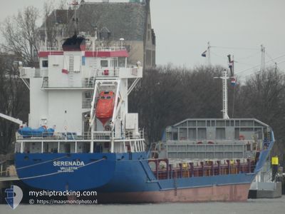
SERENADA
General Cargo
Current Trip
| Time Travelled | 1 day |
|---|---|
| Remaining Time | --- |
| Distance Travelled | 160.45 nm |
| Remaining Distance | --- |
| AVG Speed | 7.8 Knop |
| MAX Speed | 11.2 Knop |
| AVG Wind | 10.3 knots |
| MAX Wind | 19 knots |
| MIN Temp | -4.2°C / 24.44°F |
| MAX Temp | 1.8°C / 35.24°F |
| Djupgående | 3.8 m |
| Position mottagen | 2 h, 8 m sen |
Current Position
| Longitud | 29.26871° |
|---|---|
| Latitude | 60.02460° |
| Status | Under way using engine |
| Fart | 7.1 Knop |
| Kurs | 86.7° |
| Område | Gulf of Finland |
| Station | T-AIS |
| Position mottagen | 2 h, 8 m sen |
Info
Information
The current position of SERENADA is in Gulf of Finland with coordinates 60.02460° / 29.26871° as reported on 2025-02-06 17:13 by AIS to our vessel tracker app. The vessel's current speed is 7.1 Knop
The vessel SERENADA (IMO: 9201865, MMSI: 275545000) is a General Cargo that was built in 1999 ( 26 År gammal ). It's sailing under the flag of [LV] Latvia.
In this page you can find informations about the vessels current position, last detected port calls, and current voyage information. If the vessels is not in coverage by AIS you will find the latest position.
The current position of SERENADA is detected by our AIS receivers and we are not responsible for the reliability of the data. The last position was recorded while the vessel was in Coverage by the Ais receivers of our vessel tracking app.
The current draught of SERENADA as reported by AIS is 3.8 meters
Weather
| Temperature | -4°C / 24.8°F |
|---|---|
| Wind Speed | 2 knots |
| Direction | 108° ESE |
| Pressure | 1045.6 hPa |
| Humidity | 97.7 % |
| Cloud Coverage | 67 % |
Featured Company
Last Port Calls
| Port | Arrival | Departure | Time In Port |
|---|---|---|---|
| 2024-12-23 06:18 | 2025-02-05 18:41 | ||
| 2024-12-14 11:00 |
Most Visited Ports (Last year)
| Port | Arrivals | |
|---|---|---|
| 9 | ||
| 6 | ||
| 2 | ||
| 2 | ||
| 1 | ||
| 1 |
Last Trips
| Origin | Departure | Destination | Arrival | Distance | |
|---|---|---|---|---|---|
| 2024-12-14 12:00 | 2024-12-23 08:18 | 1163.86 nm |
Events
| Tid | Event | Detaljer | Position / Dest | Information |
|---|---|---|---|---|
| 2025-02-06 17:13 | UTANFÖR täckningsområde |
60.02460 / 29.26871
Gulf of Finland
RU LED
|
Fart: 7.1 kn Kurs: 86.7° |
|
| 2025-02-06 17:13 | I täckningsområde |
60.02460 / 29.26871
Gulf of Finland
RU LED
|
Fart: 7.1 kn Kurs: 86.7° |
|
| 2025-02-06 15:11 | UTANFÖR täckningsområde |
60.03802 / 28.68905
Gulf of Finland
RU LED
|
Fart: 10.6 kn Kurs: 85.8° |
|
| 2025-02-06 06:51 | Upptäckt i hav | Russian part of the Gulf of Finland |
59.95611 / 26.41278
Gulf of Finland
RU LED
|
Fart: 5.5 kn Kurs: 74.3° |
| 2025-02-06 05:41 | I täckningsområde |
59.92824 / 26.20427
Gulf of Finland
RU LED
|
Fart: 5.6 kn Kurs: 77.4° |
|
| 2025-02-06 02:49 | UTANFÖR täckningsområde |
59.86037 / 25.70267
Gulf of Finland
RU LED
|
Fart: 5.6 kn Kurs: 81.3° |
|
| 2025-02-05 23:04 | ETA ändrat | 2025/02/07 04:00 2025/02/07 00:00 |
59.79586 / 25.07086
RU LED
|
Fart: 4.9 kn Kurs: 76° |
| 2025-02-05 19:46 | ETA ändrat | 2025/02/07 00:00 2025/02/06 18:00 |
59.60806 / 24.68397
RU LED
|
Fart: 7.8 kn Kurs: 340.1° |
| 2025-02-05 18:41 | AVGÅTT HAMN |
|
59.46081 / 24.72224
RU LED
|
Fart: 6.9 kn Kurs: 68° |
| 2025-02-05 18:38 | STARTAR förflyttning |
59.46074 / 24.71449
[EE] PALJASSAARE
|
Fart: 3.1 kn Kurs: 90° |