
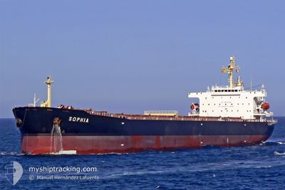
SOPHIA
Bulk Carrier
Current Trip
| Time Travelled | 15 days |
|---|---|
| Remaining Time | 4 days |
| Distance Travelled | 3703.22 nm |
| Remaining Distance | 1225.32 nm |
| AVG Speed | 11.5 Knop |
| MAX Speed | 14.6 Knop |
| AVG Wind | 12.4 knots |
| MAX Wind | 36.7 knots |
| MIN Temp | 2.2°C / 35.96°F |
| MAX Temp | 31.1°C / 87.98°F |
| Djupgående | 7.5 m |
| Position mottagen | 11 h, 19 m sen |
Current Position
| Longitud | 113.71555° |
|---|---|
| Latitude | -19.00695° |
| Status | Under way using engine |
| Fart | 10.4 Knop |
| Kurs | 193.2° |
| Område | Indian Ocean |
| Station | T-AIS |
| Position mottagen | 11 h, 19 m sen |
Info
Information
The current position of SOPHIA is in Indian Ocean with coordinates -19.00695° / 113.71555° as reported on 2025-03-04 14:25 by AIS to our vessel tracker app. The vessel's current speed is 10.4 Knop and is heading at the port of ESPERANCE. The estimated time of arrival as calculated by MyShipTracking vessel tracking app is 2025-03-09 17:17 LT
The vessel SOPHIA (IMO: 9323912, MMSI: 210970000) is a Bulk Carrier that was built in 2007 ( 18 År gammal ). It's sailing under the flag of [CY] Cyprus.
In this page you can find informations about the vessels current position, last detected port calls, and current voyage information. If the vessels is not in coverage by AIS you will find the latest position.
The current position of SOPHIA is detected by our AIS receivers and we are not responsible for the reliability of the data. The last position was recorded while the vessel was in Coverage by the Ais receivers of our vessel tracking app.
The current draught of SOPHIA as reported by AIS is 7.5 meters
Weather
| Temperature | 29.6°C / 85.28°F |
|---|---|
| Wind Speed | 8 knots |
| Direction | 169° S |
| Pressure | 1011.2 hPa |
| Humidity | 80.9 % |
| Cloud Coverage | --- |
Featured Company
Most Visited Ports (Last year)
| Port | Arrivals | |
|---|---|---|
| 2 | ||
| 2 | ||
| 2 | ||
| 1 | ||
| 1 | ||
| 1 |
Events
| Tid | Event | Detaljer | Position / Dest | Information |
|---|---|---|---|---|
| 2025-03-04 14:33 | Status ändrad | Default Under way using engine |
-19.02811 / 113.71018
ESPERANCE
|
Fart: 10.4 kn Kurs: 193.2° |
| 2025-03-04 14:25 | UTANFÖR täckningsområde |
-19.00695 / 113.71555
Indian Ocean
ESPERANCE
|
Fart: 10.4 kn Kurs: 193.2° |
|
| 2025-03-04 14:13 | Status ändrad | Under way using engine Default |
-18.97132 / 113.72430
ESPERANCE
|
Fart: 10.7 kn Kurs: 193° |
| 2025-03-04 14:09 | I täckningsområde |
-18.97321 / 113.72384
Indian Ocean
ESPERANCE
|
Fart: 10.6 kn Kurs: 192.4° |
|
| 2025-03-04 13:01 | Status ändrad | Default Under way using engine |
-18.75895 / 113.77369
ESPERANCE
|
Fart: 11.1 kn Kurs: 191.4° |
| 2025-03-04 12:53 | UTANFÖR täckningsområde |
-18.73481 / 113.77868
Indian Ocean
ESPERANCE
|
Fart: 11.1 kn Kurs: 191.4° |
|
| 2025-03-04 12:38 | Status ändrad | Under way using engine Default |
-18.69218 / 113.78781
ESPERANCE
|
Fart: 11.1 kn Kurs: 193° |
| 2025-03-04 12:05 | Status ändrad | Default Under way using engine |
-18.58939 / 113.81107
ESPERANCE
|
Fart: 11.3 kn Kurs: 191.6° |
| 2025-03-04 11:54 | Status ändrad | Under way using engine Default |
-18.55515 / 113.81878
ESPERANCE
|
Fart: 11.2 kn Kurs: 191° |
| 2025-03-04 11:53 | I täckningsområde |
-18.55515 / 113.81878
Indian Ocean
ESPERANCE
|
Fart: 11.3 kn Kurs: 192.1° |