
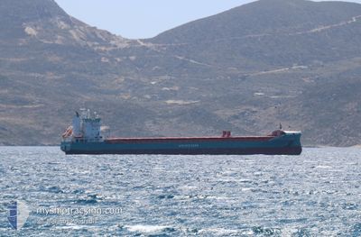
VERTOM MERIDIAAN
General Cargo
Current Trip
| Time Travelled | 11 days |
|---|---|
| Remaining Time | 8 h, 40 mins |
| Distance Travelled | 3036.58 nm |
| Remaining Distance | 69.33 nm |
| AVG Speed | 11 Knop |
| MAX Speed | 14.9 Knop |
| AVG Wind | 17.3 knots |
| MAX Wind | 34 knots |
| MIN Temp | 4.3°C / 39.74°F |
| MAX Temp | 17.4°C / 63.32°F |
| Djupgående | 6.6 m |
| Position mottagen | 6 m sen |
Current Position
| Longitud | -4.74765° |
|---|---|
| Latitude | 53.41510° |
| Status | Under way using engine |
| Fart | 7.3 Knop |
| Kurs | 35.7° |
| Område | Irish Sea and St. George's Channel |
| Station | T-AIS |
| Position mottagen | 6 m sen |
Info
Information
The current position of VERTOM MERIDIAAN is in Irish Sea and St. George's Channel with coordinates 53.41510° / -4.74765° as reported on 2026-01-06 01:30 by AIS to our vessel tracker app. The vessel's current speed is 7.3 Knop and is heading at the port of LIVERPOOL. The estimated time of arrival as calculated by MyShipTracking vessel tracking app is 2026-01-06 10:16 LT
The vessel VERTOM MERIDIAAN (IMO: 9385881, MMSI: 246180000) is a General Cargo that was built in 2010 ( 16 År gammal ). It's sailing under the flag of [NL] Netherlands.
In this page you can find informations about the vessels current position, last detected port calls, and current voyage information. If the vessels is not in coverage by AIS you will find the latest position.
The current position of VERTOM MERIDIAAN is detected by our AIS receivers and we are not responsible for the reliability of the data. The last position was recorded while the vessel was in Coverage by the Ais receivers of our vessel tracking app.
The current draught of VERTOM MERIDIAAN as reported by AIS is 6.6 meters
Weather
| Temperature | 5°C / 41°F |
|---|---|
| Wind Speed | 15 knots |
| Direction | 299° WNW |
| Pressure | 1018.2 hPa |
| Humidity | 84.1 % |
| Cloud Coverage | 100 % |
Featured Company
Last Port Calls
| Port | Arrival | Departure | Time In Port |
|---|---|---|---|
| 2025-12-21 16:25 | 2025-12-25 09:30 | 3 d | |
| 2025-12-14 16:23 | 2025-12-20 08:42 | 5 d | |
| 2025-12-04 15:05 | 2025-12-14 09:29 | 9 d | |
| 2025-11-28 09:43 | 2025-11-28 16:24 | 6 h | |
| 2025-11-18 12:38 | 2025-11-20 22:15 | 2 d | |
| 2025-11-06 13:54 | 2025-11-13 22:52 | 7 d | |
| 2025-11-02 19:06 |
Last Trips
| Origin | Departure | Destination | Arrival | Distance | |
|---|---|---|---|---|---|
| 2025-12-20 08:42 | 2025-12-21 16:25 | 298.06 nm | |||
| 2025-12-14 09:29 | 2025-12-14 16:23 | 51.80 nm | |||
| 2025-11-28 16:24 | 2025-12-04 15:05 | 1633.40 nm | |||
| 2025-11-20 22:15 | 2025-11-28 09:43 | 1873.41 nm | |||
| 2025-11-13 22:52 | 2025-11-18 12:38 | 1224.20 nm | |||
| 2025-11-02 19:06 | 2025-11-06 13:54 | 779.19 nm |
Events
| Tid | Event | Detaljer | Position / Dest | Information |
|---|---|---|---|---|
| 2026-01-06 01:35 | Status ändrad | Default Under way using engine |
53.42310 / -4.73780
GBLIV
|
Fart: 7.3 kn Kurs: 35.7° |
| 2026-01-06 01:24 | Status ändrad | Under way using engine Default |
53.40596 / -4.75918
GBLIV
|
Fart: 7.6 kn Kurs: 39° |
| 2026-01-06 01:22 | Status ändrad | Default Under way using engine |
53.40286 / -4.76314
GBLIV
|
Fart: 7.5 kn Kurs: 39.5° |
| 2026-01-06 01:12 | Status ändrad | Under way using engine Default |
53.38550 / -4.78492
GBLIV
|
Fart: 7.5 kn Kurs: 35° |
| 2026-01-06 00:55 | Status ändrad | Default Under way using engine |
53.35569 / -4.81734
GBLIV
|
Fart: 7.5 kn Kurs: 20.4° |
| 2026-01-06 00:49 | Status ändrad | Under way using engine Default |
53.34501 / -4.82395
GBLIV
|
Fart: 7.5 kn Kurs: 19° |
| 2026-01-06 00:31 | Status ändrad | Default Under way using engine |
53.30846 / -4.84673
GBLIV
|
Fart: 7.4 kn Kurs: 22.5° |
| 2026-01-05 23:53 | ETA ändrat | 2026/01/06 06:00 2026/01/05 23:00 |
53.23248 / -4.89356
GBLIV
|
Fart: 8 kn Kurs: 21.4° |
| 2026-01-05 23:42 | Upptäckt i hav | United Kingdom part of the Irish Sea and St. George's Channel |
53.21246 / -4.90609
Irish Sea and St. George's Channel
GBLIV
|
Fart: 7.7 kn Kurs: 20.2° |
| 2026-01-05 23:40 | Status ändrad | Under way using engine Default |
53.20846 / -4.90857
GBLIV
|
Fart: 7.5 kn Kurs: 22° |