

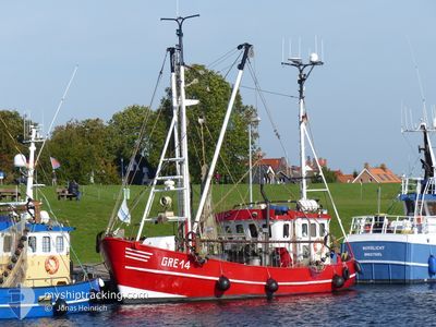
WANGERLAND
Fishing

Current Trip
FISHING GROUNDS
| Time Travelled | 2 days |
|---|---|
| Remaining Time | --- |
| Distance Travelled | 80.38 nm |
| Remaining Distance | --- |
| AVG Speed | 8.3 Knop |
| MAX Speed | 9.4 Knop |
| AVG Wind | 6.9 knots |
| MAX Wind | 10 knots |
| MIN Temp | 8.5°C / 47.3°F |
| MAX Temp | 10.2°C / 50.36°F |
| Djupgående | 2.2 m |
| Position mottagen | 1 m sen |
Current Position
| Longitud | 8.41503° |
|---|---|
| Latitude | 54.63864° |
| Status | Engaged in Fishing |
| Fart | |
| Kurs | 21° |
| Område | North Sea |
| Station | T-AIS |
| Position mottagen | 1 m sen |
Information
The current position of WANGERLAND is in North Sea with coordinates 54.63864° / 8.41503° as reported on 2025-04-23 14:03 by AIS to our vessel tracker app. The vessel's current speed is 0 Knop
The vessel WANGERLAND (MMSI: 211495000) is a Fishing It's sailing under the flag of [DE] Germany.
In this page you can find informations about the vessels current position, last detected port calls, and current voyage information. If the vessels is not in coverage by AIS you will find the latest position.
The current position of WANGERLAND is detected by our AIS receivers and we are not responsible for the reliability of the data. The last position was recorded while the vessel was in Coverage by the Ais receivers of our vessel tracking app.
The current draught of WANGERLAND as reported by AIS is 2.2 meters
Weather
| Temperature | 11.1°C / 51.98°F |
|---|---|
| Wind Speed | 10 knots |
| Direction | 351° N |
| Pressure | 1016 hPa |
| Humidity | 80.3 % |
| Cloud Coverage | 88 % |


Featured Company
Last Port Calls
| Port | Arrival | Departure | Time In Port |
|---|---|---|---|
| 2025-04-16 15:21 | 2025-04-21 08:51 | 4 d | |
| 2025-04-15 07:04 | 2025-04-15 19:35 | 12 h | |
| 2025-04-14 15:52 | 2025-04-14 17:23 | 1 h | |
| 2025-04-10 10:19 | 2025-04-10 10:39 | 19 m | |
| 2025-04-08 07:43 | 2025-04-09 07:49 | 1 d | |
| 2025-03-31 22:08 | 2025-04-01 09:46 | 11 h | |
| 2025-03-27 19:22 | 2025-03-31 16:19 | 3 d | |
| 2025-03-26 07:30 | 2025-03-26 18:57 | 11 h |
Last Trips
| Origin | Departure | Destination | Arrival | Distance | |
|---|---|---|---|---|---|
| 2025-04-15 19:35 | 2025-04-16 15:21 | 85.26 nm | |||
| 2025-04-14 17:23 | 2025-04-15 07:04 | 19.65 nm | |||
| 2025-04-10 10:39 | 2025-04-14 15:52 | 24.33 nm | |||
| 2025-04-09 07:49 | 2025-04-10 10:19 | 18.54 nm | |||
| 2025-04-01 09:46 | 2025-04-08 07:43 | 117.44 nm | |||
| 2025-03-31 16:19 | 2025-03-31 22:08 | 13.92 nm | |||
| 2025-03-26 18:57 | 2025-03-27 19:22 | 109.28 nm |
Events
| Tid | Event | Detaljer | Position / Dest | Information |
|---|---|---|---|---|
| 2025-04-23 05:21 | I täckningsområde |
54.63917 / 8.41549
North Sea
|
Fart: Kurs: 119.6° |
|
| 2025-04-22 15:56 | UTANFÖR täckningsområde |
54.61884 / 8.44556
North Sea
|
Fart: Kurs: 272° |
|
| 2025-04-22 05:20 | I täckningsområde |
54.61888 / 8.44533
North Sea
|
Fart: Kurs: 63.7° |
|
| 2025-04-21 10:09 | UTANFÖR täckningsområde |
53.88994 / 7.65116
North Sea
|
Fart: 8.3 kn Kurs: 65.3° |
|
| 2025-04-21 06:51 | AVGÅTT HAMN |
|
53.63056 / 7.15708
FISHING GROUNDS
|
Fart: 7 kn Kurs: 346° |
| 2025-04-21 06:47 | STARTAR förflyttning |
53.62372 / 7.15746
[DE] NORDDEICH
|
Fart: 4.4 kn Kurs: 10° |
|
| 2025-04-16 13:42 | STOPPAR förflyttning |
53.62190 / 7.15649
[DE] NORDDEICH
|
Fart: 0.3 kn Kurs: 14° |
|
| 2025-04-16 13:36 | STARTAR förflyttning |
53.62576 / 7.16017
[DE] NORDDEICH
|
Fart: 5.1 kn Kurs: 342° |
|
| 2025-04-16 13:25 | STOPPAR förflyttning |
53.62386 / 7.16060
[DE] NORDDEICH
|
Fart: 0.3 kn Kurs: 67° |
|
| 2025-04-16 13:21 | ANLÄNDER HAMN |
|
53.62843 / 7.15759
[DE] NORDDEICH
|
Fart: 7.3 kn Kurs: 167.9° |