

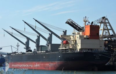
WATTLE TIGER
Cargo

Current Trip
| Trip Time | 5 days |
|---|---|
| Trip Distance | 178.45 nm |
| AVG Speed | 9.4 Knop |
| MAX Speed | 13.9 Knop |
| Djupgående | 12.5 m |
| AVG Wind | 7 knots |
| MAX Wind | 19.5 knots |
| MIN Temp | 11°C / 51.8°F |
| MAX Temp | 20.5°C / 68.9°F |
| Position mottagen | 1 h, 37 m sen |
Current Position
| Longitud | 131.86806° |
|---|---|
| Latitude | 33.25594° |
| Status | Moored |
| Fart | |
| Kurs | 150° |
| Område | Inland Sea |
| Station | T-AIS |
| Position mottagen | 1 h, 37 m sen |
Information
The current position of WATTLE TIGER is in Inland Sea with coordinates 33.25594° / 131.86806° as reported on 2025-04-13 22:24 by AIS to our vessel tracker app. The vessel's current speed is 0 Knop and is currently inside the port of SAGANOSEKI.
The vessel WATTLE TIGER (IMO: 9890276, MMSI: 351292000) is a Cargo It's sailing under the flag of [PA] Panama.
In this page you can find informations about the vessels current position, last detected port calls, and current voyage information. If the vessels is not in coverage by AIS you will find the latest position.
The current position of WATTLE TIGER is detected by our AIS receivers and we are not responsible for the reliability of the data. The last position was recorded while the vessel was in Coverage by the Ais receivers of our vessel tracking app.
The current draught of WATTLE TIGER as reported by AIS is 12.5 meters
Weather
| Temperature | 11.2°C / 52.16°F |
|---|---|
| Wind Speed | 7 knots |
| Direction | 145° SE |
| Pressure | 1004.4 hPa |
| Humidity | 55.9 % |
| Cloud Coverage | 3 % |


Featured Company
Last Port Calls
| Port | Arrival | Departure | Time In Port |
|---|---|---|---|
| 2025-04-12 07:42 | |||
| 2025-04-04 07:53 | 2025-04-06 09:54 | 2 d | |
| 2025-02-22 08:13 | 2025-02-22 20:49 | 12 h | |
| 2025-02-19 20:57 | 2025-02-20 19:37 | 22 h | |
| 2025-02-06 15:05 | 2025-02-19 20:26 | 13 d | |
| 2025-02-02 20:17 | 2025-02-05 04:48 | 2 d |
Most Visited Ports (Last year)
| Port | Arrivals | |
|---|---|---|
| 17 | ||
| 5 | ||
| 5 | ||
| 3 | ||
| 2 | ||
| 2 |
Last Trips
| Origin | Departure | Destination | Arrival | Distance | |
|---|---|---|---|---|---|
| 2025-04-06 09:54 | 2025-04-12 07:42 | 178.45 nm | |||
| 2025-02-22 20:49 | 2025-04-04 07:53 | 8093.22 nm | |||
| 2025-02-20 19:37 | 2025-02-22 08:13 | 3.60 nm | |||
| 2025-02-19 20:26 | 2025-02-19 20:57 | 2.96 nm | |||
| 2025-02-05 04:48 | 2025-02-06 15:05 | 49.69 nm | |||
| 2025-01-31 00:41 | 2025-02-02 20:17 | 305.70 nm |
Events
| Tid | Event | Detaljer | Position / Dest | Information |
|---|---|---|---|---|
| 2025-04-13 22:39 | Status ändrad | Default Moored |
33.25601 / 131.86809
[JP] SAGANOSEKI
|
Fart: Kurs: 150° |
| 2025-04-13 22:24 | Status ändrad | Moored Default |
33.25594 / 131.86806
[JP] SAGANOSEKI
|
Fart: Kurs: 150° |
| 2025-04-13 22:24 | I täckningsområde |
33.25594 / 131.86806
Inland Sea
[JP] SAGANOSEKI
|
Fart: Kurs: 282.4° |
|
| 2025-04-13 22:24 | UTANFÖR täckningsområde |
33.25594 / 131.86806
Inland Sea
[JP] SAGANOSEKI
|
Fart: Kurs: 282.4° |
|
| 2025-04-11 22:42 | ANLÄNDER HAMN |
|
33.25599 / 131.86455
[JP] SAGANOSEKI
|
Fart: 1.3 kn Kurs: 244° |
| 2025-04-08 23:58 | STOPPAR förflyttning | 1.1 nm, North West of SAGANOSEKI |
33.26704 / 131.85643
JP_HIB
|
Fart: 0.3 kn Kurs: 289° |
| 2025-04-08 07:42 | Status ändrad | Default Under way using engine |
34.40303 / 133.88509
JP_HIB
|
Fart: 8.7 kn Kurs: 224.7° |
| 2025-04-08 07:41 | Status ändrad | Under way using engine Default |
34.40389 / 133.88611
JP_HIB
|
Fart: 8.4 kn Kurs: 224° |
| 2025-04-08 07:41 | UTANFÖR täckningsområde |
34.40389 / 133.88611
Inland Sea
|
Fart: 8.7 kn Kurs: 224.7° |
|
| 2025-04-08 07:34 | Status ändrad | Default Under way using engine |
34.41622 / 133.90067
JP_HIB
|
Fart: 6.4 kn Kurs: 223.9° |