
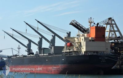
WATTLE TIGER
Cargo
Current Trip
JP_HIB
| Time Travelled | 1 day |
|---|---|
| Remaining Time | --- |
| Distance Travelled | 411.84 nm |
| Remaining Distance | --- |
| AVG Speed | 11.7 Knopen |
| MAX Speed | 13.8 Knopen |
| AVG Wind | 18.6 knots |
| MAX Wind | 31.5 knots |
| MIN Temp | 15.4°C / 59.72°F |
| MAX Temp | 20.8°C / 69.44°F |
| Diepgang | 12.5 M |
| Positie ontvangen | 12 d geleden |
Current Position
| Lengtegraad | 131.86806° |
|---|---|
| Breedtegraat | 33.25594° |
| Status | Moored |
| Snelheid | |
| Koers | 150° |
| Gebied | Inland Sea |
| Station | T-AIS |
| Positie ontvangen | 12 d geleden |
Information
The current position of WATTLE TIGER is in Inland Sea with coordinates 33.25594° / 131.86806° as reported on 2025-04-13 22:24 by AIS to our vessel tracker app. The vessel's current speed is 0 Knopen
The vessel WATTLE TIGER (IMO: 9890276, MMSI: 351292000) is a Cargo It's sailing under the flag of [PA] Panama.
In this page you can find informations about the vessels current position, last detected port calls, and current voyage information. If the vessels is not in coverage by AIS you will find the latest position.
The current position of WATTLE TIGER is detected by our AIS receivers and we are not responsible for the reliability of the data. The last position was recorded while the vessel was in Coverage by the Ais receivers of our vessel tracking app.
The current draught of WATTLE TIGER as reported by AIS is 12.5 meters
Weather
| Temperature | 17.8°C / 64.04°F |
|---|---|
| Wind Speed | 29 knots |
| Direction | 275° W |
| Pressure | 1013.3 hPa |
| Humidity | 48.8 % |
| Cloud Coverage | --- |
Featured Company
Last Port Calls
| Port | Arrival | Departure | Time In Port |
|---|---|---|---|
| 2025-04-22 07:41 | 2025-04-24 22:22 | 2 d | |
| 2025-04-21 02:00 | 2025-04-21 03:57 | 1 h | |
| 2025-04-11 22:42 | 2025-04-16 22:36 | 4 d | |
| 2025-04-03 22:53 | 2025-04-06 00:54 | 2 d | |
| 2025-02-22 11:13 | 2025-02-22 23:49 | 12 h | |
| 2025-02-19 23:57 | 2025-02-20 22:37 | 22 h | |
| 2025-02-06 18:05 | 2025-02-19 23:26 | 13 d | |
| 2025-02-02 23:17 | 2025-02-05 07:48 | 2 d |
Most Visited Ports (Last year)
| Port | Arrivals | |
|---|---|---|
| 17 | ||
| 7 | ||
| 5 | ||
| 3 | ||
| 2 | ||
| 2 |
Last Trips
| Origin | Departure | Destination | Arrival | Distance | |
|---|---|---|---|---|---|
| 2025-04-21 12:57 | 2025-04-22 16:41 | 9.50 nm | |||
| 2025-04-17 07:36 | 2025-04-21 11:00 | 326.80 nm | |||
| 2025-04-06 09:54 | 2025-04-12 07:42 | 178.45 nm | |||
| 2025-02-22 20:49 | 2025-04-04 07:53 | 8093.22 nm | |||
| 2025-02-20 19:37 | 2025-02-22 08:13 | 3.60 nm | |||
| 2025-02-19 20:26 | 2025-02-19 20:57 | 2.96 nm | |||
| 2025-02-05 04:48 | 2025-02-06 15:05 | 49.69 nm | |||
| 2025-01-31 00:41 | 2025-02-02 20:17 | 305.70 nm |
Events
| Tijd | Evenement | Details | Positie / Bestemming | Info |
|---|---|---|---|---|
| 2025-04-24 22:22 | Vertrekhaven |
|
33.29141 / 131.65790
JP_HIB
|
Snelheid: 6 kn Koers: 350° |
| 2025-04-24 22:06 | Start beweging |
33.26700 / 131.66524
[JP] OITA
|
Snelheid: 3.9 kn Koers: 342° |
|
| 2025-04-22 07:42 | Stop beweging |
33.26186 / 131.66568
[JP] OITA
|
Snelheid: Koers: 342° |
|
| 2025-04-22 07:41 | Aankomsthaven |
|
33.26186 / 131.66568
[JP] OITA
|
Snelheid: 1.6 kn Koers: 335° |
| 2025-04-22 06:01 | Start beweging | 4.79 nm, East of OITA |
33.27481 / 131.75928
JP_HIB
|
Snelheid: 4.3 kn Koers: 327° |
| 2025-04-21 03:57 | Vertrekhaven |
|
33.27018 / 131.76071
JP_HIB
|
Snelheid: 0.1 kn Koers: 302° |
| 2025-04-21 02:00 | Aankomsthaven |
|
33.26909 / 131.75905
[JP] OITA
|
Snelheid: Koers: 346° |
| 2025-04-21 00:58 | Stop beweging | 4.89 nm, East of OITA |
33.27082 / 131.76057
JP_HIB
|
Snelheid: 0.2 kn Koers: 265° |
| 2025-04-20 02:08 | Start beweging | 20.66 nm, South East of MIMITSU |
32.20258 / 131.98614
JP_HIB
|
Snelheid: 4.2 kn Koers: 129° |
| 2025-04-19 14:06 | Stop beweging |
31.98577 / 131.99142
JP_HIB
|
Snelheid: 0.1 kn Koers: 101° |