
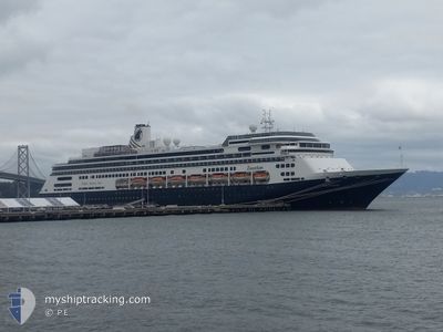
ZAANDAM
Passengers Ship
Current Trip
| Trip Time | 12 h, 32 mins |
|---|---|
| Trip Distance | 167.52 nm |
| AVG Speed | 12 Knop |
| MAX Speed | 12 Knop |
| Djupgående | 8.1 m |
| AVG Wind | 10.3 knots |
| MAX Wind | 13.2 knots |
| MIN Temp | 22.7°C / 72.86°F |
| MAX Temp | 24.2°C / 75.56°F |
| Position mottagen | 4 m sen |
Current Position
| Longitud | -80.17285° |
|---|---|
| Latitude | 25.77846° |
| Status | Moored |
| Fart | |
| Kurs | 294° |
| Område | North Atlantic Ocean |
| Station | T-AIS |
| Position mottagen | 4 m sen |
Info
Information
The current position of ZAANDAM is in North Atlantic Ocean with coordinates 25.77846° / -80.17285° as reported on 2025-02-08 13:16 by AIS to our vessel tracker app. The vessel's current speed is 0 Knop and is currently inside the port of MIAMI.
The vessel ZAANDAM (IMO: 9156527, MMSI: 246442000) is a Passengers Ship that was built in 2000 ( 25 År gammal ). It's sailing under the flag of [NL] Netherlands.
In this page you can find informations about the vessels current position, last detected port calls, and current voyage information. If the vessels is not in coverage by AIS you will find the latest position.
The current position of ZAANDAM is detected by our AIS receivers and we are not responsible for the reliability of the data. The last position was recorded while the vessel was in Coverage by the Ais receivers of our vessel tracking app.
The current draught of ZAANDAM as reported by AIS is 8.1 meters
Weather
| Temperature | 23.1°C / 73.58°F |
|---|---|
| Wind Speed | 7 knots |
| Direction | 91° E |
| Pressure | 1021.8 hPa |
| Humidity | 73.1 % |
| Cloud Coverage | 4 % |
Featured Company
Last Port Calls
| Port | Arrival | Departure | Time In Port |
|---|---|---|---|
| 2025-02-08 06:07 | |||
| 2025-01-25 19:35 | 2025-02-07 17:35 | 12 d | |
| 2025-01-25 05:43 | 2025-01-25 14:46 | 9 h | |
| 2025-01-25 05:23 | |||
| 2025-01-23 10:40 | 2025-01-23 18:00 | 7 h | |
| 2025-01-22 06:35 | 2025-01-22 17:19 | 10 h | |
| 2025-01-21 09:08 | 2025-01-21 19:11 | 10 h | |
| 2025-01-19 07:34 | 2025-01-19 15:18 | 7 h | |
| 2025-01-18 05:44 | 2025-01-18 15:50 | 10 h | |
| 2025-01-17 06:28 | 2025-01-17 14:12 | 7 h |
Last Trips
| Origin | Departure | Destination | Arrival | Distance | |
|---|---|---|---|---|---|
| 2025-02-07 17:35 | 2025-02-08 06:07 | 167.52 nm | |||
| 2025-01-25 14:46 | 2025-01-25 19:35 | 78.42 nm | |||
| 2025-01-23 18:00 | 2025-01-25 05:43 | 691.36 nm | |||
| 2025-01-23 18:00 | 2025-01-25 05:23 | 690.58 nm | |||
| 2025-01-22 17:19 | 2025-01-23 10:40 | 279.92 nm | |||
| 2025-01-21 19:11 | 2025-01-22 06:35 | 106.31 nm | |||
| 2025-01-19 15:18 | 2025-01-21 09:08 | 730.05 nm | |||
| 2025-01-18 15:50 | 2025-01-19 07:34 | 276.27 nm | |||
| 2025-01-17 14:12 | 2025-01-18 05:44 | 272.54 nm | |||
| 2025-01-14 17:21 | 2025-01-17 06:28 | 910.71 nm |
Events
| Tid | Event | Detaljer | Position / Dest | Information |
|---|---|---|---|---|
| 2025-02-08 13:13 | Status ändrad | Moored Default |
25.77844 / -80.17285
[US] MIAMI
|
Fart: Kurs: 294° |
| 2025-02-08 13:10 | Status ändrad | Default Moored |
25.77845 / -80.17285
[US] MIAMI
|
Fart: Kurs: 295° |
| 2025-02-08 11:40 | Status ändrad | Moored Under way using engine |
25.77847 / -80.17283
[US] MIAMI
|
Fart: 0.2 kn Kurs: 294° |
| 2025-02-08 11:36 | STOPPAR förflyttning |
25.77844 / -80.17250
[US] MIAMI
|
Fart: 0.3 kn Kurs: 291° |
|
| 2025-02-08 11:07 | ANLÄNDER HAMN |
|
25.76259 / -80.12989
[US] MIAMI
|
Fart: 9 kn Kurs: 295.4° |
| 2025-02-08 09:02 | Status ändrad | Under way using engine Default |
25.56192 / -79.82757
USMIA
|
Fart: 13.6 kn Kurs: 356° |
| 2025-02-08 08:52 | Status ändrad | Default Under way using engine |
25.52237 / -79.82461
USMIA
|
Fart: 13.5 kn Kurs: 356.6° |
| 2025-02-08 08:48 | Status ändrad | Under way using engine Default |
25.50992 / -79.82377
USMIA
|
Fart: 13.6 kn Kurs: 356° |
| 2025-02-08 08:35 | Status ändrad | Default Under way using engine |
25.45983 / -79.81930
USMIA
|
Fart: 12.9 kn Kurs: 355° |
| 2025-02-08 08:30 | Upptäckt i hav | United States part of the North Atlantic Ocean |
25.44208 / -79.81767
North Atlantic Ocean
USMIA
|
Fart: 12.9 kn Kurs: 355° |