

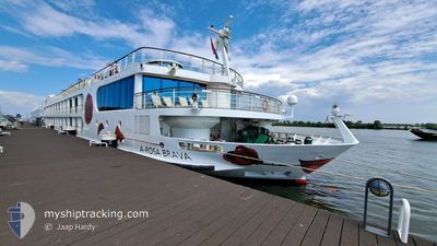
A ROSA BRAVA
Passenger
Current Trip
| Time Travelled | 2 days |
|---|---|
| Remaining Time | 15 h, 48 mins |
| Distance Travelled | 144.92 nm |
| Remaining Distance | 70.03 nm |
| AVG Speed | 5.4 Knots |
| MAX Speed | 5.4 Knots |
| AVG Wind | 2.9 knots |
| MAX Wind | 5.8 knots |
| MIN Temp | 5.5°C / 41.9°F |
| MAX Temp | 19.6°C / 67.28°F |
| Draught | 1.7 m |
| Position Received | 1 m ago |
Current Position
| Longitude | 8.30907° |
|---|---|
| Latitude | 49.05065° |
| Status | Under way using engine |
| Speed | 4.4 Knots |
| Course | 208.1° |
| Area | North Sea |
| Station | T-AIS |
| Position Received | 1 m ago |
Information
The current position of A ROSA BRAVA is in North Sea with coordinates 49.05065° / 8.30907° as reported on 2025-04-22 21:21 by AIS to our vessel tracker app. The vessel's current speed is 4.4 Knots and is heading at the port of BREISACH. The estimated time of arrival as calculated by MyShipTracking vessel tracking app is 2025-04-23 15:11 LT
The vessel A ROSA BRAVA (MMSI: 211519930) is a Passenger It's sailing under the flag of [DE] Germany.
In this page you can find informations about the vessels current position, last detected port calls, and current voyage information. If the vessels is not in coverage by AIS you will find the latest position.
The current position of A ROSA BRAVA is detected by our AIS receivers and we are not responsible for the reliability of the data. The last position was recorded while the vessel was in Coverage by the Ais receivers of our vessel tracking app.
The current draught of A ROSA BRAVA as reported by AIS is 1.7 meters
Weather
| Temperature | 10.5°C / 50.9°F |
|---|---|
| Wind Speed | --- |
| Direction | 169° S |
| Pressure | 1018.7 hPa |
| Humidity | 78.8 % |
| Cloud Coverage | 74 % |


Featured Company
Last Port Calls
| Port | Arrival | Departure | Time In Port |
|---|---|---|---|
| 2025-04-20 20:26 | 2025-04-20 20:33 | 6 m | |
| 2025-04-20 05:12 | 2025-04-20 17:47 | 12 h | |
| 2025-04-18 23:51 | 2025-04-19 00:33 | 42 m | |
| 2025-04-18 04:30 | 2025-04-18 22:47 | 18 h | |
| 2025-04-18 03:48 | 2025-04-18 04:21 | 32 m | |
| 2025-04-15 05:54 | 2025-04-17 00:05 | 1 d | |
| 2025-04-13 11:11 | 2025-04-14 08:08 | 20 h | |
| 2025-04-12 13:43 | 2025-04-12 14:31 | 48 m | |
| 2025-04-12 10:35 | 2025-04-12 12:27 | 1 h | |
| 2025-04-11 12:15 | 2025-04-12 08:12 | 19 h |
Most Visited Ports (Last year)
| Port | Arrivals | |
|---|---|---|
| 56 | ||
| 38 | ||
| 30 | ||
| 23 | ||
| 22 | ||
| 22 |
Last Trips
| Origin | Departure | Destination | Arrival | Distance | |
|---|---|---|---|---|---|
| 2025-04-20 17:47 | 2025-04-20 20:26 | 15.20 nm | |||
| 2025-04-19 00:33 | 2025-04-20 05:12 | 122.43 nm | |||
| 2025-04-18 22:47 | 2025-04-18 23:51 | 9.39 nm | |||
| 2025-04-18 04:21 | 2025-04-18 04:30 | 1.06 nm | |||
| 2025-04-17 00:05 | 2025-04-18 03:48 | 95.96 nm | |||
| 2025-04-14 08:08 | 2025-04-15 05:54 | 203.30 nm | |||
| 2025-04-12 14:31 | 2025-04-13 11:11 | 121.04 nm | |||
| 2025-04-12 12:27 | 2025-04-12 13:43 | 10.07 nm | |||
| 2025-04-12 08:12 | 2025-04-12 10:35 | 19.91 nm | |||
| 2025-04-11 08:06 | 2025-04-11 12:15 | 29.20 nm |
Events
| Time | Event | Details | Position / Dest | Info |
|---|---|---|---|---|
| 2025-04-22 18:54 | Destination Changed | BREISACH SPEYER |
49.21264 / 8.38721
BREISACH
|
Speed: 4.6 kn Course: 169.4° |
| 2025-04-22 18:54 | ETA Changed | 2025/04/23 12:00 2025/04/22 06:00 |
49.21264 / 8.38721
BREISACH
|
Speed: 4.6 kn Course: 169.4° |
| 2025-04-22 17:20 | START Moving | 6.19 nm, North East of GERMERSHEIM |
49.30161 / 8.48783
SPEYER
|
Speed: 4.8 kn Course: 155.3° |
| 2025-04-22 16:55 | Status Changed | Under way using engine Default |
49.31308 / 8.45498
SPEYER
|
Speed: 0.5 kn Course: -1° |
| 2025-04-22 16:49 | Status Changed | Default Under way using engine |
49.31145 / 8.45704
SPEYER
|
Speed: 1.8 kn Course: 511° |
| 2025-04-22 16:15 | IN Coverage |
49.31284 / 8.45458
North Sea
|
Speed: 0.1 kn Course: 171.4° |
|
| 2025-04-22 14:58 | OUT of Coverage |
49.31283 / 8.45459
North Sea
|
Speed: 0.1 kn Course: 186.7° |
|
| 2025-04-22 14:56 | IN Coverage |
49.31283 / 8.45459
North Sea
|
Speed: 0.1 kn Course: 187.1° |
|
| 2025-04-22 05:10 | OUT of Coverage |
49.31177 / 8.45604
North Sea
SPEYER
|
Speed: 0.5 kn Course: 279.7° |
|
| 2025-04-22 04:30 | Status Changed | Under way using engine Default |
49.34122 / 8.47218
SPEYER
|
Speed: 5.6 kn Course: 217° |