
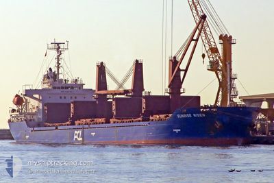
AFRICAN JOSEPH R
Bulk Carrier
Current Trip
| Time Travelled | 4 h, 27 mins |
|---|---|
| Remaining Time | 1 day |
| Distance Travelled | 25.10 nm |
| Remaining Distance | 441.05 nm |
| AVG Speed | 10.9 Knots |
| MAX Speed | 12.1 Knots |
| AVG Wind | 10.2 knots |
| MAX Wind | 14 knots |
| MIN Temp | 23.3°C / 73.94°F |
| MAX Temp | 26.5°C / 79.7°F |
| Draught | 6.1 m |
| Position Received | 5 d ago |
Current Position
| Longitude | -60.69088° |
|---|---|
| Latitude | 13.25338° |
| Status | Under way using engine |
| Speed | 8.6 Knots |
| Course | 147° |
| Area | Caribbean Sea |
| Station | T-AIS |
| Position Received | 5 d ago |
Info
Information
The current position of AFRICAN JOSEPH R is in Caribbean Sea with coordinates 13.25338° / -60.69088° as reported on 2025-02-26 14:27 by AIS to our vessel tracker app. The vessel's current speed is 8.6 Knots and is heading at the port of VIEUX FORT. The estimated time of arrival as calculated by MyShipTracking vessel tracking app is 2025-03-05 22:13 LT
The vessel AFRICAN JOSEPH R (IMO: 9333711, MMSI: 636016043) is a Bulk Carrier that was built in 2006 ( 19 years old ). It's sailing under the flag of [LR] Liberia.
In this page you can find informations about the vessels current position, last detected port calls, and current voyage information. If the vessels is not in coverage by AIS you will find the latest position.
The current position of AFRICAN JOSEPH R is detected by our AIS receivers and we are not responsible for the reliability of the data. The last position was recorded while the vessel was in Coverage by the Ais receivers of our vessel tracking app.
The current draught of AFRICAN JOSEPH R as reported by AIS is 6.1 meters
Weather
| Temperature | 26.3°C / 79.34°F |
|---|---|
| Wind Speed | 14 knots |
| Direction | 70° ENE |
| Pressure | 1011.8 hPa |
| Humidity | 79.7 % |
| Cloud Coverage | 62 % |
Featured Company
Last Port Calls
| Port | Arrival | Departure | Time In Port |
|---|---|---|---|
| 2025-02-28 10:22 | 2025-03-04 02:15 | 3 d | |
| 2025-02-25 11:35 | 2025-02-26 10:43 | 23 h | |
| 2025-02-23 18:52 | 2025-02-24 12:29 | 17 h | |
| 2025-01-15 02:43 | 2025-02-06 20:25 | 22 d | |
| 2025-01-05 14:03 |
Most Visited Ports (Last year)
| Port | Arrivals | |
|---|---|---|
| 7 | ||
| 5 | ||
| 3 | ||
| 2 | ||
| 2 | ||
| 2 |
Last Trips
| Origin | Departure | Destination | Arrival | Distance | |
|---|---|---|---|---|---|
| 2025-02-26 06:43 | 2025-02-28 06:22 | 462.53 nm | |||
| 2025-02-24 08:29 | 2025-02-25 07:35 | 189.68 nm | |||
| 2025-02-06 14:25 | 2025-02-23 14:52 | 2115.47 nm | |||
| 2025-01-05 10:03 | 2025-01-14 20:43 | 2607.88 nm |
Events
| Time | Event | Details | Position / Dest | Info |
|---|---|---|---|---|
| 2025-03-04 02:15 | PORT DEPARTURE |
|
6.81467 / -58.17290
LC VIF
|
Speed: 7.4 kn Course: 5° |
| 2025-03-04 02:06 | START Moving |
6.78695 / -58.17633
[GY] GEORGETOWN
|
Speed: 7.4 kn Course: 5° |
|
| 2025-02-28 10:24 | STOP Moving |
6.77883 / -58.17588
[GY] GEORGETOWN
|
Speed: 0.1 kn Course: 188° |
|
| 2025-02-28 10:22 | PORT ARRIVAL |
|
6.77888 / -58.17590
[GY] GEORGETOWN
|
Speed: 3.9 kn Course: 182° |
| 2025-02-26 14:31 | Status Changed | Default Under way using engine |
13.24528 / -60.68540
LC VIF
|
Speed: 8.6 kn Course: 147° |
| 2025-02-26 14:27 | OUT of Coverage |
13.25338 / -60.69088
Caribbean Sea
|
Speed: 8.6 kn Course: 147° |
|
| 2025-02-26 14:13 | Change Sea Area | Saint Vincent and the Grenadines part of the Caribbean Sea Saint Lucia part of the Caribbean Sea |
13.28073 / -60.70917
Caribbean Sea
|
Speed: 8.7 kn Course: 143° |
| 2025-02-26 14:13 | IN Coverage |
13.28073 / -60.70917
Caribbean Sea
|
Speed: 8.7 kn Course: 143° |
|
| 2025-02-26 14:10 | Status Changed | Under way using engine Default |
13.28647 / -60.71313
LC VIF
|
Speed: 8.6 kn Course: 151° |
| 2025-02-26 13:09 | OUT of Coverage |
13.41053 / -60.78858
Caribbean Sea
|
Speed: 8.2 kn Course: 150° |