

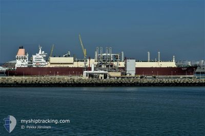
AL GHARIYA
Lng Tanker

Current Trip
| Time Travelled | 32 days |
|---|---|
| Remaining Time | --- |
| Distance Travelled | 9578.08 nm |
| Remaining Distance | 2289.55 nm |
| AVG Speed | 14.2 Knots |
| MAX Speed | 18.4 Knots |
| AVG Wind | 8.5 knots |
| MAX Wind | 24 knots |
| MIN Temp | 18°C / 64.4°F |
| MAX Temp | 31.6°C / 88.88°F |
| Draught | 9.5 m |
| Position Received | 3 d ago |
Current Position
| Longitude | 101.99070° |
|---|---|
| Latitude | 2.17756° |
| Status | Under way using engine |
| Speed | 14.9 Knots |
| Course | 308.9° |
| Area | Malacca Strait |
| Station | T-AIS |
| Position Received | 3 d ago |
Information
The current position of AL GHARIYA is in Malacca Strait with coordinates 2.17756° / 101.99070° as reported on 2025-05-27 10:47 by AIS to our vessel tracker app. The vessel's current speed is 14.9 Knots and is heading at the port of RAS LAFFAN. The estimated time of arrival as calculated by MyShipTracking vessel tracking app is 2025-06-06 13:00 LT
The vessel AL GHARIYA (IMO: 9337987, MMSI: 308248000) is a Lng Tanker that was built in 2008 ( 17 years old ). It's sailing under the flag of [BS] Bahamas.
In this page you can find informations about the vessels current position, last detected port calls, and current voyage information. If the vessels is not in coverage by AIS you will find the latest position.
The current position of AL GHARIYA is detected by our AIS receivers and we are not responsible for the reliability of the data. The last position was recorded while the vessel was in Coverage by the Ais receivers of our vessel tracking app.
The current draught of AL GHARIYA as reported by AIS is 9.5 meters
Weather
| Temperature | 27.7°C / 81.86°F |
|---|---|
| Wind Speed | 24 knots |
| Direction | 255° WSW |
| Pressure | 1008.9 hPa |
| Humidity | 81.5 % |
| Cloud Coverage | 97 % |


Featured Company
Last Port Calls
| Port | Arrival | Departure | Time In Port |
|---|---|---|---|
| 2025-04-27 21:59 | 2025-04-29 01:28 | 1 d | |
| 2025-04-08 11:14 | 2025-04-09 14:30 | 1 d | |
| 2025-03-23 00:48 | 2025-03-24 04:07 | 1 d |
Most Visited Ports (Last year)
| Port | Arrivals | |
|---|---|---|
| 8 | ||
| 1 | ||
| 1 | ||
| 1 |
Last Trips
| Origin | Departure | Destination | Arrival | Distance | |
|---|---|---|---|---|---|
| 2025-04-09 14:30 | 2025-04-27 21:59 | 5161.69 nm | |||
| 2025-03-24 04:07 | 2025-04-08 11:14 | 5167.37 nm | |||
| 2025-02-08 09:25 | 2025-03-23 00:48 | 11769.83 nm |
Events
| Time | Event | Details | Position / Dest | Info |
|---|---|---|---|---|
| 2025-05-27 10:55 | Status Changed | Default Under way using engine |
2.19857 / 101.96518
QA RLF
|
Speed: 14.9 kn Course: 308.9° |
| 2025-05-27 10:47 | OUT of Coverage |
2.17756 / 101.99070
Malacca Strait
QA RLF
|
Speed: 14.9 kn Course: 308.9° |
|
| 2025-05-27 10:29 | Status Changed | Under way using engine Default |
2.13121 / 102.04515
QA RLF
|
Speed: 14.9 kn Course: 312° |
| 2025-05-27 10:18 | Status Changed | Default Under way using engine |
2.10076 / 102.07891
QA RLF
|
Speed: 15.2 kn Course: 311.6° |
| 2025-05-27 10:09 | Status Changed | Under way using engine Default |
2.07398 / 102.10905
QA RLF
|
Speed: 15.3 kn Course: 312° |
| 2025-05-27 09:46 | Status Changed | Default Under way using engine |
2.00982 / 102.18099
QA RLF
|
Speed: 15.8 kn Course: 311.4° |
| 2025-05-27 09:39 | Change Sea Area | Malaysian part of the Malacca Strait Malaysian part of the Singapore Strait |
1.98691 / 102.20677
Malacca Strait
QA RLF
|
Speed: 15.8 kn Course: 311.3° |
| 2025-05-27 09:39 | Status Changed | Under way using engine Default |
1.98691 / 102.20677
QA RLF
|
Speed: 15.9 kn Course: 311° |
| 2025-05-27 09:27 | IN Coverage |
1.98691 / 102.20677
Malacca Strait
QA RLF
|
Speed: 15.8 kn Course: 311.3° |
|
| 2025-05-27 03:54 | OUT of Coverage |
1.20336 / 103.55035
Singapore Strait
QA RLF
|
Speed: 14 kn Course: 282.9° |