
ALANI
Cargo
Current Trip
| Time Travelled | 14 days |
|---|---|
| Remaining Time | 13 days |
| Distance Travelled | 3229.63 nm |
| Remaining Distance | 4110.24 nm |
| AVG Speed | 10.4 Knots |
| MAX Speed | 14.3 Knots |
| AVG Wind | 8.3 knots |
| MAX Wind | 25.8 knots |
| MIN Temp | 15°C / 59°F |
| MAX Temp | 30.3°C / 86.54°F |
| Draught | 9.5 m |
| Position Received | 3 d ago |
Current Position
| Longitude | 102.07536° |
|---|---|
| Latitude | 2.11599° |
| Status | Under way using engine |
| Speed | 12.2 Knots |
| Course | 311.8° |
| Area | Malacca Strait |
| Station | T-AIS |
| Position Received | 3 d ago |
Information
The current position of ALANI is in Malacca Strait with coordinates 2.11599° / 102.07536° as reported on 2025-05-18 07:08 by AIS to our vessel tracker app. The vessel's current speed is 12.2 Knots and is heading at the port of DURBAN. The estimated time of arrival as calculated by MyShipTracking vessel tracking app is 2025-06-04 15:40 LT
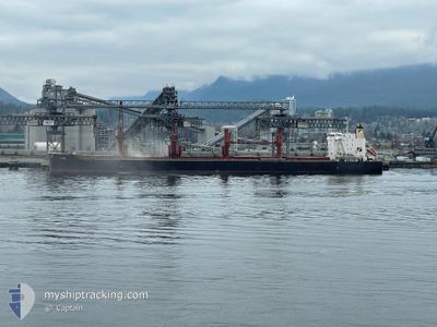
The vessel ALANI (IMO: 9782352, MMSI: 249726000) is a Cargo It's sailing under the flag of [MT] Malta.
In this page you can find informations about the vessels current position, last detected port calls, and current voyage information. If the vessels is not in coverage by AIS you will find the latest position.
The current position of ALANI is detected by our AIS receivers and we are not responsible for the reliability of the data. The last position was recorded while the vessel was in Coverage by the Ais receivers of our vessel tracking app.
The current draught of ALANI as reported by AIS is 9.5 meters
Weather
| Temperature | 29°C / 84.2°F |
|---|---|
| Wind Speed | 3 knots |
| Direction | 272° W |
| Pressure | 1009.1 hPa |
| Humidity | 74.1 % |
| Cloud Coverage | 100 % |
Featured Company
Last Trips
Events
| Time | Event | Details | Position / Dest | Info |
|---|---|---|---|---|
| 2025-05-18 07:13 | Status Changed | Default Under way using engine |
2.12698 / 102.06310
ZA DUR
|
Speed: 12.2 kn Course: 311.8° |
| 2025-05-18 07:08 | Status Changed | Under way using engine Default |
2.11599 / 102.07536
ZA DUR
|
Speed: 12.2 kn Course: 312° |
| 2025-05-18 07:08 | OUT of Coverage |
2.11599 / 102.07536
Malacca Strait
ZA DUR
|
Speed: 12.2 kn Course: 311.8° |
|
| 2025-05-18 06:58 | Status Changed | Default Under way using engine |
2.09483 / 102.09915
ZA DUR
|
Speed: 12.1 kn Course: 311.5° |
| 2025-05-18 06:50 | Status Changed | Under way using engine Default |
2.07683 / 102.11946
ZA DUR
|
Speed: 12 kn Course: 312° |
| 2025-05-18 06:42 | Status Changed | Default Under way using engine |
2.05888 / 102.13963
ZA DUR
|
Speed: 12 kn Course: 309.3° |
| 2025-05-18 06:10 | Change Sea Area | Malaysian part of the Malacca Strait Malaysian part of the Singapore Strait |
1.98861 / 102.22242
Malacca Strait
ZA DUR
|
Speed: 11.8 kn Course: 310.6° |
| 2025-05-18 06:09 | Status Changed | Under way using engine Default |
1.98681 / 102.22451
ZA DUR
|
Speed: 11.7 kn Course: 310° |
| 2025-05-18 05:50 | IN Coverage |
1.98861 / 102.22242
Malacca Strait
ZA DUR
|
Speed: 11.8 kn Course: 310.6° |
|
| 2025-05-17 22:15 | OUT of Coverage |
1.19399 / 103.56019
Singapore Strait
ZA DUR
|
Speed: 12 kn Course: 286.3° |