
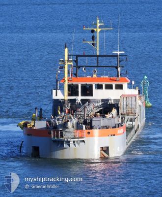
ALBATROS
Trailing Suction Hopper Dredger
Current Trip
| Time Travelled | 8 h, 21 mins |
|---|---|
| Remaining Time | 4 h, 25 mins |
| Distance Travelled | 73.42 nm |
| Remaining Distance | 46.35 nm |
| AVG Speed | 9 Knots |
| MAX Speed | 9.5 Knots |
| AVG Wind | 2.7 knots |
| MAX Wind | 7.5 knots |
| MIN Temp | 12.9°C / 55.22°F |
| MAX Temp | 16.4°C / 61.52°F |
| Draught | 2.8 m |
| Position Received | 3 h, 22 m ago |
Current Position
| Longitude | 172.85318° |
|---|---|
| Latitude | -43.95838° |
| Status | Under way using engine |
| Speed | 9.4 Knots |
| Course | 254.3° |
| Area | South Pacific Ocean |
| Station | T-AIS |
| Position Received | 3 h, 22 m ago |
Info
Information
The current position of ALBATROS is in South Pacific Ocean with coordinates -43.95838° / 172.85318° as reported on 2025-01-31 21:55 by AIS to our vessel tracker app. The vessel's current speed is 9.4 Knots and is heading at the port of TIMARU. The estimated time of arrival as calculated by MyShipTracking vessel tracking app is 2025-02-01 05:43 LT
The vessel ALBATROS (IMO: 9671618, MMSI: 244790087) is a Trailing Suction Hopper Dredger that was built in 2013 ( 12 years old ). It's sailing under the flag of [NL] Netherlands.
In this page you can find informations about the vessels current position, last detected port calls, and current voyage information. If the vessels is not in coverage by AIS you will find the latest position.
The current position of ALBATROS is detected by our AIS receivers and we are not responsible for the reliability of the data. The last position was recorded while the vessel was in Coverage by the Ais receivers of our vessel tracking app.
The current draught of ALBATROS as reported by AIS is 2.8 meters
Weather
| Temperature | 16.3°C / 61.34°F |
|---|---|
| Wind Speed | 5 knots |
| Direction | 146° SE |
| Pressure | 1016.7 hPa |
| Humidity | 81.9 % |
| Cloud Coverage | 12 % |
Featured Company
Last Port Calls
| Port | Arrival | Departure | Time In Port |
|---|---|---|---|
| 2025-01-30 01:19 | 2025-01-31 16:57 | 1 d | |
| 2025-01-29 04:42 | 2025-01-29 16:57 | 12 h | |
| 2025-01-28 20:46 | 2025-01-28 21:19 | 32 m | |
| 2025-01-28 04:41 | 2025-01-28 16:52 | 12 h | |
| 2025-01-27 04:46 | 2025-01-27 17:02 | 12 h | |
| 2025-01-26 04:42 | 2025-01-26 16:56 | 12 h | |
| 2025-01-25 04:48 | 2025-01-25 16:58 | 12 h | |
| 2025-01-24 19:58 | 2025-01-24 20:28 | 30 m | |
| 2025-01-24 04:49 | 2025-01-24 17:00 | 12 h | |
| 2025-01-23 04:44 | 2025-01-23 16:52 | 12 h |
Last Trips
| Origin | Departure | Destination | Arrival | Distance | |
|---|---|---|---|---|---|
| 2025-01-30 05:57 | 2025-01-30 14:19 | 41.13 nm | |||
| 2025-01-29 10:19 | 2025-01-29 17:42 | 38.85 nm | |||
| 2025-01-29 05:52 | 2025-01-29 09:46 | 23.51 nm | |||
| 2025-01-28 06:02 | 2025-01-28 17:41 | 64.32 nm | |||
| 2025-01-27 05:56 | 2025-01-27 17:46 | 72.98 nm | |||
| 2025-01-26 05:58 | 2025-01-26 17:42 | 70.61 nm | |||
| 2025-01-25 09:28 | 2025-01-25 17:48 | 51.12 nm | |||
| 2025-01-25 06:00 | 2025-01-25 08:58 | 18.62 nm | |||
| 2025-01-24 05:52 | 2025-01-24 17:49 | 73.94 nm | |||
| 2025-01-23 05:54 | 2025-01-23 17:44 | 72.81 nm |
Events
| Time | Event | Details | Position / Dest | Info |
|---|---|---|---|---|
| 2025-01-31 22:02 | Status Changed | Default Under way using engine |
-43.96413 / 172.82907
TIMARU
|
Speed: 9.4 kn Course: 254.3° |
| 2025-01-31 21:55 | Status Changed | Under way using engine Default |
-43.95838 / 172.85318
TIMARU
|
Speed: 9.3 kn Course: 251° |
| 2025-01-31 21:55 | OUT of Coverage |
-43.95838 / 172.85318
South Pacific Ocean
|
Speed: 9.4 kn Course: 254.3° |
|
| 2025-01-31 21:37 | IN Coverage |
-43.95838 / 172.85318
South Pacific Ocean
|
Speed: 9.4 kn Course: 254.3° |
|
| 2025-01-31 20:43 | Status Changed | Default Under way using engine |
-43.88772 / 173.09315
TIMARU
|
Speed: 9.3 kn Course: 245° |
| 2025-01-31 20:37 | Status Changed | Under way using engine Default |
-43.88162 / 173.11411
TIMARU
|
Speed: 9.2 kn Course: 243° |
| 2025-01-31 20:37 | OUT of Coverage |
-43.88162 / 173.11411
South Pacific Ocean
|
Speed: 9.3 kn Course: 245° |
|
| 2025-01-31 20:27 | IN Coverage |
-43.88162 / 173.11411
South Pacific Ocean
|
Speed: 9.3 kn Course: 245° |
|
| 2025-01-31 18:39 | Status Changed | Default Under way using engine |
-43.64135 / 173.07153
TIMARU
|
Speed: 8.7 kn Course: 110.1° |
| 2025-01-31 18:32 | OUT of Coverage |
-43.63611 / 173.05022
South Pacific Ocean
|
Speed: 8.7 kn Course: 110.1° |