
ANTWERP
Container Ship
Current Trip
| Time Travelled | 10 days |
|---|---|
| Remaining Time | --- |
| Distance Travelled | 4307.81 nm |
| Remaining Distance | --- |
| AVG Speed | 16.5 Knots |
| MAX Speed | 23.1 Knots |
| AVG Wind | 12.6 knots |
| MAX Wind | 24.1 knots |
| MIN Temp | 7.2°C / 44.96°F |
| MAX Temp | 28.5°C / 83.3°F |
| Draught | 9.7 m |
| Position Received | 4 d ago |
Current Position
| Longitude | -13.47117° |
|---|---|
| Latitude | 28.05405° |
| Status | Under way using engine |
| Speed | 17.6 Knots |
| Course | 217° |
| Area | North Atlantic Ocean |
| Station | T-AIS |
| Position Received | 4 d ago |
Information
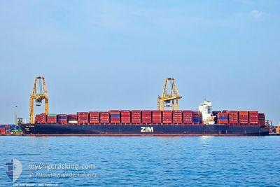
The current position of ANTWERP is in North Atlantic Ocean with coordinates 28.05405° / -13.47117° as reported on 2025-05-19 23:52 by AIS to our vessel tracker app. The vessel's current speed is 17.6 Knots and is heading at the port of DA CHAN BAY. The estimated time of arrival as calculated by MyShipTracking vessel tracking app is 2025-06-18 09:00 LT
The vessel ANTWERP (IMO: 9398448, MMSI: 636014220) is a Container Ship that was built in 2009 ( 16 years old ). It's sailing under the flag of [LR] Liberia.
In this page you can find informations about the vessels current position, last detected port calls, and current voyage information. If the vessels is not in coverage by AIS you will find the latest position.
The current position of ANTWERP is detected by our AIS receivers and we are not responsible for the reliability of the data. The last position was recorded while the vessel was in Coverage by the Ais receivers of our vessel tracking app.
The current draught of ANTWERP as reported by AIS is 9.7 meters
Weather
| Temperature | 26.4°C / 79.52°F |
|---|---|
| Wind Speed | 11 knots |
| Direction | 151° SSE |
| Pressure | 1013.3 hPa |
| Humidity | 77 % |
| Cloud Coverage | 74 % |
Featured Company
Last Port Calls
| Port | Arrival | Departure | Time In Port |
|---|---|---|---|
| 2025-05-12 12:51 | 2025-05-14 00:03 | 1 d | |
| 2025-05-11 09:08 | 2025-05-12 04:18 | 19 h | |
| 2025-05-08 03:31 | 2025-05-09 09:18 | 1 d | |
| 2025-05-04 06:23 | 2025-05-05 11:39 | 1 d | |
| 2025-04-30 16:11 | 2025-05-03 03:48 | 2 d | |
| 2025-04-24 06:33 | 2025-04-25 02:53 | 20 h | |
| 2025-03-22 21:17 | 2025-03-23 16:32 | 19 h | |
| 2025-03-20 04:22 | 2025-03-20 20:05 | 15 h | |
| 2025-03-18 14:04 | 2025-03-19 03:05 | 13 h | |
| 2025-03-14 19:41 | 2025-03-15 16:53 | 21 h |
Most Visited Ports (Last year)
| Port | Arrivals | |
|---|---|---|
| 6 | ||
| 4 | ||
| 3 | ||
| 3 | ||
| 3 | ||
| 3 |
Last Trips
| Origin | Departure | Destination | Arrival | Distance | |
|---|---|---|---|---|---|
| 2025-05-12 04:18 | 2025-05-12 12:51 | 65.06 nm | |||
| 2025-05-09 09:18 | 2025-05-11 09:08 | 874.96 nm | |||
| 2025-05-05 11:39 | 2025-05-08 03:31 | 316.09 nm | |||
| 2025-05-03 03:48 | 2025-05-04 06:23 | 88.98 nm | |||
| 2025-04-25 02:53 | 2025-04-30 16:11 | 1775.69 nm | |||
| 2025-03-23 16:32 | 2025-04-24 06:33 | 12626.59 nm | |||
| 2025-03-20 20:05 | 2025-03-22 21:17 | 784.33 nm | |||
| 2025-03-19 03:05 | 2025-03-20 04:22 | 224.05 nm | |||
| 2025-03-15 16:53 | 2025-03-18 14:04 | 433.87 nm | |||
| 2025-03-11 13:03 | 2025-03-14 19:41 | 506.21 nm |
Events
| Time | Event | Details | Position / Dest | Info |
|---|---|---|---|---|
| 2025-05-19 23:58 | Status Changed | Default Under way using engine |
28.03098 / -13.49080
DA CHAN BAY
|
Speed: 17.6 kn Course: 217° |
| 2025-05-19 23:52 | OUT of Coverage |
28.05405 / -13.47117
North Atlantic Ocean
DA CHAN BAY
|
Speed: 17.6 kn Course: 217° |
|
| 2025-05-19 23:47 | Change Sea Area | Spanish (Canary Islands) part of the North Atlantic Ocean Moroccan part of the North Atlantic Ocean |
28.07733 / -13.45118
North Atlantic Ocean
DA CHAN BAY
|
Speed: 17.6 kn Course: 217° |
| 2025-05-19 23:31 | Detected in Sea | Moroccan part of the North Atlantic Ocean |
28.13905 / -13.39847
North Atlantic Ocean
DA CHAN BAY
|
Speed: 17.6 kn Course: 216° |
| 2025-05-19 23:29 | Status Changed | Under way using engine Default |
28.14530 / -13.39313
DA CHAN BAY
|
Speed: 17.6 kn Course: 217° |
| 2025-05-19 23:24 | IN Coverage |
28.13905 / -13.39847
North Atlantic Ocean
DA CHAN BAY
|
Speed: 17.6 kn Course: 216° |
|
| 2025-05-19 21:47 | Status Changed | Default Under way using engine |
28.54965 / -13.07608
DA CHAN BAY
|
Speed: 17.3 kn Course: 211° |
| 2025-05-19 21:40 | Status Changed | Under way using engine Default |
28.57865 / -13.05563
DA CHAN BAY
|
Speed: 17.3 kn Course: 211° |
| 2025-05-19 21:40 | OUT of Coverage |
28.57865 / -13.05563
North Atlantic Ocean
DA CHAN BAY
|
Speed: 17.3 kn Course: 211° |
|
| 2025-05-19 21:11 | Status Changed | Default Under way using engine |
28.69892 / -12.96897
DA CHAN BAY
|
Speed: 17.3 kn Course: 214° |