
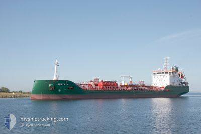
APATYTH
Tanker B
Current Trip
| Time Travelled | 10 days |
|---|---|
| Remaining Time | 3 days |
| Distance Travelled | 635.73 nm |
| Remaining Distance | 772.97 nm |
| AVG Speed | 9.3 Knots |
| MAX Speed | 12.1 Knots |
| AVG Wind | 17.7 knots |
| MAX Wind | 30 knots |
| MIN Temp | -2.5°C / 27.5°F |
| MAX Temp | 4.3°C / 39.74°F |
| Draught | 7.2 m |
| Position Received | Now |
Current Position
| Longitude | 14.82519° |
|---|---|
| Latitude | 55.51215° |
| Status | Under way using engine |
| Speed | 9.4 Knots |
| Course | 240.9° |
| Area | Kattegat |
| Station | T-AIS |
| Position Received | Now |
Info
Information
The current position of APATYTH is in Kattegat with coordinates 55.51215° / 14.82519° as reported on 2026-01-07 19:11 by AIS to our vessel tracker app. The vessel's current speed is 9.4 Knots and is heading at the port of ANTWERP. The estimated time of arrival as calculated by MyShipTracking vessel tracking app is 2026-01-11 06:42 LT
The vessel APATYTH (IMO: 9970739, MMSI: 210765000) is a Tanker B It's sailing under the flag of [CY] Cyprus.
In this page you can find informations about the vessels current position, last detected port calls, and current voyage information. If the vessels is not in coverage by AIS you will find the latest position.
The current position of APATYTH is detected by our AIS receivers and we are not responsible for the reliability of the data. The last position was recorded while the vessel was in Coverage by the Ais receivers of our vessel tracking app.
The current draught of APATYTH as reported by AIS is 7.2 meters
Weather
| Temperature | 1°C / 33.8°F |
|---|---|
| Wind Speed | 22 knots |
| Direction | 178° S |
| Pressure | 1011.1 hPa |
| Humidity | 72.9 % |
| Cloud Coverage | 100 % |
Featured Company
Last Port Calls
| Port | Arrival | Departure | Time In Port |
|---|---|---|---|
| 2025-12-28 08:09 | 2025-12-28 08:39 | 29 m | |
| 2025-12-22 03:43 | 2025-12-23 17:31 | 1 d | |
| 2025-12-13 21:02 | 2025-12-16 05:20 | 2 d | |
| 2025-12-08 13:54 | 2025-12-09 19:07 | 1 d | |
| 2025-12-06 16:26 | 2025-12-07 20:00 | 1 d | |
| 2025-12-06 10:34 | 2025-12-06 14:57 | 4 h | |
| 2025-12-02 07:37 | 2025-12-03 18:54 | 1 d | |
| 2025-11-28 12:16 | 2025-11-30 10:14 | 1 d | |
| 2025-11-19 02:55 | 2025-11-20 06:38 | 1 d | |
| 2025-11-11 16:33 | 2025-11-13 21:34 | 2 d |
Last Trips
| Origin | Departure | Destination | Arrival | Distance | |
|---|---|---|---|---|---|
| 2025-12-23 17:31 | 2025-12-28 08:09 | 808.64 nm | |||
| 2025-12-16 05:20 | 2025-12-22 03:43 | 1228.18 nm | |||
| 2025-12-09 19:07 | 2025-12-13 21:02 | 196.87 nm | |||
| 2025-12-07 20:00 | 2025-12-08 13:54 | 161.70 nm | |||
| 2025-12-06 14:57 | 2025-12-06 16:26 | 13.73 nm | |||
| 2025-12-03 18:54 | 2025-12-06 10:34 | 531.13 nm | |||
| 2025-11-30 10:14 | 2025-12-02 07:37 | 510.23 nm | |||
| 2025-11-20 06:38 | 2025-11-28 12:16 | 1454.26 nm | |||
| 2025-11-13 21:34 | 2025-11-19 02:55 | 897.42 nm | |||
| 2025-11-08 14:31 | 2025-11-11 16:33 | 767.63 nm |
Events
| Time | Event | Details | Position / Dest | Info |
|---|---|---|---|---|
| 2026-01-07 17:29 | Detected in Sea | Danish part of the Kattegat |
55.64156 / 15.23643
Kattegat
BE ANR
|
Speed: 9.4 kn Course: 240.2° |
| 2026-01-07 15:06 | Draught Changed | 7.2 7.4 |
55.81508 / 15.81559
BE ANR
|
Speed: 9 kn Course: 239.4° |
| 2026-01-07 14:55 | Status Changed | Under way using engine Default |
55.82775 / 15.85730
BE ANR
|
Speed: 9.2 kn Course: 242° |
| 2026-01-07 14:53 | IN Coverage |
55.82730 / 15.85592
Baltic Sea
BE ANR
|
Speed: 9.2 kn Course: 240.3° |
|
| 2026-01-07 06:17 | Status Changed | Default Under way using engine |
56.86583 / 17.25091
BE ANR
|
Speed: 9.9 kn Course: 200° |
| 2026-01-07 06:10 | OUT of Coverage |
56.88404 / 17.26308
Baltic Sea
BE ANR
|
Speed: 9.9 kn Course: 200° |
|
| 2026-01-07 06:06 | Status Changed | Under way using engine Default |
56.89491 / 17.27033
BE ANR
|
Speed: 9.8 kn Course: 200° |
| 2026-01-07 05:49 | Status Changed | Default Under way using engine |
56.93882 / 17.29896
BE ANR
|
Speed: 9.7 kn Course: 199.9° |
| 2026-01-07 02:15 | Status Changed | Under way using engine Default |
57.49385 / 17.69210
BE ANR
|
Speed: 9.9 kn Course: 196° |
| 2026-01-07 02:13 | Status Changed | Default Under way using engine |
57.49876 / 17.69466
BE ANR
|
Speed: 9.9 kn Course: 195.7° |