
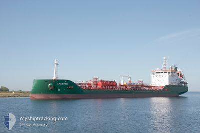
APATYTH
Tanker
Current Trip
| Time Travelled | 23 h, 27 mins |
|---|---|
| Remaining Time | 2 days |
| Distance Travelled | 73.94 nm |
| Remaining Distance | 489.32 nm |
| AVG Speed | 4.5 Knopen |
| MAX Speed | 9.9 Knopen |
| AVG Wind | 23.3 knots |
| MAX Wind | 29.8 knots |
| MIN Temp | 7.5°C / 45.5°F |
| MAX Temp | 10.4°C / 50.72°F |
| Diepgang | 5.9 M |
| Positie ontvangen | 4 h, 0 m geleden |
Current Position
| Lengtegraad | -7.07932° |
|---|---|
| Breedtegraat | 50.95747° |
| Status | Under way using engine |
| Snelheid | 9.9 Knopen |
| Koers | 138.4° |
| Gebied | Celtic Sea |
| Station | T-AIS |
| Positie ontvangen | 4 h, 0 m geleden |
Info
Information
The current position of APATYTH is in Celtic Sea with coordinates 50.95747° / -7.07932° as reported on 2025-02-14 16:46 by AIS to our vessel tracker app. The vessel's current speed is 9.9 Knopen and is heading at the port of TERNEUZEN. The estimated time of arrival as calculated by MyShipTracking vessel tracking app is 2025-02-17 07:07 LT
The vessel APATYTH (IMO: 9970739, MMSI: 210765000) is a Tanker It's sailing under the flag of [CY] Cyprus.
In this page you can find informations about the vessels current position, last detected port calls, and current voyage information. If the vessels is not in coverage by AIS you will find the latest position.
The current position of APATYTH is detected by our AIS receivers and we are not responsible for the reliability of the data. The last position was recorded while the vessel was in Coverage by the Ais receivers of our vessel tracking app.
The current draught of APATYTH as reported by AIS is 5.9 meters
Weather
| Temperature | 10.3°C / 50.54°F |
|---|---|
| Wind Speed | 3 knots |
| Direction | 252° WSW |
| Pressure | 1015.2 hPa |
| Humidity | 93.6 % |
| Cloud Coverage | 100 % |
Featured Company
Last Port Calls
| Port | Arrival | Departure | Time In Port |
|---|---|---|---|
| 2025-02-12 16:30 | 2025-02-13 21:20 | 1 d | |
| 2025-02-12 15:49 | 2025-02-12 16:00 | 10 m | |
| 2025-02-06 14:15 | 2025-02-07 11:22 | 21 h | |
| 2025-02-05 05:17 | 2025-02-05 19:25 | 14 h | |
| 2025-01-30 19:45 | 2025-02-01 17:13 | 1 d | |
| 2025-01-28 22:57 | 2025-01-30 10:55 | 1 d | |
| 2025-01-24 15:06 | 2025-01-27 01:05 | 2 d | |
| 2025-01-16 00:35 | 2025-01-17 14:47 | 1 d | |
| 2025-01-13 18:50 | 2025-01-15 23:07 | 2 d | |
| 2025-01-09 23:48 | 2025-01-11 04:59 | 1 d |
Last Trips
| Origin | Departure | Destination | Arrival | Distance | |
|---|---|---|---|---|---|
| 2025-02-12 16:00 | 2025-02-12 16:30 | 3.28 nm | |||
| 2025-02-07 12:22 | 2025-02-12 15:49 | 1432.38 nm | |||
| 2025-02-05 21:25 | 2025-02-06 15:15 | 135.83 nm | |||
| 2025-02-01 18:13 | 2025-02-05 07:17 | 825.72 nm | |||
| 2025-01-30 11:55 | 2025-01-30 20:45 | 53.32 nm | |||
| 2025-01-27 02:05 | 2025-01-28 23:57 | 403.64 nm | |||
| 2025-01-17 15:47 | 2025-01-24 16:06 | 955.55 nm | |||
| 2025-01-16 00:07 | 2025-01-16 01:35 | 11.76 nm | |||
| 2025-01-11 05:59 | 2025-01-13 19:50 | 193.84 nm | |||
| 2025-01-07 21:32 | 2025-01-10 00:48 | 404.50 nm |
Events
| Tijd | Evenement | Details | Positie / Bestemming | Info |
|---|---|---|---|---|
| 2025-02-14 16:46 | Buitenbereik |
50.95747 / -7.07932
Celtic Sea
FOR ORDER
|
Snelheid: 9.9 kn Koers: 138.4° |
|
| 2025-02-14 16:46 | Binnenbereik |
50.95747 / -7.07932
Celtic Sea
FOR ORDER
|
Snelheid: 9.9 kn Koers: 138.4° |
|
| 2025-02-14 15:28 | Buitenbereik |
51.12289 / -7.28552
Celtic Sea
FOR ORDER
|
Snelheid: 9.4 kn Koers: 147.5° |
|
| 2025-02-14 15:02 | Binnenbereik |
51.17917 / -7.34561
Celtic Sea
FOR ORDER
|
Snelheid: 9.4 kn Koers: 153° |
|
| 2025-02-14 13:49 | Buitenbereik |
51.32090 / -7.46519
Celtic Sea
FOR ORDER
|
Snelheid: 7.5 kn Koers: 159.2° |
|
| 2025-02-14 08:41 | ETA Changed | 2025/02/16 17:00 2025/02/18 11:00 |
51.57062 / -7.88114
FOR ORDER
|
Snelheid: 2.1 kn Koers: 119° |
| 2025-02-14 08:03 | ETA Changed | 2025/02/18 11:00 2025/02/12 13:00 |
51.57956 / -7.91689
FOR ORDER
|
Snelheid: 2.4 kn Koers: 121° |
| 2025-02-14 05:42 | Start beweging | 14.8 nm, South East of WHITEGATE |
51.63871 / -7.99572
FOR ORDER
|
Snelheid: 3.2 kn Koers: 130° |
| 2025-02-13 23:41 | Stop beweging | 6.86 nm, South of WHITEGATE |
51.71433 / -8.24262
FOR ORDER
|
Snelheid: 0.3 kn Koers: 116° |
| 2025-02-13 21:20 | Vertrekhaven |
|
51.81108 / -8.26915
FOR ORDER
|
Snelheid: 8.7 kn Koers: 144° |